Fort Popham's unfinished Civil War fort guarding the Kennebec River
Fort Popham still rises over the Kennebec as a half-finished granite fort, a shoreline landmark that helps define Phippsburg’s summer landscape and identity.
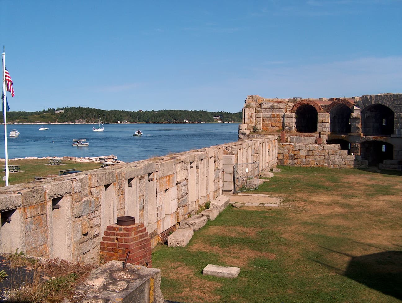
Fort Popham stands on Hunniwell Point like a piece of public architecture left in mid-sentence. Its granite walls still frame the mouth of the Kennebec River, giving Phippsburg a ruin that is not hidden behind glass but open to wind, tide, and long views across one of Sagadahoc County’s most consequential waterways.
What makes Fort Popham worth the stop
The site works because it is easy to read from the shoreline. Clio describes walls that rise 30 feet high, and that height is part of the fort’s impact today: even in its unfinished state, it still dominates the tidal landscape. Visitors do not have to imagine much to understand the fort’s purpose, because the river itself is right there, broad and exposed, exactly where a coastal defense planner would have wanted to see an approaching vessel.
That visible ruin matters in Phippsburg for reasons that go beyond military history. Fort Popham sits inside a coast shaped by recreation, scenic drives, and summer traffic, so the fort’s broad stonework has become part of the local sense of place. It is a landmark people can walk through, photograph, and interpret from the shoreline, which gives it an everyday role in the county’s visitor economy instead of leaving it as a distant historical label.
Why the fort was built here
Fort Popham was authorized in 1857 as a Third System fort, part of a larger federal effort to strengthen coastal defenses. The Historical Marker Database says construction commenced in 1861, while FortWiki places the start in 1862 and notes that the fort was never completed. That disagreement in secondary summaries does not change the larger fact that the project began as the Civil War era was transforming how the federal government thought about protecting ports, river mouths, and supply lines.
The location was strategic because the Kennebec connected inland industrial activity to the sea. Protecting that route mattered to shipbuilding, commerce, and wartime planning, and Hunniwell Point gave defenders a commanding angle on traffic moving up and down the river. The National Register of Historic Places inventory says a large, polygonal granite structure was built there on the site of an 1811 blockhouse, which shows that the point had already been understood as a place worth fortifying before the Civil War project began.
What survives on the ground
The fort’s unfinished condition is part of its identity. FortWiki dates the site to 1862-1924 and says it was never completed, while the National Register inventory records it as Fort Popham and lists the site on October 1, 1969. That long span helps explain why the fort feels less like a sealed relic than a structure that was used, adapted, and then left to sit in the weather as strategy moved elsewhere.
Its armament also points to the scale of the original ambition. Secondary sources describe 36 cannon, including Rodman guns and 10-inch Parrott rifles, arranged in two tiers of vaulted casements, though another reference gives 35 cannon. Even with that slight inconsistency, the picture is clear: this was meant to be a serious artillery position, not a decorative outpost. The stone shell that remains is enough to show how much firepower planners expected to mount on this point above the Kennebec.
A quick way to take it in is to slow down and look for the fort’s relationship to the tide and the river approach:
- Stand where the walls meet the open view and watch how the Kennebec widens toward the river mouth.
- Trace the polygonal outline of the granite work, which still reveals the fort’s intended defensive geometry.
- Look beyond the casemates to see how the site sits in the same sightline as passing boats, marsh, and shoreline.
- Notice how the unfinished stonework makes the fort feel both permanent and incomplete at once.
How Fort Popham fits into Phippsburg’s larger defense story
Fort Popham did not stand alone for long. Sources say it was later garrisoned during the Spanish-American War and World War I, which shows that its strategic position still mattered after the Civil War ended. Nearby Fort Baldwin eventually made the site obsolete, shifting coastal defense planning to a later generation of batteries and technology.
Fort Baldwin State Historic Site, built between 1905 and 1912, originally consisted of three batteries: Cogan, Hardman, and Hawley. That later complex shows how the same geography at the mouth of the Kennebec was reused by military planners as naval threats, artillery design, and coastal strategy changed. In that sense, Fort Popham is not an isolated ruin but the first visible chapter in a longer defensive map of the same shoreline.
A place layered with older and newer histories
The fort’s name reaches back to Captain George Popham, founder of the 1607 Popham Colony. That connection folds the Civil War fort into a much older story of settlement, survival, and the difficult pull of the Maine coast. Phippsburg holds that layering unusually well: the Popham Colony, the Civil War fortification, the later Fort Baldwin batteries, and today’s recreation landscape all sit within the same small stretch of shore.
That is why Fort Popham still resonates with locals and summer visitors alike. It is a monument to unfinished ambition, but it is also a working part of the landscape, a place where the Kennebec, the tide, and Phippsburg’s identity still meet in plain view.
This article was produced by Prism’s automated news system from verified source data, official records, and press releases, then run through automated quality and moderation checks before publishing. The system is built and supervised by the people who set the standards it runs under. Read our full AI policy.
Did this article answer your question?