Bay Area Braces for Rain and Thunderstorms After Dry Stretch
SF's thunderstorm threat this week is rare: the Bay Area has logged only 37 thunder warnings since 2005, third fewest in the U.S. Rain hits Wednesday.
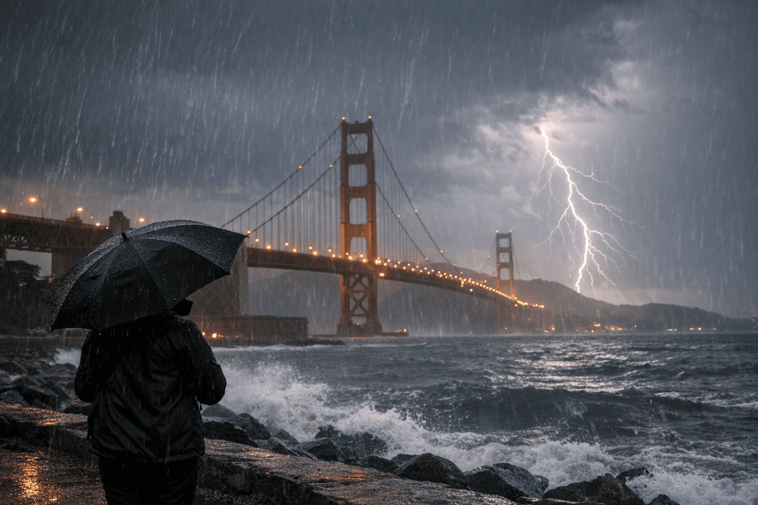
Out in the Sunset, where fog usually does the heavy lifting, the sky is poised for something genuinely unusual. After a stretch of temperatures running 15 to 20 degrees above normal across the Bay Area interior, a cooling trend that began Monday is setting the stage for rain and a low but real chance of thunderstorms by midweek — a combination so uncommon here that only 37 thunderstorm warnings have been issued for the SF Bay Area since 2005, the third lowest count of any region in the United States.
The most widespread rainfall is expected Wednesday and Thursday, with amounts between one-quarter and one-half of an inch. That window, roughly from Wednesday morning through Thursday night, covers both the morning and evening commute on 280 and 101, the approaches to Civic Center, and the surface streets through the Sunset and Richmond that drain slowly when rain arrives after long dry spells.
The National Weather Service flagged a cooling trend beginning Monday and beneficial rain with a low potential for thunderstorms mid to late week. The thunderstorm question hinges on exactly where a surface low tracks. If the low maintains its current path and moves into the Bay Area, thunderstorms will be more likely south of the North Bay and across the Central Coast; if it shifts further south toward San Luis Obispo, the thunderstorm chances largely diminish.
The majority of locations are expected to see wetting rains, with precipitation totals at or above 0.1 inches, which alleviates the risk of fires started by lightning. That is a meaningful shift from earlier modeling, which briefly raised dry-lightning concerns.
For the Wednesday commute window specifically, the NWS 7-day forecast for the Inner Sunset shows showers and possibly a thunderstorm with a high near 53 degrees, breezy southwest winds of 21 to 28 mph, and gusts as high as 34 mph, with a 100 percent chance of precipitation and new rainfall amounts between a quarter and half of an inch. The evening period carries a 90 percent chance of precipitation, with showers and possibly a thunderstorm before 10 p.m., then rain likely after 10 p.m., with northwest winds of 13 to 15 mph and gusts up to 22 mph.
The reason thunder is so rare along the Pacific Coast is atmospheric: thunderstorm formation requires warm air rising and colliding with cold descending air, but the Pacific Ocean keeps coastal temperatures relatively consistent. Even within the West Coast, San Francisco is an outlier, with Los Angeles and Portland recording triple the Bay Area's thunderstorm warnings since 2005.
For families timing school pickups, drivers planning to use the 101 approaches during the Wednesday and Thursday afternoon rush, or Muni riders who know that surface lines slow in heavy rain, the practical window to watch is roughly 6 a.m. to 10 p.m. Wednesday, with the most intense conditions possible in the afternoon hours. Some variability in model guidance remains, and exact rain amounts and locations will be refined over the coming days. Checking updated NWS forecasts Tuesday evening before Wednesday morning school runs will give the clearest picture of whether that thunderstorm chance materializes or fades offshore.
This article was produced by Prism’s automated news system from verified source data, official records, and press releases, then run through automated quality and moderation checks before publishing. The system is built and supervised by the people who set the standards it runs under. Read our full AI policy.
Did this article answer your question?