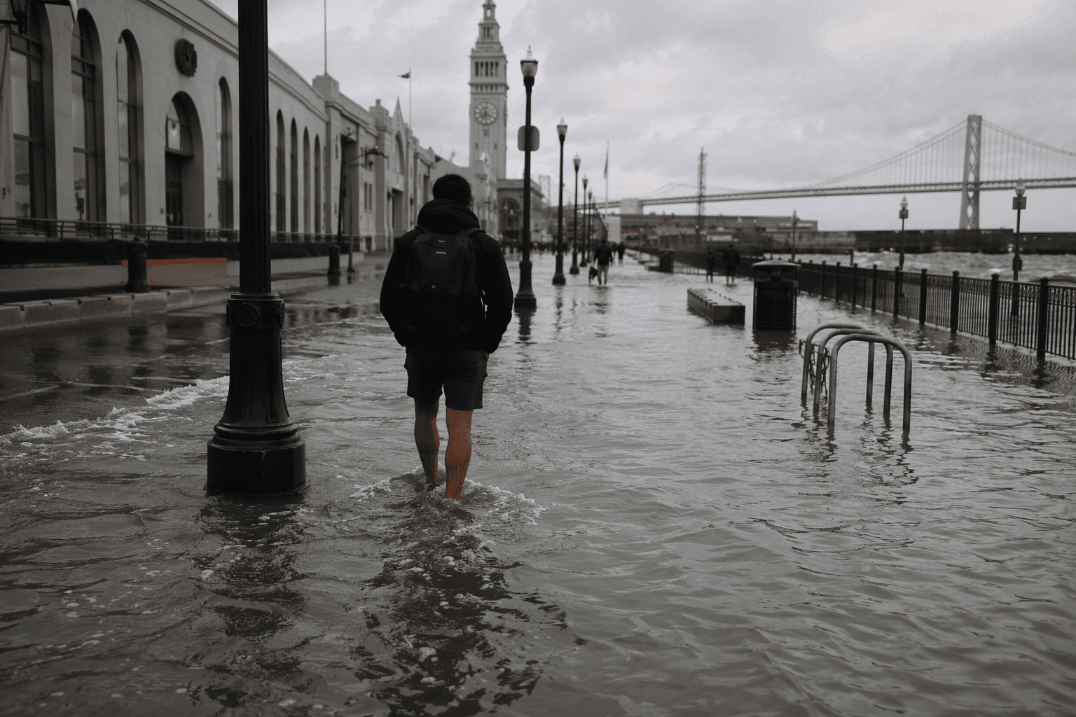
King tides flood San Francisco Embarcadero, raising sea-level concerns
King tides pushed water onto the Embarcadero, exposing how BART, Muni and waterfront businesses are already living with flood risk.
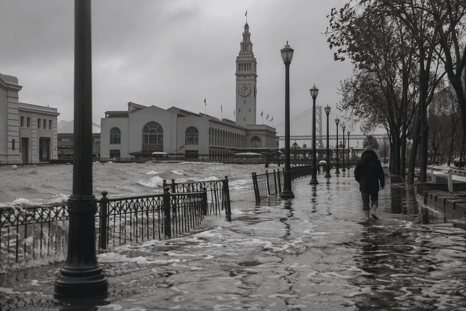
Overnight flooding along San Francisco’s Embarcadero turned one of the city’s best-known waterfront corridors into a live test of how much water the shoreline can absorb before daily life starts to break down. The flooding was expected to continue through Wednesday, and for commuters, tourists and businesses near the Ferry Building, the scene was a reminder that the Embarcadero is no longer just a scenic promenade, but a place where transit access, sidewalks and storefronts now have to function around repeated inundation.
The water was driven by king tides and unusually high summer tides, the kind of conditions that can push several extra feet of water into the bayfront depending on the reference point being used. That makes the Embarcadero especially vulnerable because it sits low, handles constant foot traffic, and serves as a connector for people headed to downtown, the waterfront and nearby transit stops. When the tide comes up, the impact is immediate: traffic slows, access narrows, and the public sees just how exposed the shoreline has become.
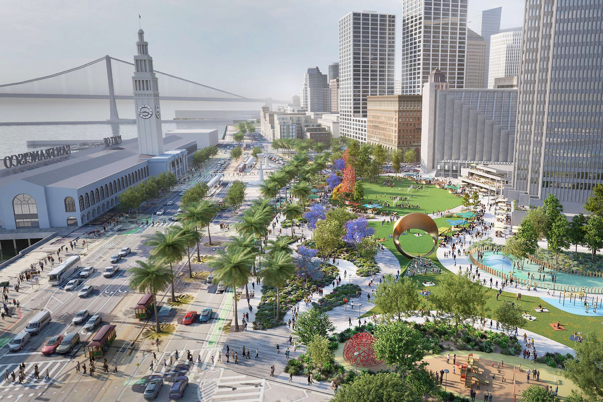
City and regional agencies have spent years building out the response. San Francisco’s ClimateSF effort is launching a multi-year Shoreline Adaptation Plan to guide how the city adapts its coastline to sea level rise, coastal flooding and storm impacts. The Port of San Francisco has said the neighborhoods along the Embarcadero face both urgent seismic risks and increasing flood risks from sea level rise, while its Downtown Coastal Resilience Project identifies the stretch between Broadway and Harrison Streets as one of the most flood-vulnerable areas on the waterfront.
That project is meant to protect assets that San Francisco cannot afford to lose for long, including BART, Muni, sewer systems, downtown businesses and historic buildings. The Port’s waterfront flood study covers its 7.5-mile jurisdiction over the next 100 years, and the draft flood study plan was released for public comment on January 26, 2024. Taken together, the work shows that the latest flooding is not an isolated nuisance. It is part of a longer planning clock already running along the bay.
A U.S. Geological Survey study found that flood-mitigation strategies can reduce risk under about 1 meter of sea-level rise, but no single fix is likely to hold up forever. The strongest path, the study concluded, is a hybrid one combining wetlands, engineered defenses and carefully sited floodgates, a sign that the Embarcadero’s future will depend on more than one wall or one project.
This article was produced by Prism’s automated news system from verified source data, official records, and press releases, then run through automated quality and moderation checks before publishing. The system is built and supervised by the people who set the standards it runs under. Read our full AI policy.
Know something we missed? Have a correction or additional information?
Submit a Tip