Lake-Effect Snow Blankets Wisconsin Snowbelt, Winter Storm Warning Extended
Hurley, Wisconsin's snowiest city, saw 1-2 inches of snow every six hours as a Winter Storm Warning for Ashland and Iron Counties stretched through 7 PM Monday.
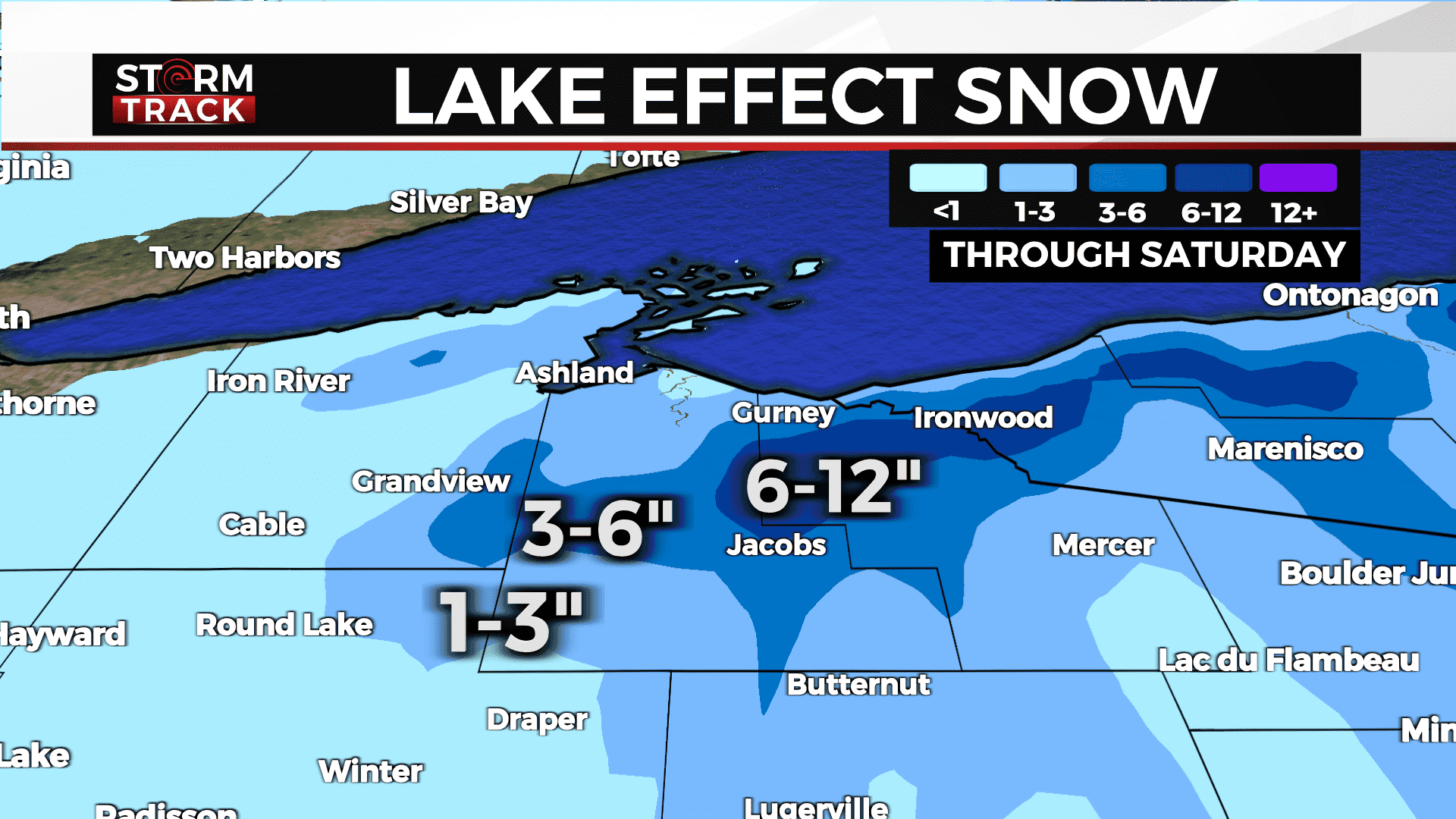
Robust lake-effect showers deposited several inches of snow across central Ashland and northern Iron County on Monday as the National Weather Service office in Duluth extended a Winter Storm Warning for both counties through 7 p.m., with accumulations heaviest around Hurley, widely recognized as Wisconsin's snowiest city.
NWS Duluth meteorologist Kevin Huyck described the pace of snowfall in northern Iron County during active lake-effect setups: "We're generally expecting about 1 to 2 inches in the northern part of the county every six hours." A 3:15 p.m. radar update from NWS Duluth confirmed light to moderate snow showers were returning through the evening, with areas of freezing drizzle also possible along and north of the Iron Range. Earlier forecasts had projected an additional 3 to 5 inches along the South Shore snowbelt, with wind gusts ranging from 30 to 40 mph. NWS meteorologists later narrowed that estimate to 1 to 3 more inches for northwest Wisconsin as northwesterly flow allowed snow showers to persist into the afternoon.
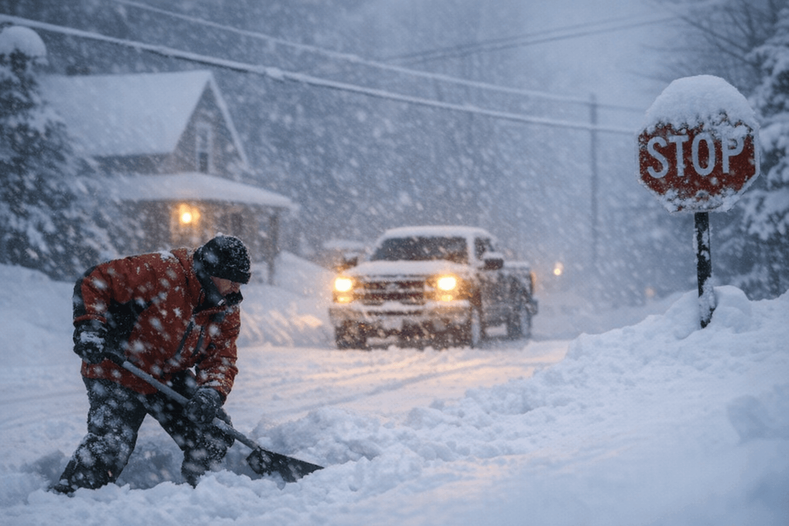
U.S. Highway 2 and WI-13, which cut through the South Shore's most snow-prone terrain, faced particularly hazardous travel. The warning area also covered portions of the Bad River Reservation and Lac du Flambeau tribal lands, where drifting snow can rapidly block secondary roads.
Northern Bayfield and east-central Ashland Counties recorded elevated accumulations alongside northern Iron County, while on-and-off showers spread across Burnett, Washburn, and western Douglas County. Lighter snow and flurries extended across the broader Northland, with slippery roads reported region-wide.
Lake-effect snow from Lake Superior forms when cold, dry air masses push across the relatively warm open water, absorbing heat and moisture before releasing that energy as intense, localized snow bands on the southern and eastern shores. The mechanism intensifies sharply in northern Iron County when northerly winds are sustained.
The South Shore's vulnerability is well documented. In late November 2025, unseasonably warm Lake Superior surface temperatures fueled potent lake-effect bands across Bayfield, Ashland, Iron, and Vilas Counties. Mercer, in Iron County, recorded 32.2 inches in that single event, the largest northern Wisconsin snowfall totals by December 1 since 2019. Winds gusted above 40 mph, and Xcel Energy reported roughly 14,000 customers without power, many remaining in the dark through Thanksgiving. A separate lake-effect round later in the 2025-26 season again triggered a Winter Storm Warning for Ashland and Iron Counties, with forecasters projecting 4 to 12 additional inches and flagging northern Iron County for the highest totals.
Monday's April storm, unusual in its timing but consistent in its geography, underscored how reliably the South Shore snowbelt draws the worst of whatever Lake Superior can produce, long after the rest of Wisconsin has moved on from winter.
This article was produced by Prism’s automated news system from verified source data, official records, and press releases, then run through automated quality and moderation checks before publishing. The system is built and supervised by the people who set the standards it runs under. Read our full AI policy.
Did this article answer your question?