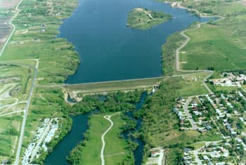
Chan SanSan Scenic Backway highlights Stutsman County’s James River valley
The Chan SanSan Scenic Backway turns the James River valley into a short, packed drive with prairie views, bridge history, and Yanktonai Sioux place-name heritage.
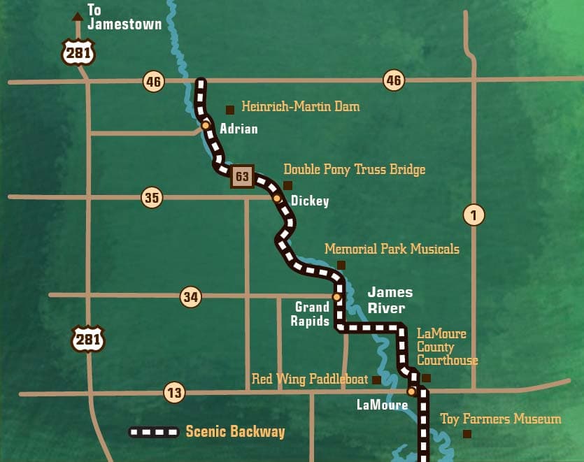
The Chan SanSan Scenic Backway is one of the easiest ways to see Stutsman County’s landscape as a living map. The route runs south from Jamestown through the James River valley, where the river winds past tallgrass prairie, wildflowers, wildlife, and historic places. It is a compact drive with a lot of local meaning: the name Chan SanSan is the Yanktonai Sioux name for the James River, so the road carries Indigenous history in plain sight.
What the drive is, and why the mileage matters
The route is described two ways in official and local tourism materials. Discover Jamestown calls it a 35-mile scenic drive south of Jamestown centered on the James River valley, while North Dakota Tourism describes a 32-mile Chan SanSan Scenic Backway. Both point to the same stretch of country, and the difference in mileage does not change the experience on the ground: this is still the James River valley drive that ties Stutsman County to the broader landscape of south-central North Dakota.
That stretch is part of the federal America’s Byways system, which helps explain why it is treated as more than a local back road. It is a named scenic route with a defined identity, and that identity starts with the river itself. The James River valley is not a random corridor of fields and water; it is a glacial landscape formed by meltwater more than 12,000 years ago, giving the backway a geologic story as old as the open prairie around it.
What you will see from the road
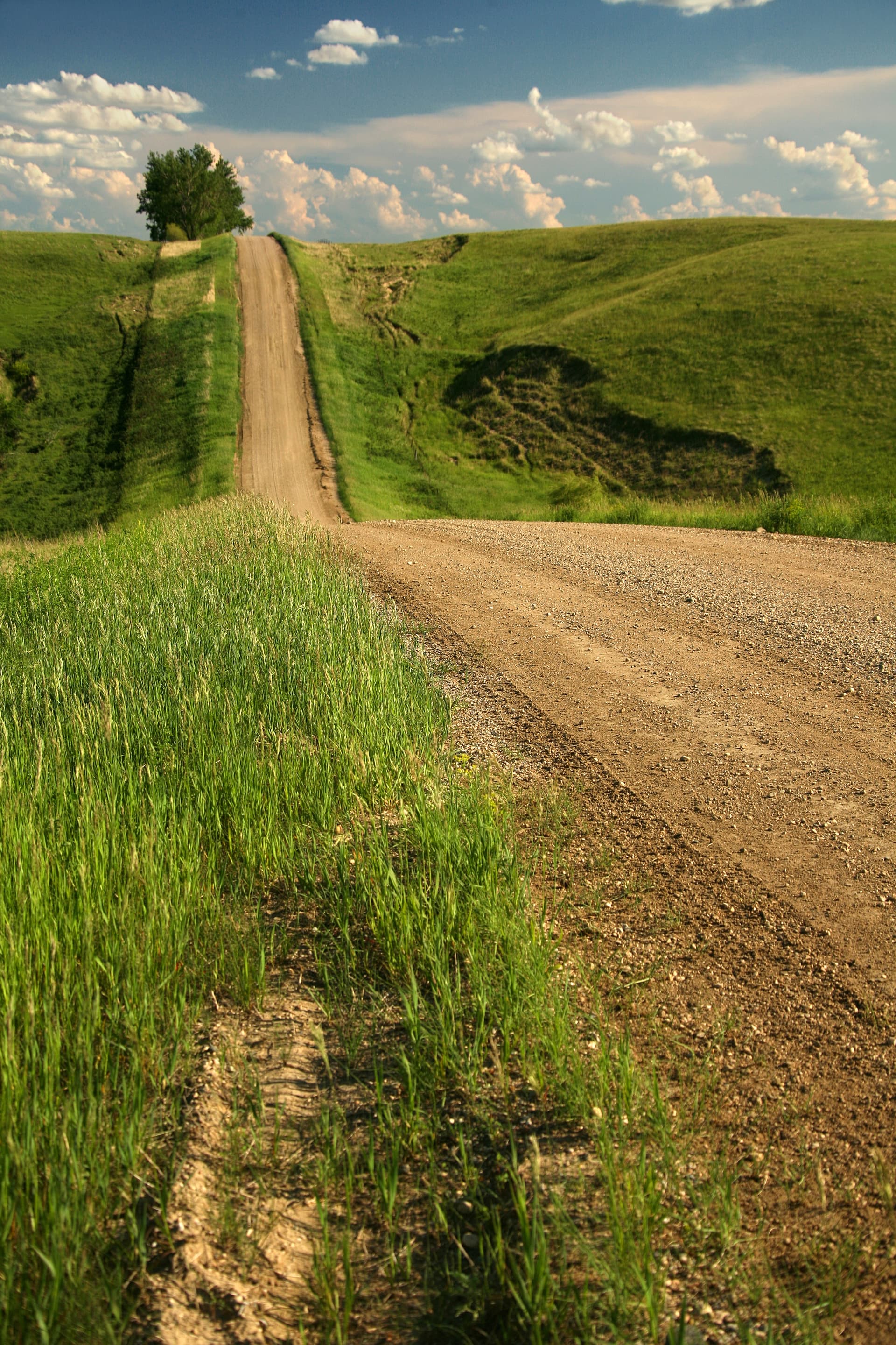
The most immediate draw is the scenery. Discover Jamestown describes “the smell of warm pavement and prairie grasses” and “the beautiful vista of the James River snaking along the river valley,” with wildflowers, wildlife, and historical places along the way. North Dakota Tourism adds “the charming pastoral scenery of the James River Valley,” a useful description for a drive that shifts constantly between river bends, grassland edges, and open sky.
That mix makes the route especially strong in different seasons. In summer, the prairie is green and the river corridor feels full of movement and color. In fall, the contrast between the valley and the surrounding fields becomes sharper. In winter, the same road turns stark and wide, which makes the slope of the valley and the line of the river stand out even more clearly. The route works because it is never just about scenery in the abstract, but about a specific valley that reveals how water, ice, and grassland shaped this corner of North Dakota.
The history built into the route
The Chan SanSan Scenic Backway is also a useful local-history drive because the roadside landmarks are concrete, not symbolic. North Dakota Tourism says the route features three rare pony truss bridges built in the early 1900s, and that detail gives the byway a clear architectural thread. Those bridges are part of what makes the drive feel rooted in the early settlement period, when transportation across the river valley depended on practical, durable engineering.
North Dakota Tourism’s site list for the backway points to several stops that turn the route into a series of shorter walks or pullovers. The Double Pony Truss Bridge in Dickey, North Dakota, is one of the names to know if you want a direct look at that bridge history. LaMoure County Memorial Park in Grand Rapids, North Dakota, adds a county-park stop to the route, while the LaMoure County Courthouse in LaMoure gives the drive a civic landmark that connects the road to county identity. Taken together, those sites show that the backway is not only a scenic overlook loop. It is a corridor of built history stretching through neighboring communities.
How the James River valley shapes the experience
The valley itself is the reason the route feels so distinctive. The National Scenic Byway Foundation says the James River Valley was formed by glacial melt more than 12,000 years ago, and North Dakota Tourism says the backway follows a glacial valley carved 12,000 years ago. That shared geologic frame matters because it explains the shape of the drive: the broad lowlands, the river’s course, and the way prairie and water sit together in the same view.
For Stutsman County, that means the backway offers more than a pretty detour. It gives residents a way to read the county’s landscape through its formation. The river valley tells a story of retreating ice, moving water, and the long settling of grassland that still defines the region today. That is why the route can feel familiar and surprising at the same time. Many people know the James River valley as part of everyday geography, but the byway turns it into something worth tracing mile by mile.
A practical way to plan the drive
The backway works well as a half-day or day trip from Jamestown because it is short, accessible, and tied to roads people already know. Start with the stretch south of town, then give yourself time to stop at the bridge sites and courthouse landmark instead of treating the drive as a quick pass-through. A slower pace is the point here: the route is designed around scenery, local history, and the visible curve of the river.
A simple way to approach the drive is:
1. Leave Jamestown and head into the James River valley section of the route.
2. Watch for river views, prairie grasses, and wildflowers along the way.
3. Stop at the bridge sites and county landmarks in LaMoure County.
4. Use the drive as a return route into the county story, not just a road out of town.
That approach makes the route useful for both residents and weekend visitors. It is close enough to fit easily into a regular day, but layered enough to feel like a destination. You do not need a special season or event to make it worthwhile. The James River, the valley formed by glacial melt, the pony truss bridges, and the Yanktonai Sioux name together make the Chan SanSan Scenic Backway one of the clearest ways to see Stutsman County as landscape, history, and place all at once.
This article was produced by Prism’s automated news system from verified source data, official records, and press releases, then run through automated quality and moderation checks before publishing. The system is built and supervised by the people who set the standards it runs under. Read our full AI policy.
Did this article answer your question?