New London board backs Otter Pond erosion fixes, public access plan
New London zoning officials backed four infiltration steps at Otter Pond Beach to curb erosion and runoff while keeping public access open. The fix comes as water clarity and phosphorus trends worsen.
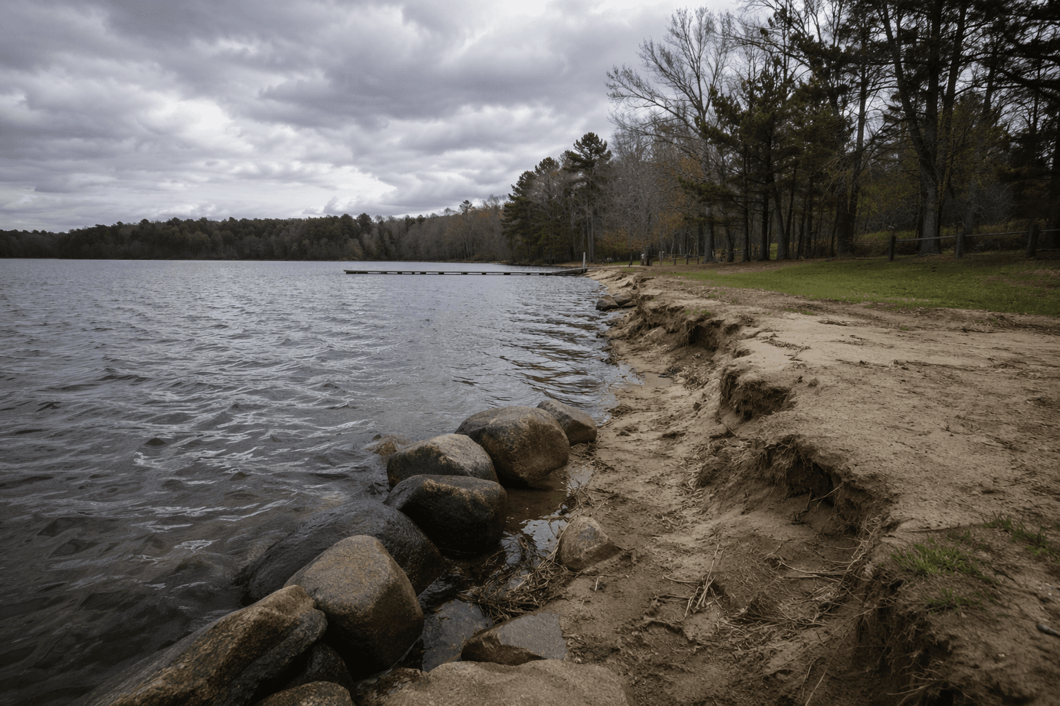
A small network of four infiltration steps won backing from New London zoning officials as the town tried to keep Otter Pond Beach open to the public without letting more foot traffic chew away the shoreline. The plan is aimed at the erosion created by informal access paths cut through the buffer, a problem local supporters say has been worsening for years.
The Otter Pond Protective Association sought a variance from the Shore Land Overlay District rule to install four pathways of infiltration steps at Otter Pond Beach, according to the public notice for the June 16 hearing before the New London Zoning Board of Adjustment. The board’s approval reflected a hardship-based approach, with the steps intended to preserve access along the long, narrow shoreline while reducing erosion and controlling stormwater before it reaches Otter Pond.
Lake Sunapee Protective Association backed the request in a May 18 letter, saying the project would “ensure adequate public access while minimizing erosion.” The association said the beach had seen more and wider access paths cut through the shoreline buffer over time, which had led to shoreline erosion. A neighbor letter dated May 15 said the 2023 flooding carved gullies into the beach and increased the amount of material washing into the pond.
The project is part of a broader restoration push at Otter Pond Beach. In late April 2026, volunteers planted more than 200 native plants and shrubs to help define parking and beach access areas, funded by Otter Pond Protective Association and the Lake Sunapee Protective Association’s Watershed Challenge Fund. The next phase, planned for fall 2026, calls for the infiltration steps that were at the center of the zoning request.
The water-quality stakes are high. Otter Pond Protective Association describes the pond as mesotrophic and exceptionally clear, covering 187 acres, reaching 34 feet deep and sitting at 1,125 feet in elevation in Sunapee, Georges Mills and New London. But the 2024 New Hampshire Department of Environmental Services Volunteer Lake Assessment Program report said chlorophyll levels and water clarity were worsening, with elevated phosphorus and turbidity after major storms pointing to stormwater runoff as a pollutant source. The report also said epilimnetic conductivity had shown a significantly worsening trend since monitoring began.
That is why the Otter Pond case could matter beyond one beach. Lake Sunapee Protective Association’s 2020 watershed management plan was built to reduce phosphorus loading across watershed waterbodies, including Otter Pond, and the group has been working on shoreline fixes since its founding in 1898. By approving a hardship-based access and erosion remedy here, New London officials may have set a practical template for other Sunapee-area disputes where shoreline access, stormwater control and lake protection collide.
This article was produced by Prism’s automated news system from verified source data, official records, and press releases, then run through automated quality and moderation checks before publishing. The system is built and supervised by the people who set the standards it runs under. Read our full AI policy.
Know something we missed? Have a correction or additional information?
Submit a Tip