Sullivan County’s Unity lands offer recreation, conservation and education space
Sullivan County’s Unity lands are more than open space: they are trails, classrooms, water infrastructure and a 2,100-acre public asset with daily uses.
The best way to think about Sullivan County’s lands in Unity is as a working public landscape. More than 2,100 acres spread across six parcels give residents a place to hike, fish, garden, snowmobile on designated routes and learn how the county manages soil, water and wildlife. The same ground that once supported the county’s poor farm and jail now functions as a recreation network, an outdoor classroom and a conservation base.
A county land base with six distinct tracts
Sullivan County says its undeveloped land in Unity is divided among Marshall Pond, Unity Mountain, County Farm, Little Sugar River, Stowell and Judkins. Three of those tracts, Marshall Pond, Unity Mountain and County Farm, are contiguous; the other three are separate parcels. The county describes much of the land as old farms with forests, fields, streams, wetlands and mountain views, which is what makes the property useful for more than one purpose at once.
The county’s own land overview makes clear that the original goal was practical, not scenic. The land was intended to supply firewood, agricultural fields and other natural resources to the Sullivan County Poorhouse and Jail, while also providing potable water piped downhill from Marshall Pond. That mix of water, timber and farm use shaped the county holdings from the start, and those same pieces still show up in the way the property is managed today.
What the forest plan is trying to balance
Sullivan County has used formal forest management plans since 1990, and the current plan is meant to guide land management through 2030. The county lists seven goals for the lands: protecting soil and water, conserving wildlife habitat and native biodiversity, encouraging recreation and education, promoting community involvement, supporting hunting and fishing, and facilitating scientific research.
That is not just a statement of values. It explains why the county treats these lands as infrastructure, not simply preserved acreage. A managed forest can support classrooms, trail access, water protection and habitat at the same time, so long as the county keeps the uses organized and the rules clear.
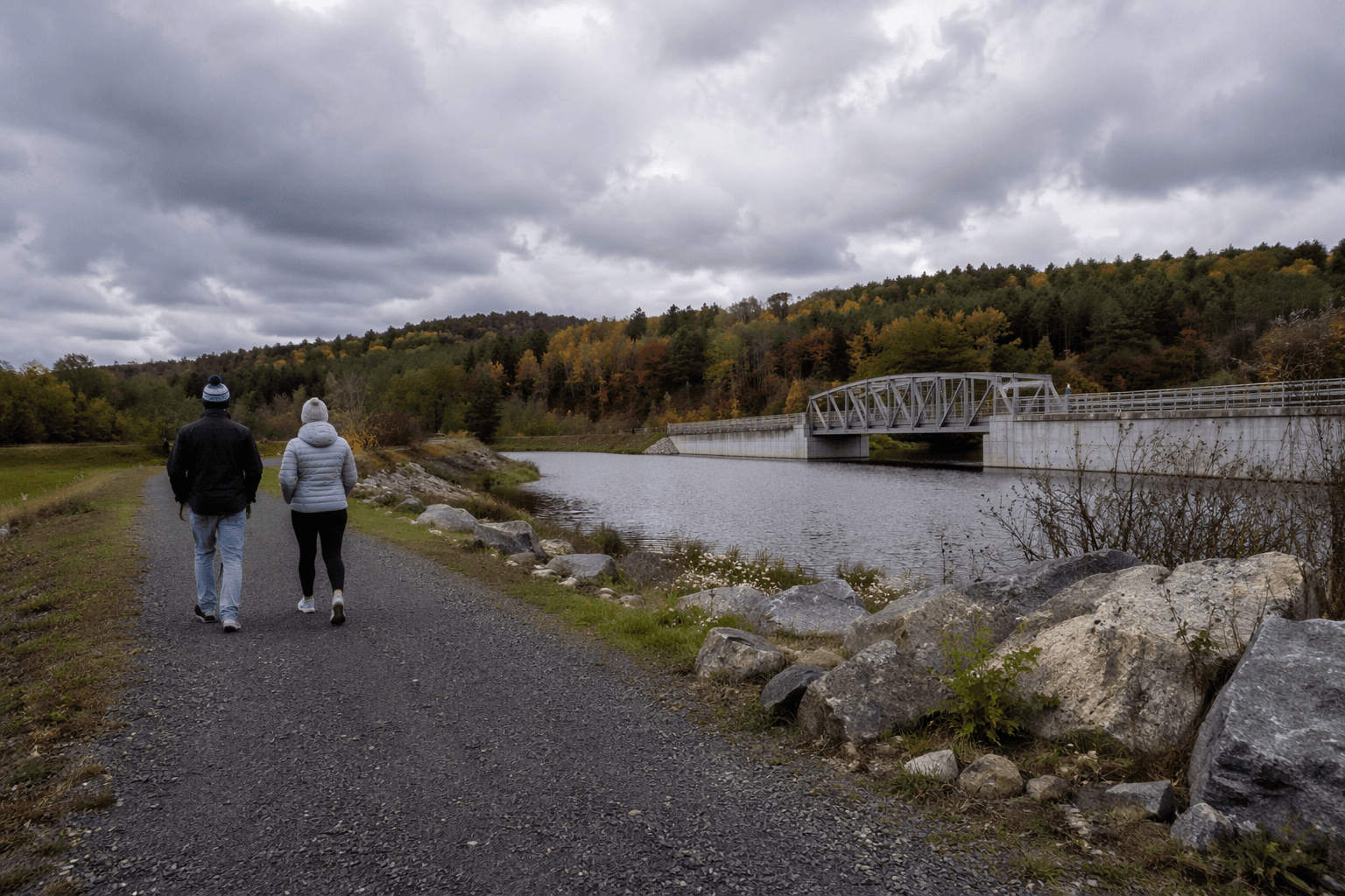
Where people can go now
The most visible public use is the trail network. The Unity Mountain Trail is four miles long, built entirely on public lands in Unity, marked with blue blazes and routed from the Sullivan County Complex toward Mica Mine Road near the historic Marshall family cemetery. The trail crosses the 2nd New Hampshire Turnpike, climbs past a small pond, follows the flank of Unity Mountain and drops toward Marshall Pond, with a scenic overlook near the summit.
Sam’s Lookout is one of the best-known stops. On a clear day, the county says, it offers a view into Vermont. Glidden Hill adds another vista, and the county also identifies the two-mile Glidden Ridge Trail. Taken together, the county says its lands already support more than 6.5 miles of hiking trails.
The trail system is not limited to foot traffic. The county says the property also holds miles of snowmobile trails maintained by the Crescent Lake Regional Snow Riders club, along with internal roads and smaller foot paths. The rules are straightforward: hiking, hunting, fishing, gardening and snowmobiling are allowed only on designated trails, while motorized vehicles and campfires are prohibited.
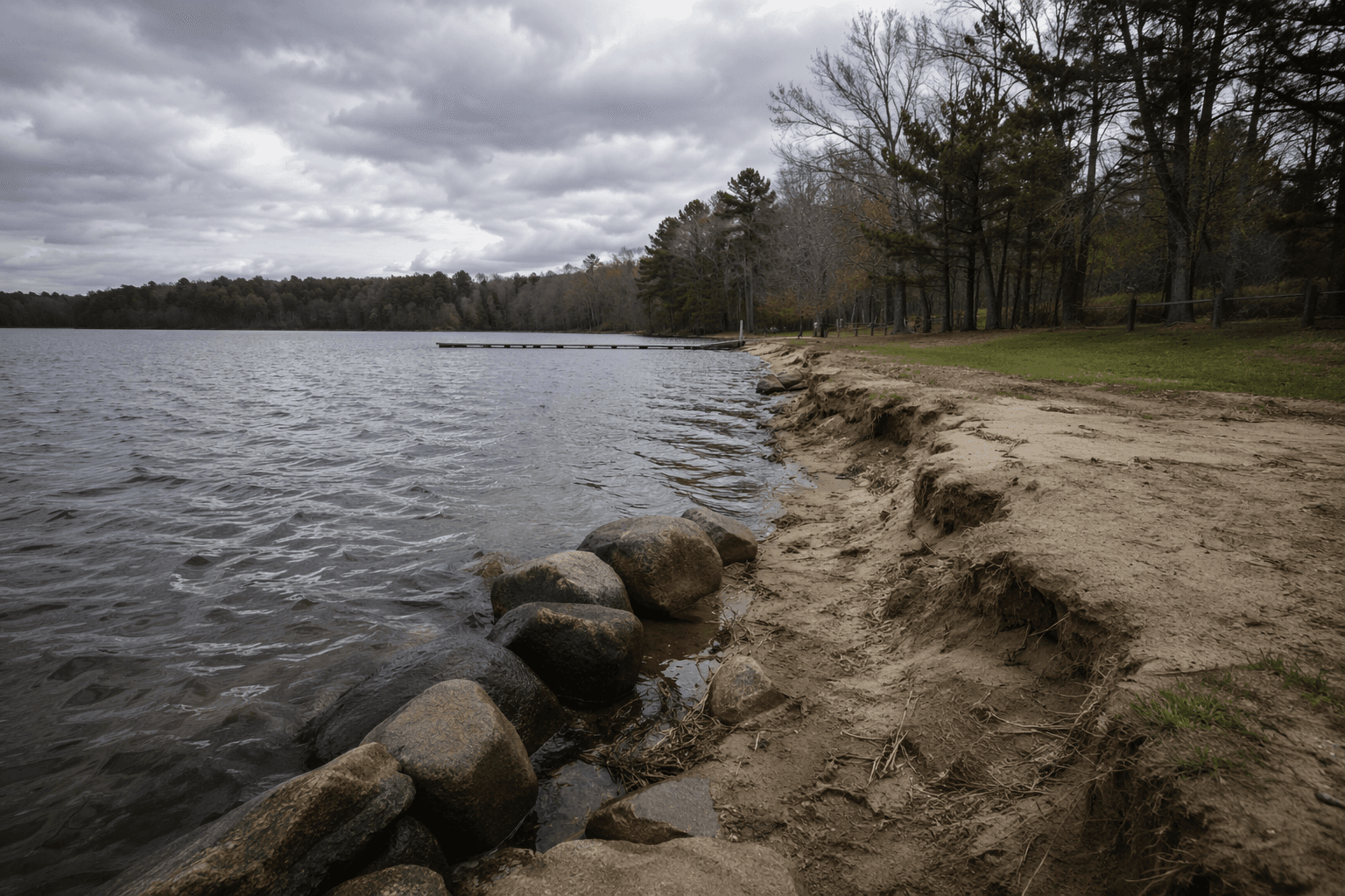
Marshall Pond and the county’s water story
Marshall Pond is one of the most important tracts in the system because it links the county’s past and present. The tract is mapped at 262 acres and includes open maintained fields, wetlands, streams, a mixed forest, a cement dam and an active water pipe that supplies non-potable water to the county complex for fire suppression. Parts of the tract near Mica Mine Road are mapped as prime agricultural soil.
That water role matters beyond the woods. The county’s water system provides drinking water and fire suppression water for the Unity complex, while the Marshall Pond tract still supplies non-potable water for fire protection. The result is a public land base that doubles as a utility asset, something most residents probably do not see when they look at the tree line.
Education is built into the property
The county says education sites at Marshall Pond and the Eco Ag Center are used year round to teach schoolchildren, families and adults about natural resources and management techniques. The Sullivan County Conservation District points to the Eco Ag Center’s community garden, pond with a fishing dock, pollinator garden, Jessie’s Trail and forest classroom as part of that learning landscape.
The county’s Natural Resources Department houses the Sullivan County Conservation District, whose purpose is to preserve and promote the county’s natural resources through management and research, landowner assistance and educational outreach. Lionel Chute serves as the county’s Natural Resources director, and the county also identifies him as manager of the Conservation District. Madeline Ferland is Sullivan County’s sustainability educator, adding another staff role tied directly to public programming on the land.
That programming is not hypothetical. The county held a School-to-Farm Day at the Eco Ag Center in May 2025, and it advertised an agriforestry workshop there in spring 2026. Those events show the county using the land for hands-on instruction, not just passive visitation.
A landscape shaped by older county institutions
The historical record helps explain why the land matters. Sullivan County bought the Judkins property in 1921, paying $2,100 for 300 acres. It also bought the Mills farm for $8,700 to protect Marshall Pond from pollution, a move that tied land acquisition directly to water quality. In 1930, the county voted to build a new almshouse for $150,000, and the building was erected in 1931.
The county’s Poor House operated from 1868 to 1932, and county jail prisoner records run from 1903 to 1932. The county also notes a burial ground for the Poor House cemetery at the County Complex. Those dates show how the Unity lands grew out of a county service system built around care, confinement, water supply and land use, then evolved into a much broader public resource.
The civic pieces that make it work
The county says its Natural Resources office is at 95 County Farm Road in Unity, while the county complex is at 5 Nursing Home Drive in Unity. The county also describes itself as the custodian of the land base and highlights the Eco Ag Center, Sam’s Lookout, the outdoor classroom at Marshall Pond and a public cidery.
The cidery is another example of how the land is used for community purposes, not just conservation. It is volunteer-supported and generally open seasonally from September to mid-October. That seasonal opening, along with the trails, classroom sites and field programming, gives Sullivan County a public asset that operates in multiple modes across the year.
Taken together, the Unity lands are not a hidden preserve in the usual sense. They are a county-owned working landscape with a trail network, water infrastructure, classroom sites and a management plan that ties recreation to conservation and education.
This article was produced by Prism’s automated news system from verified source data, official records, and press releases, then run through automated quality and moderation checks before publishing. The system is built and supervised by the people who set the standards it runs under. Read our full AI policy.
Know something we missed? Have a correction or additional information?
Submit a Tip