Kamas celebrates its role as the Gateway to the Uintas
Kamas’ walking-tour history shows how valley geography, pioneer settlement, and incorporation turned a small town into the Gateway to the Uintas.
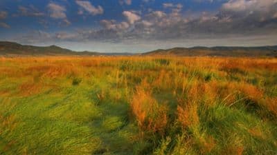
Kamas is easiest to understand on foot. From the center of town, the valley opens in every direction, with the Uinta Mountains to the east, the Wasatch Mountains to the west, and Beaver Creek cutting diagonally through the settlement on its way toward the larger rivers that border the valley. That geography explains why Kamas became a supply stop, a farming community, and eventually the town that still carries the name Gateway to the Uintas.
The valley that made Kamas
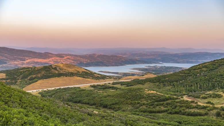
Kamas sits in a long, narrow valley that runs about 10 miles from end to end and 2 to 4 miles across. The Weber River crosses the north end, the Provo River marks the south end, and low rolling hills soften the view enough that the mountains beyond can seem farther away than they are. The largest of the valley’s five main creeks, Beaver Creek, flows diagonally across the whole area, tying the town to the water routes that shaped settlement and agriculture.
The landscape has a deeper backstory than the present-day road grid suggests. Summit County notes that the valley may once have been covered by a large inland lake, leaving behind rich soil and fossils of water animals. The town’s name is tied to a Native term associated with the camass plant and the image of a small grassy plain among the hills, which fits the setting well enough that the name and the land still read as one story.
From Rhodes Valley to an incorporated town
Before Kamas was incorporated, it was known by another name. Summit County’s history page says the settlement was founded in 1857 by John Simpson and originally called Rhodes Valley. The official walking-tour material adds that Thomas Rhoades was sent in 1858 by Brigham Young, then spent the first full winter in the valley in 1860 with George W. Brown.
The town became official on Wednesday, July 5, 1911, when the Summit County Board of County Commissioners unanimously approved the resolution incorporating the Town of Kamas. That date matters because it marks the transition from a frontier settlement to a municipality with its own civic identity. The city’s current mission statement still reflects that balance, emphasizing orderly growth while preserving the open and rural environment that defines the valley today.
A settlement built around protection and survival
Early Kamas was shaped by the practical realities of a mountain valley on the edge of travel routes and conflict. The walking-tour history says settlers first built a stockade and later completed a fort in 1867. Summit County’s Peoa and Kamas history page adds a key detail: the log fort was built for 32 families during the Black Hawk Indian War and was vacated in 1870.
That fortified beginning gives the town’s development a more grounded arc than a simple pioneer narrative. Kamas did not grow as an isolated farm village alone. It became a place where families, livestock, and supplies needed protection, and where a community had to organize quickly to survive winter conditions, distance, and uncertainty.

Once that stability took hold, the town diversified. The county history page says Kamas later developed flour mills, creameries, a bank, a hotel, a movie theatre, an undertaker, and garages. Those businesses show a town that moved from defense and subsistence into commerce, services, and local institutions, all within a valley that still feels compact enough to cross in a single afternoon.
Why the “Gateway to the Uintas” label stuck
Kamas earned its gateway reputation because it sits at the point where local life and mountain access meet. The city’s welcome page describes the town historically as a supply station for people heading into the Uinta Mountains and Wilderness Area for camping, hunting, hiking, horseback riding, and other recreation. That role still makes sense on the ground: the roads out of town lead directly toward high-country access, and the valley framing makes Kamas feel like the last settled stop before the mountains open up.
The broader regional history deepens that identity. Summit County’s Peoa and Kamas history page connects the area to early trappers and explorers, including William Ashley, Jedediah Smith, Jim Bridger, and Kit Carson, who reportedly stopped at springs near Peoa around 1824 and 1825. The same county history notes an old Indian trail crossing the valley and a Spanish cannon found in the middle of it, details that show Kamas was part of a travel corridor long before it became a modern recreation base.
That corridor logic is still visible in how the town is described today. Kamas is not just a place with pioneer roots; it is a point of departure. The valley’s shape, the rivers at either end, and the mountain walls on both sides explain why travelers, traders, ranchers, and vacationers have all passed through the same narrow landscape.
What a visitor can still read in the town today
The clearest thing about Kamas is that its history is not locked away in a museum file. The valley geometry is still visible, the creek still runs through town, and the wide-open setting still makes the gateway label feel earned rather than decorative. Even the town’s present-day emphasis on open space and rural character echoes the older settlement logic that favored room for livestock, storage, and movement toward the Uintas.
The population figures tell the same story of a small but changing town. Summit County’s Kamas history page lists the city population at 1,061, while census-based profiles tied to the 2020 Census place it at 2,092. However the count is framed, Kamas remains small enough to feel intimate and large enough to support the role it has long held for Summit County: a working town, a trailhead town, and a place where the valley still explains the map.
This article was produced by Prism’s automated news system from verified source data, official records, and press releases, then run through automated quality and moderation checks before publishing. The system is built and supervised by the people who set the standards it runs under. Read our full AI policy.
Did this article answer your question?