Summit County's role in the historic Lincoln Highway route
Summit County's canyon roads carried mail, stages and the Lincoln Highway, and the same corridor still links I-80, Union Pacific and old auto-era traces.
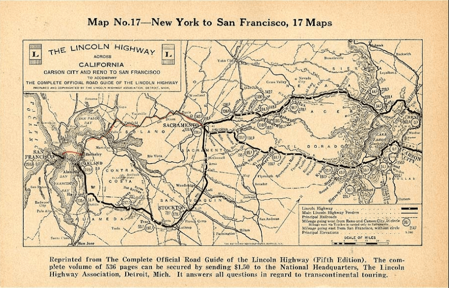
The Lincoln Highway ran through Summit County from Evanston to Salt Lake City and turned Echo Canyon into part of a national network of movement, signage and hard-surfaced roads.
Why the Lincoln Highway mattered here
The Lincoln Highway Association formed in 1913 with a simple but ambitious goal: build a coast-to-coast automobile highway and mark it clearly so drivers could actually follow it. Federal Highway Aid Acts in 1916 and 1921 helped push that national idea toward reality, and Summit County ended up carrying one of its western segments through some of Utah’s most challenging mountain terrain.
In Summit County, the highway connected local communities to a growing national mobility system, linking mountain settlements to Salt Lake City and to the broader east-west travel corridor that was taking shape across the American West.
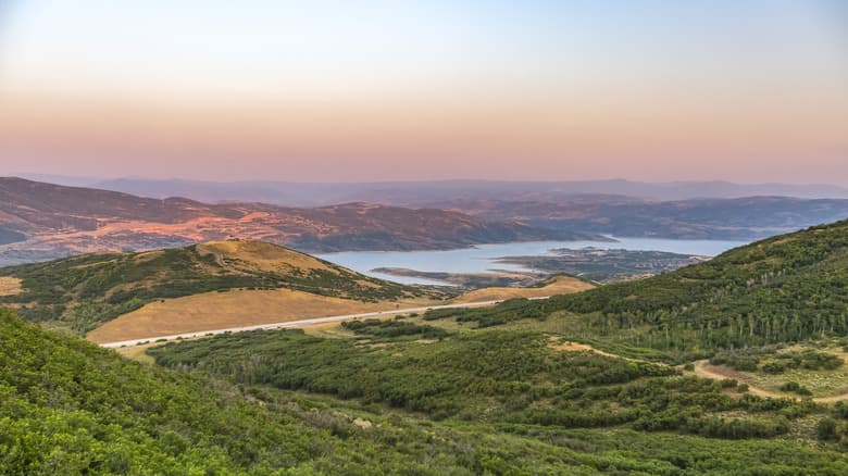
Echo Canyon as the county’s transportation spine
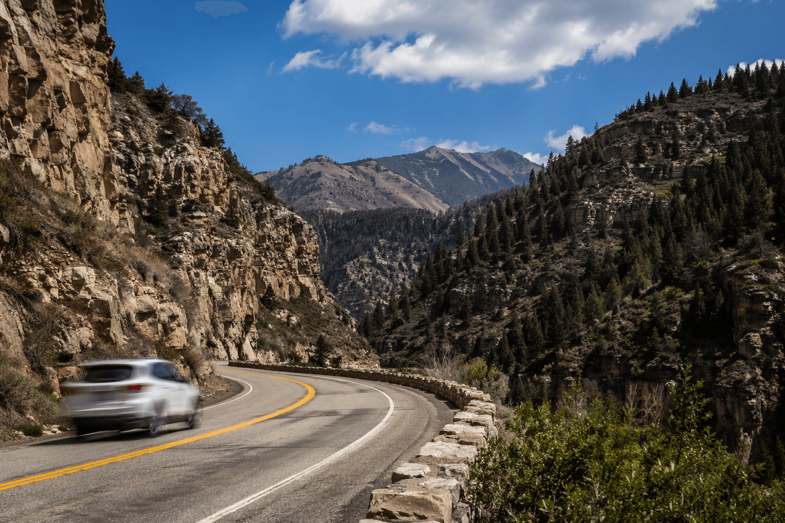
Echo Canyon is a 24-mile passage through the Wasatch Mountains, a natural conduit that has long funneled people, animals and infrastructure through a narrow corridor. Echo Canyon Road evolved from an Indian trail into a wagon road, then an early automobile highway known as the Old Lincoln Highway, and later U.S.-30.
The same passage used by Native peoples and wildlife also carried Mormon pioneers in 1847, the Overland Stage, the Pony Express, gold prospectors, silver miners, the Union Pacific Railroad, the first transcontinental telegraph line, the Lincoln Highway and eventually Interstate 80. Today the canyon still carries I-80, the Union Pacific Railroad, a segment of the Old Lincoln Highway and utility lines, making it one of the clearest places in the county to see transportation eras stacked on top of one another.
The local labor behind the road
Summit County’s Lincoln Highway story is also a story of local work. On May 9, 1917, five miles of the Lincoln Highway between Echo and Coalville were leveled and cleared of rocks with a tractor, a road drag, three men working for one day and 40 high school boys with rakes for 2.5 hours. The route was shaped not only by distant planners or big railroad interests. It was built and maintained by people who lived here, studied here and expected the road to serve their own towns.
That kind of labor was part of the wider Good Roads movement that helped drive the Lincoln Highway era, with schoolboys, boosters and local crews making the corridor passable enough to keep travelers moving through Echo Canyon and on toward the next town.
Before automobiles, Summit County was already organized around routes
Long before the Lincoln Highway arrived, Summit County was already thinking in terms of corridors, mail lines and settlement nodes. The first U.S. mail to Salt Lake City through Parley’s Park came in January 1860, Wanship received a post office in 1864 and a February 17, 1869 memorial asked for a semi-weekly mail route from Echo City to Provo through Coalville, Wanship, Rockport, Peoa, Kamas, Heber City and Midway.
Echo itself was settled in 1854 by James Bromley, who ran the Weber Stage Station, and Coalville was incorporated in 1867 before Summit County built a courthouse there in 1871.
What still remains to see today
Summit County’s Lincoln Highway heritage is still visible. The canyon remains narrow and winding, and many historic features sit on private land, but the route can still be traced through the corridor itself. The Summit County Courthouse in Coalville keeps copies of the Lincoln Highway tour guide, and numbered red, white and blue signposts mark the route for travelers who want to follow the old alignment.
In the same canyon, you can read the change from trail to wagon road, from stage route to railroad corridor, from early auto highway to interstate freight route. Summit County’s stretch of the Lincoln Highway helped make the county an early gateway for cross-country travelers, and the landscape still carries the physical evidence of that transition through Echo Canyon and Coalville.
This article was produced by Prism’s automated news system from verified source data, official records, and press releases, then run through automated quality and moderation checks before publishing. The system is built and supervised by the people who set the standards it runs under. Read our full AI policy.
Did this article answer your question?