Summit County’s historic driving tour reveals small-town landmarks and roads
Summit County's road tour links Coalville, Echo Canyon and east-side towns to living landmarks, from a courthouse museum to a working co-op and a 1930 cash store.
Summit County’s historic driving tour is more than a scenic loop, it is a way to move visitor spending off Park City Main Street and into the county’s smaller towns. The route ties together Coalville, Wanship, Echo Canyon, Peoa, Marion, Francis, Woodland and the Snyderville Basin, where roads, settlements and still-used buildings keep the county’s past visible from the car.
Why this route matters now
Summit County covers 1,849 square miles, and its name comes from the high mountain summits that divide the Weber, Bear and Green River drainage areas. The Utah History Encyclopedia lists Park City, Coalville and Kamas as the county’s principal towns, a reminder that Summit County has never been a single-center place. Its economy has long mixed skiing, tourism, lumbering and livestock, which makes a driving tour especially useful because it connects recreation to working communities instead of isolating history in one museum district.
The county’s own history pages frame roads as a central part of the story, and that emphasis is not accidental. Early Summit County was shaped by the route through Echo Canyon used by immigrant groups and later travelers, a corridor that turned geography into settlement and settlement into commerce. A driving tour built around that history gives travelers a low-cost way to spend time in places where the county’s identity still shows up in ordinary buildings, roadside markers and local institutions.
Coalville anchors the county seat story
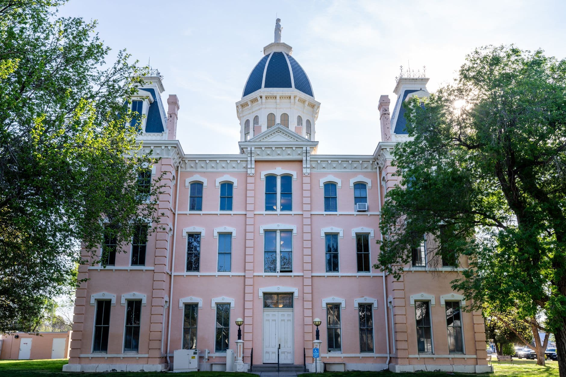
Coalville gives the route its civic core. William Henderson Smith founded the town in 1859, it was incorporated in 1867, and it remains the county seat, so the city is the place where county history and county government meet. The Summit County Courthouse Museum is in the basement of the 1904 courthouse, which makes the building itself part of the exhibit, not just the container for it.
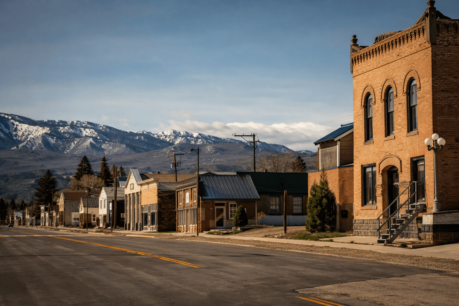
Coalville also reinforces the idea that Summit County’s story is about roads and settlement patterns, not only tourism. The county maintains a history page devoted to roads, and Coalville’s historic Main Street has its own walking-tour book, which shows how the county’s public identity can be experienced both on foot and by car. For visitors, that means the county seat can serve as a practical stop for history, a meal, or a short stretch before heading east or south along the route.
Peoa, Marion, Francis and Woodland keep the smaller towns in view
The east-side stops are where the tour most clearly spreads attention beyond the resort core. In Peoa, the School House was built between 1927 and 1930, and the Fort Sage Bottom Monument marks the site with a detail that links the building to daily life from another era: a bell once hung atop the school for 60 years. That kind of roadside landmark is easy to miss at highway speed, but it gives the route a concrete place to pause and read how education, community identity and local memory were tied together.
Marion adds one of the route’s strongest examples of adaptive reuse. The Mormon church there was built from 1910 to 1914 and now serves as a Farmers’ Co-op, so the building remains part of local economic life rather than standing empty as a monument. Marion also carries a more difficult layer of modern history: the 1988 church bombing and siege tied to the Singer-Swapp case, involving John Singer’s family and Addam Swapp, a reminder that rural historic sites can hold both preservation value and painful memory.
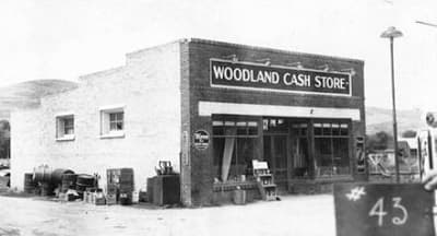
Francis gives the route a more traditional heritage stop, but one that still matters because it keeps pioneer memory connected to a lived community. The Daughters of the Utah Pioneers Cabin and Monument sit alongside the Byron T. Mitchell House, built in 1897 and listed on the National Register of Historic Places. Woodland rounds out the east-side circuit with the Cash Store, built in 1930, a commercial building that shows how the county’s history is not limited to churches, schools and houses but also includes the places where local trade happened.
How the route turns heritage into activity
The best way to read the tour is as a network of places that still do something. In Coalville, the courthouse museum keeps the county seat active as a place of public memory. In Marion, the old church still has a business use as a Farmers’ Co-op. In Francis and Woodland, the historic structures themselves are the draw, which means travelers are spending time in towns that do not rely on Park City traffic to tell their story.
The route also works because it can be folded into the county’s geography. Highway 32, Highway 35, Echo Reservoir and the Uinta Mountains all shape how the landscape feels from the road, and the Snyderville Basin marks the transition between older settlement patterns and the county’s more modern resort economy. That mix is exactly why the driving tour has staying power: it links a county-seat museum, a canyon corridor, farm-town buildings and roadside monuments into one day’s drive.
For Summit County, the economic case is straightforward. A visitor who stops in Coalville, Peoa, Marion, Francis or Woodland is not just consuming history; that person is moving through communities that can capture a meal, a museum visit, or time spent at a working local institution. The county’s heritage is not sealed off from the present, it is distributed across roads and towns that still shape how people live, work and travel.
This article was produced by Prism’s automated news system from verified source data, official records, and press releases, then run through automated quality and moderation checks before publishing. The system is built and supervised by the people who set the standards it runs under. Read our full AI policy.
Did this article answer your question?