Amistad National Recreation Area offers birding, hiking and lake access
Lake levels are changing access at Amistad, so start at the Highway 90 visitor center, check conditions, and plan around campgrounds, birding and boat launches.
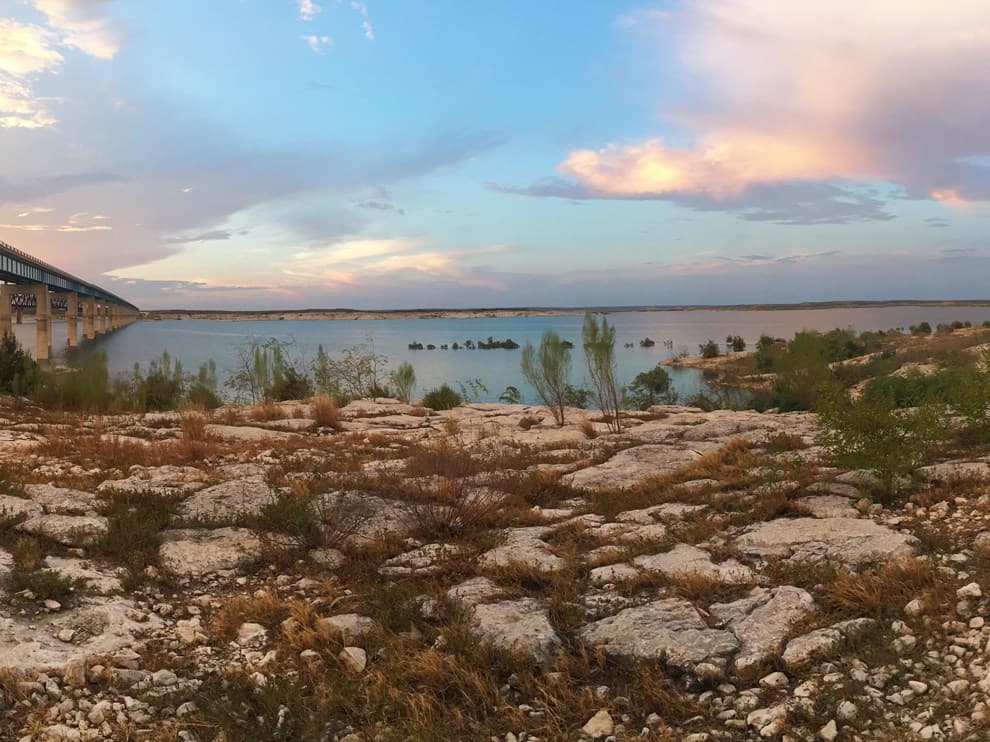
Low water is changing how Amistad works on the ground, so a safe trip starts with the current-conditions page and the Highway 90 visitor center six miles west of Del Rio. The park exists to give the public outdoor access to the U.S. side of International Amistad Reservoir, and that purpose matters when lake levels shift ramp access, trailheads and shoreline safety. With 291 bird species on the checklist and five primitive campgrounds, Amistad is easiest to use when you plan around water, not scenery alone.
Start with the visitor center and the conditions page
The most practical first stop is the Amistad Visitor Center on Highway 90, six miles west of Del Rio. The park’s foundation document lists the superintendent contact as amis_superintendent@nps.gov and (830) 775-7491, with the office address at 4121 Highway 90 West, Del Rio, TX 78840-9350. Hunting regulations materials also place the visitor center at Highway 90 and say it is open from 8:00 a.m. to 4:30 p.m., while noting that days of operation can change, so the hours page should be checked before you drive out.
That check matters because Amistad is a moving target. Park materials say fluctuating lake levels can change access and create hazards at many locations, which affects boat ramps, shoreline routes and trailheads all at once. The current-conditions page and the boating page are the right places to look before a launch, a hike or a day of shoreline exploring.
A quick pre-trip checklist helps keep the visit simple:
- Confirm current conditions and water levels
- Check the visitor center hours for that day
- Review the boating and camping pages if you are taking a boat or staying overnight
- Look at the fees and permits pages if your trip involves hunting, special use or a reserved activity
Birding is one of Amistad’s strongest draws
The bird checklist for Amistad National Recreation Area documents 291 species, which is a big number for a single recreation area and a major reason birders keep returning. The park sits at the intersection of three bird conservation regions and on the central migratory flyway, so the same shoreline, brush and open-water edge can produce a wide range of sightings over the course of a season. NPS birding materials also highlight peregrine falcons, sandhill cranes and shorebirds as part of the area’s appeal.
That diversity makes the reservoir edge more important than a single scenic overlook. When water rises or falls, habitat changes with it, and the best birding can shift from exposed mud and shoreline cover to higher brushy edges or broader water views. In practical terms, the birding value of Amistad is tied to the reservoir’s changing profile, which is why checking lake conditions before planning a birding day is more than a formality.
Camping is straightforward, but it is primitive
If you want to stay overnight, the park’s camping brochure identifies five campgrounds: Rough Canyon, 277 North, San Pedro, Governors Landing and Spur 406. Those campgrounds are primitive and do not have RV hookups, and campsites are open year-round on a first-come, first-served basis with no reservations. Pay stations are located at the campgrounds, so the system is built for simple, flexible use rather than a full-service resort stay.
That setup makes Amistad a good fit for families and local anglers who want a quick base near the water, but the reservation-free model also means timing matters. On busy weekends, the first-come system favors early arrivals, especially when lake access is good and more people decide to go out at once. Because shoreline access changes with reservoir level, a campground that looks close to the water on one visit may sit farther from usable launch or trail access on the next.
Boating, fishing, hunting and diving all depend on water level
Amistad’s identity is built around water. Park history materials describe the area as a place for boating, fishing, canoeing and bow hunting, and the boating page sits alongside the conditions page for a reason: the reservoir is not a fixed shoreline lake. Scuba divers also have reasons to pay close attention, since underwater features and access points can change as levels rise and fall.
The Texas Water Development Board reported Amistad Reservoir at 36.0% full as of 2026-07-21, which is a reminder that the lake is well below full conservation capacity. The same board notes that Texas has rights to 56.2% of the reservoir’s total conservation capacity under the treaty arrangement, a detail that underscores how closely this water body is managed. For anyone launching a boat, fishing from shore or planning a dive, the key question is not just where to go, but whether the access point is usable that day.
Fees and permits belong in that same planning step. Amistad has separate park pages for fees and passes, permits and reservations, and special use permits, while hunting has its own 2026-2027 regulations booklet. If the outing includes hunting, a special activity or an overnight plan that is not purely casual, those pages are part of the trip prep, not extra reading.
Amistad is a border reservoir with a local history behind it
The water here is tied to international infrastructure. The International Boundary and Water Commission says Amistad Dam is a joint U.S.-Mexico project under the Water Treaty of 1944, located on the Rio Grande about 12 miles upstream from Del Rio and Ciudad Acuña. Lake Amistad was first created in 1969, and Amistad became a National Recreation Area on November 28, 1990, which explains why the park blends recreation, water management and cross-border geography in one place.
That border setting also shapes how the park presents itself. The visitor center screens Transparent Border, the park’s film about how the reservoir influenced the relationship between Del Rio and Ciudad Acuña. In county terms, that makes Amistad part of the same outdoor landscape that includes the Rio Grande, the Pecos River and the Devils River, but with a very different management and access pattern because it sits on an international reservoir.
For a weekend trip, the rule is simple: check current conditions, match your plan to the lake level, and use the campground, birding and boating pages before you leave Del Rio. At Amistad, access is the story, and the safest visit is the one built around what the reservoir allows that day.
This article was produced by Prism’s automated news system from verified source data, official records, and press releases, then run through automated quality and moderation checks before publishing. The system is built and supervised by the people who set the standards it runs under. Read our full AI policy.
Did this article answer your question?