7.8 magnitude quake off Mindanao topples buildings, displaces thousands
A 7.8 quake off Mindanao toppled buildings and damaged bridges, leaving dozens injured and thousands displaced. Aftershocks and tsunami fears now deepen the risk.

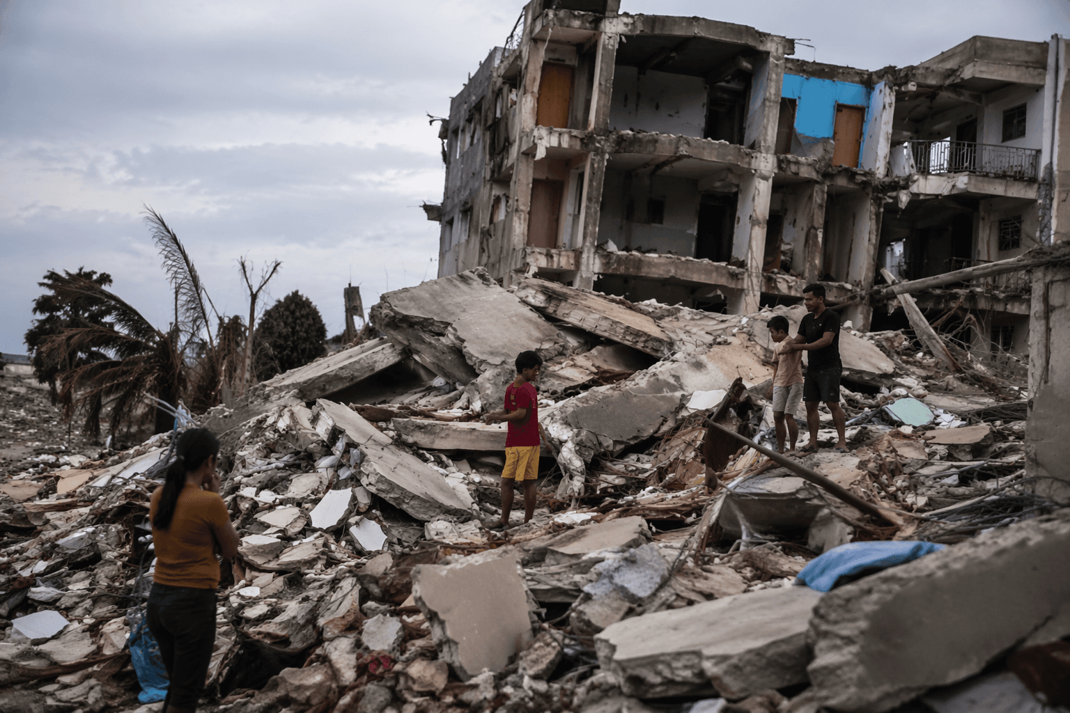
A powerful 7.8-magnitude earthquake off the island of Mindanao toppled buildings and damaged bridges, underscoring how vulnerable homes, roads and emergency routes remain in one of the Philippines’ most seismically active regions. Dozens of people were injured and tens of thousands were displaced as the initial damage gave way to a broader scramble for shelter, transport and medical care.
The immediate danger did not end with the shaking. PHIVOLCS has said major offshore earthquakes in the region can trigger aftershocks and tsunami warnings, a combination that can complicate rescue work and slow the movement of aid. When bridges are damaged and roads are cut, even a localized quake can become a logistics crisis, delaying ambulances, supply trucks and evacuations just when communities need them most.
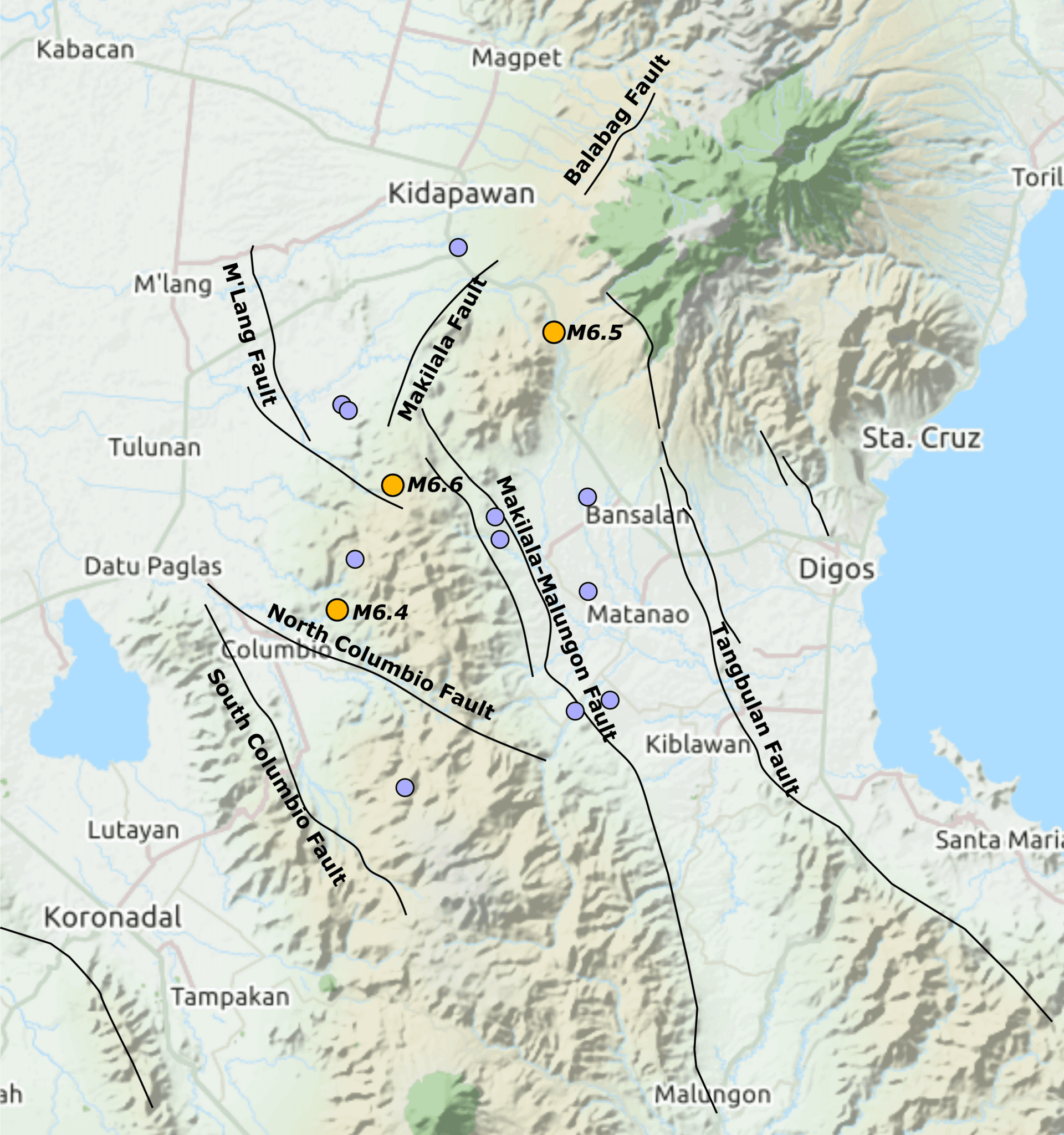
Mindanao sits on a fault-prone zone shaped by the Philippine Sea plate, which subducts west-northwest beneath the Sunda plate near the island. That tectonic setting helps explain why offshore earthquakes can inflict severe damage far beyond their epicenter, especially where building standards vary and infrastructure is already stretched. The latest destruction has again raised hard questions about the resilience of public buildings, transport links and coastal preparedness in a region that regularly absorbs seismic shocks.
The threat is not theoretical. On Oct. 10, 2025, a magnitude 7.4 earthquake struck offshore Davao Oriental at 9:43 a.m. Philippine Standard Time, with PHIVOLCS placing the epicenter about 48 kilometers northeast of Manay at an estimated depth of 23 kilometers. USGS said that quake was caused by oblique reverse faulting off the east coast of Mindanao, and PHIVOLCS reported 299 aftershocks by 4:00 p.m. that same day.
That 2025 quake also generated a tsunami. USGS recorded wave heights of 7 centimeters in Davao and higher measurements in Indonesia, while PHIVOLCS later canceled the warning. The National Disaster Risk Reduction and Management Council and local reports put the death toll at seven to 10, with later counts showing more than 1,000 injuries and tens of thousands of families displaced across Davao Oriental and nearby areas.
The damage in 2025 spread to roads, hospitals and schools, forcing evacuations and class suspensions in towns including Manay and Santiago. The pattern now looks familiar: one offshore rupture can quickly become a humanitarian emergency, with the heaviest burden falling on households that lose safe shelter, transport access and the ability to recover before the next aftershock arrives.
This article was produced by Prism’s automated news system from verified source data, official records, and press releases, then run through automated quality and moderation checks before publishing. The system is built and supervised by the people who set the standards it runs under. Read our full AI policy.
Know something we missed? Have a correction or additional information?
Submit a Tip
