Coffee giants launch global satellite system to track deforestation
A satellite-AI coffee map may expose forest loss faster, but the test is whether it blocks bad beans or just burnishes ESG claims.
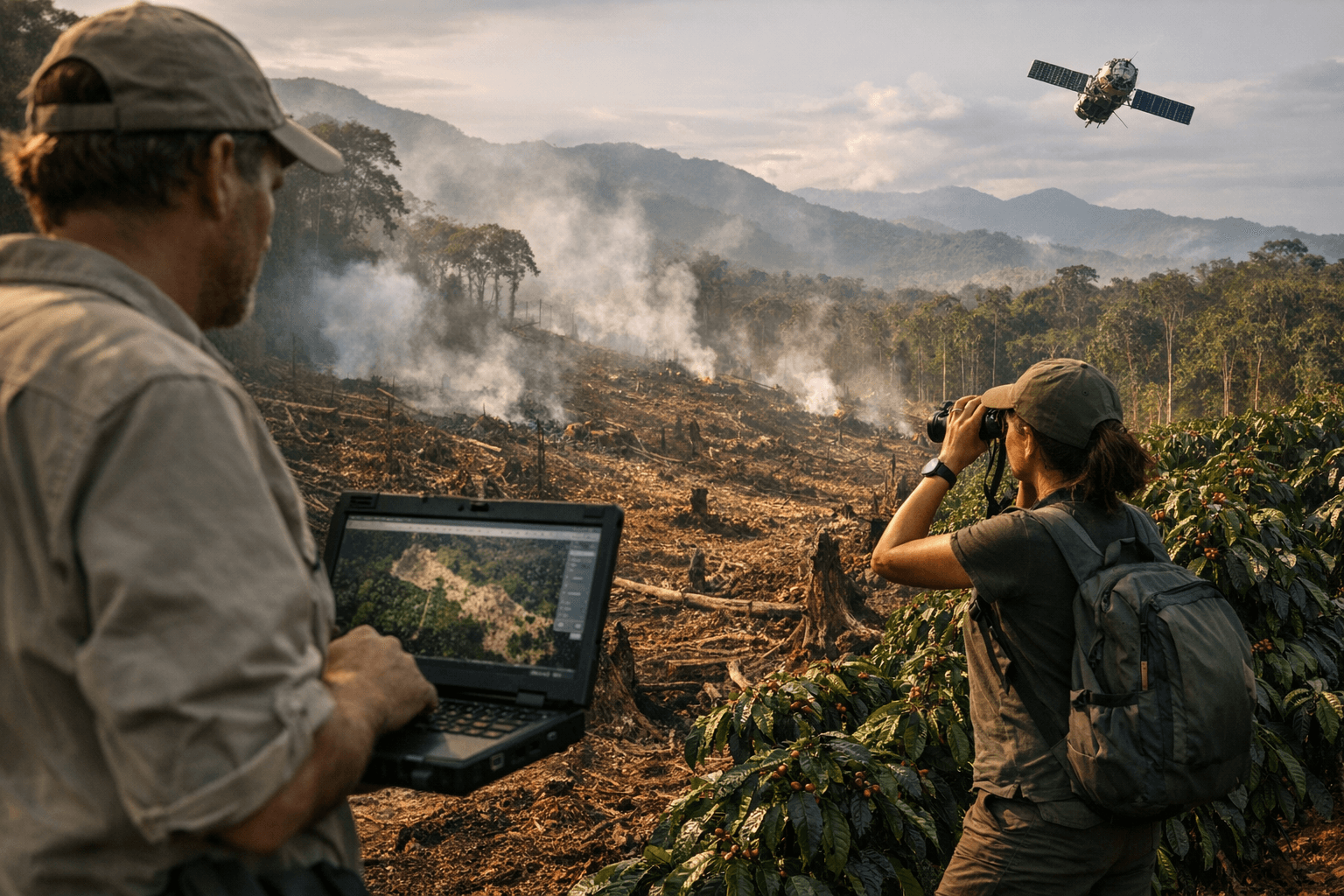
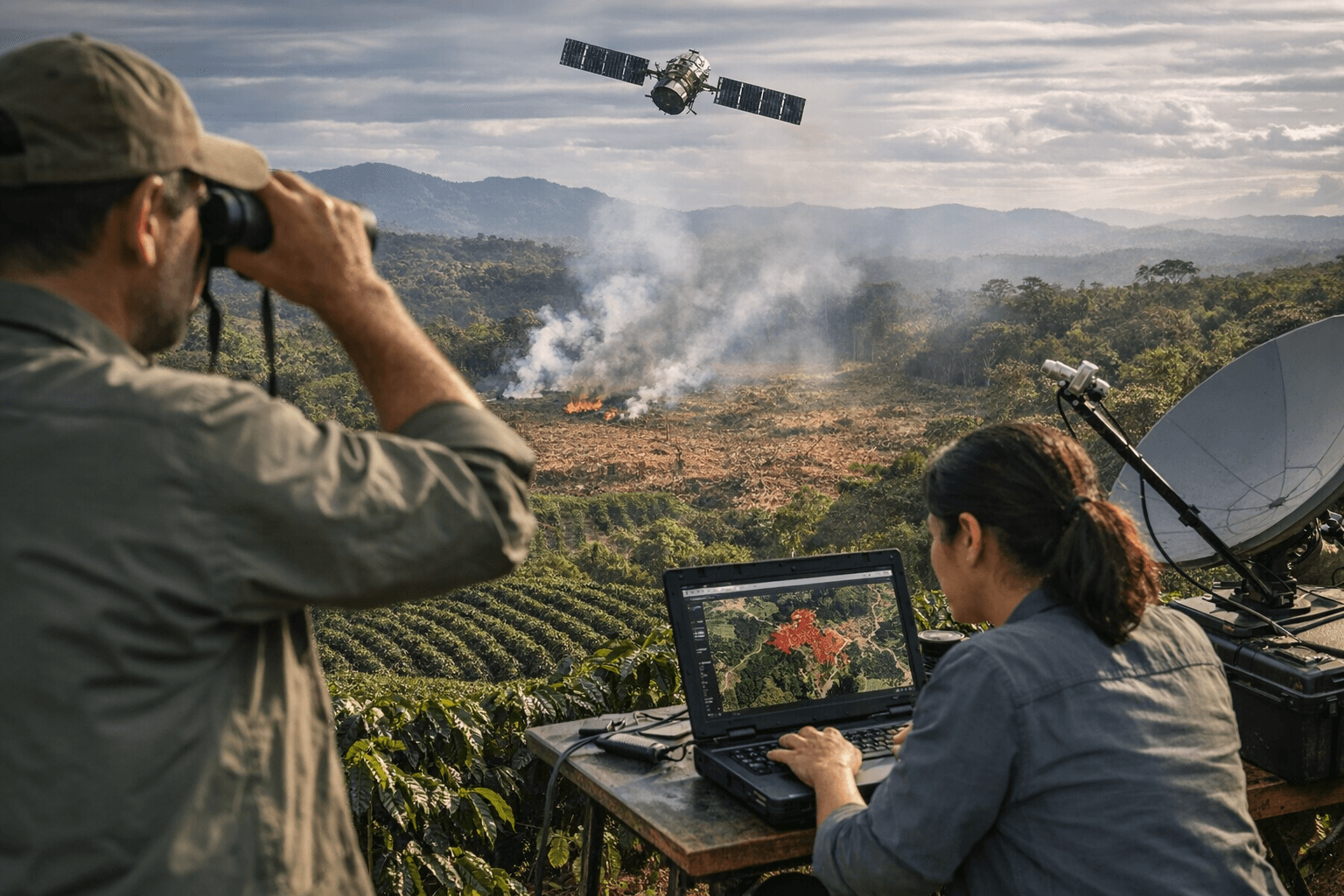
Who gets flagged, who gets paid, and who gets shut out of Europe’s coffee trade will determine whether a new satellite-and-AI system changes deforestation on the ground or merely improves corporate optics. A group of major coffee companies and traders said on April 22 that they were launching the Coffee Canopy Partnership, a shared mapping effort meant to track forest loss tied to coffee cultivation and sharpen supply-chain compliance before tougher European rules bite.
Airbus Defence and Space was selected as the technical partner for the project, which aims to create what Airbus called the world’s first comprehensive, open map of coffee plantations. The first rollout focuses on East Africa, covering Ethiopia, Tanzania, Kenya, Uganda, Burundi and Rwanda across about 1.2 million square kilometers of coffee landscapes. Company materials say deliveries for the pilot begin in April 2026 and the full pilot dataset is due by June 2026.
The roster behind the effort includes JDE Peet’s, now part of Keurig Dr Pepper, along with Tchibo, Louis Dreyfus Company, Sucafina, Touton, Neumann Kaffee Gruppe and Sucden. The project has been framed as pre-competitive, a public good for roasters, traders, governments and farmers rather than a proprietary screening tool for one buyer. The companies say the point is to improve land mapping, work with governments and local communities, and help restore forests while preventing future clearing.
The timing is no accident. The European Union’s deforestation rule requires companies to prove that products are deforestation-free, and forest conversion after December 31, 2020 is central to compliance. Under current European Commission guidance, the application date for large and medium operators is December 30, 2026, while micro and small operators have until June 30, 2027. For coffee exporters, that means better maps can be the difference between access to the EU market and a costly exclusion.
That is why the partnership is more than a climate pledge. If the system identifies coffee plots that sit on newly cleared forest, it could help buyers cut off noncompliant growers and redirect sourcing. If it mislabels shade-grown or agroforestry coffee as forest, it could wrongly block smallholders from lucrative export channels. Development groups, including the World Resources Institute and Solidaridad, have warned that current monitoring tools can confuse agroforestry with deforestation or miss actual forest loss.
Backers of the pilot say the East Africa project is supported by the UK Foreign, Commonwealth & Development Office and endorsed by the U.N. Food and Agriculture Organization. That backing gives the program added credibility, but the economics will be decided in the trading offices and farm records that follow. If the maps are accurate, the system could become a template for other commodities facing stricter traceability demands. If not, it risks becoming another expensive layer of ESG branding while coffee prices, supply chains and compliance disputes keep moving.
This article was produced by Prism’s automated news system from verified source data, official records, and press releases, then run through automated quality and moderation checks before publishing. The system is built and supervised by the people who set the standards it runs under. Read our full AI policy.
Did this article answer your question?