Colorado ski country sees up to 30 inches of snow; more expected
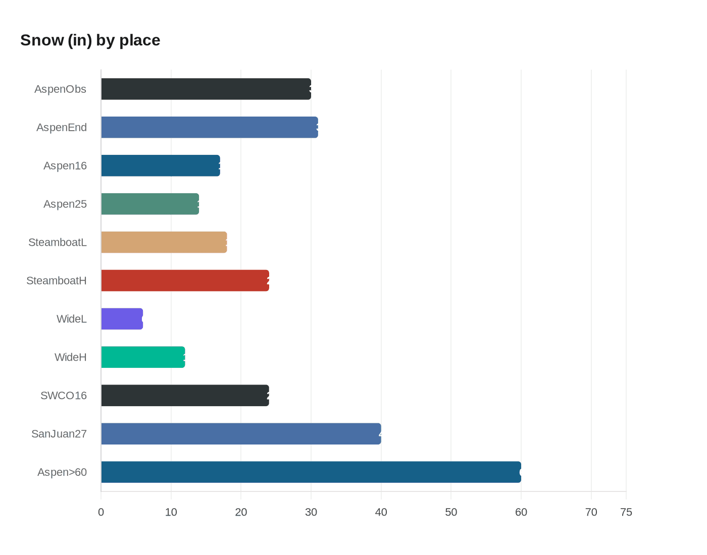
Over the last three days, about 30 inches fell on select Aspen peaks and 18–24 inches near Steamboat Springs, with Pivotal Weather and ECMWF models calling for more snow later this month.

Over the last three days, big snow has fallen in several key parts of Colorado’s ski country, including about 30 inches on some select peaks in the Aspen area and between 18 and 24 inches on peaks near Steamboat Springs. Outside of areas that saw exceptional snowfall, totals of about six to 12 inches were widespread, leaving most of the state’s ski areas getting decent snow.
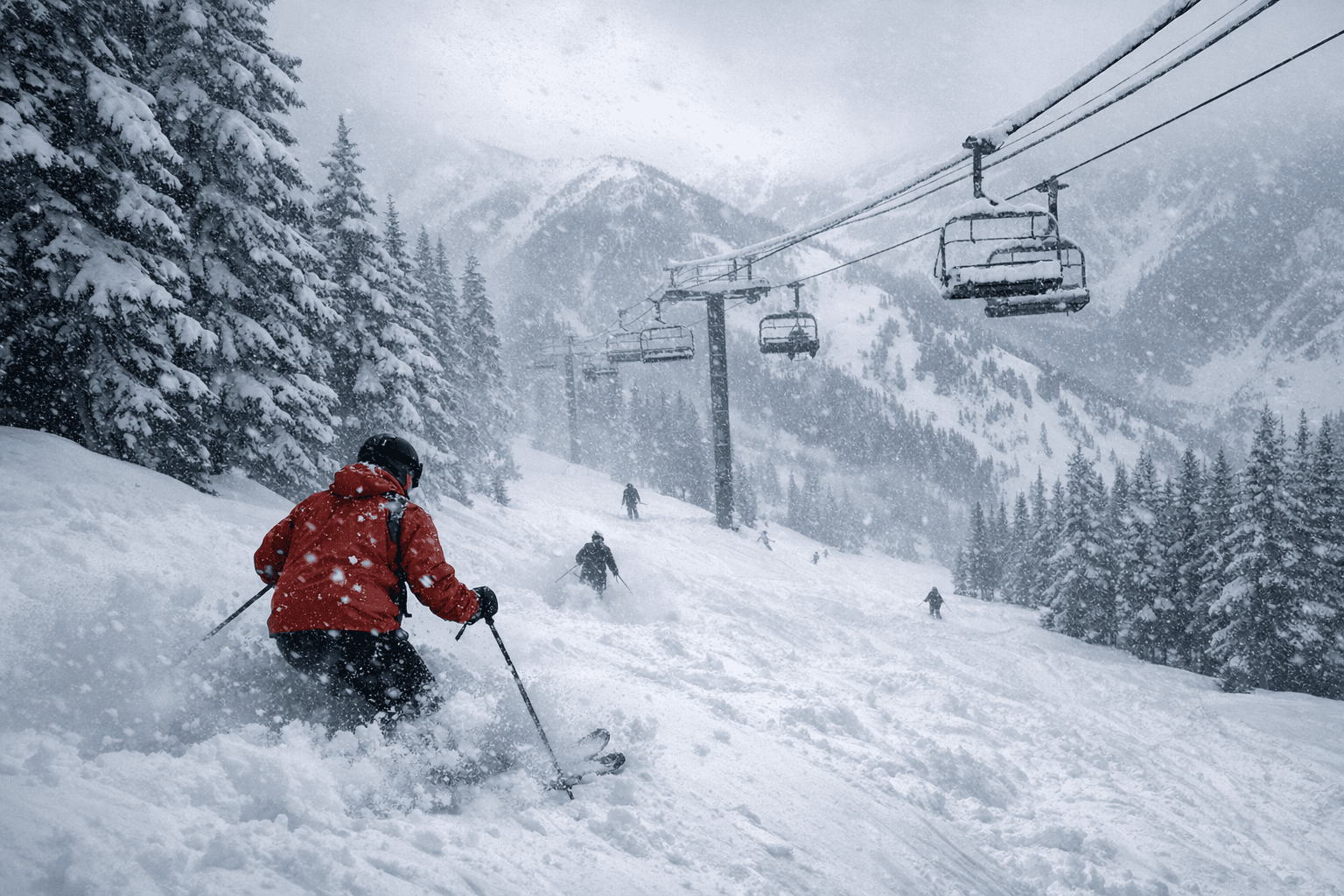
Here’s a look at what snow fell over the last 72 hours (reds indicate 18-plus inches, with the deepest red being 30). The map and forecast visuals are based on Pivotal Weather output and ECMWF-AIFS data, and imagery in coverage is credited to Michael Hausmann (iStock).
Short-term models show a relative lull for the upcoming weekend, but snowfall should start ramping up again come February 16 with on-and-off snowfall expected through February 22. By that point, the Aspen area should have another 17 inches of snow, per the Pivotal Weather report, with peaks in southwest Colorado likely to have accumulated an additional 24-plus inches.
Forecasts then point to another significant pulse starting February 25. Come February 25, widespread snow is expected to start up again, adding about 14 additional inches in the Aspen area over the next couple of days. Some peaks in the San Juan region will also get hit hard, getting a total of up to 40 inches between now and February 27, and days later another wave of snow will be on the way.
Looking at the month as a whole, the Aspen area should benefit the most. Throughout the month of February, the Aspen area should benefit the most, with the 31 inches expected now through the end of the month packing on top of the 30 inches that came with the most recent storm for more than 60 inches of snow over a stretch of about 18 days. That aggregation pairs the observed 30-inch burst on select Aspen peaks with the model-run expectation of 31 inches through month end.
That’s good news and all, but the even better news is what lies ahead. Pivotal Weather and ECMWF-AIFS projections show multiple rounds of heavy accumulation across distinct windows - Feb. 16–22 and Feb. 25–27 - that are likely to reshape powder conditions at Aspen-area terrain, southwest Colorado peaks and the San Juan ranges. Check local resort updates and avalanche information as these model-driven totals come into clearer focus.
Know something we missed? Have a correction or additional information?
Submit a Tip