CSU Forecasts Below-Average 2026 Atlantic Hurricane Season, but Dangers Remain
CSU projected a below-average 2026 Atlantic hurricane season, but forecasters cautioned that even one landfalling storm can overwhelm communities and cause catastrophic damage.
Colorado State University released its first seasonal outlook for the 2026 Atlantic hurricane season Wednesday, projecting fewer named storms, hurricanes and major hurricanes than the long-term average. The forecast offered a cautiously optimistic headline number, but meteorologists were quick to warn that the label carries real risks of its own.
CSU's reduced storm count is driven by a combination of large-scale climate factors, including the current phase of the El Niño-Southern Oscillation, cooler-than-normal sea-surface temperatures in key breeding areas across the Atlantic's main development region, elevated Saharan dust activity and increased vertical wind shear. That wind shear, in particular, acts as a suppressor: it disrupts the vertical structure storms need to organize and intensify, cutting overall formation rates. When multiple atmospheric and oceanic signals align in the same suppressive direction, the seasonal arithmetic tips below normal.
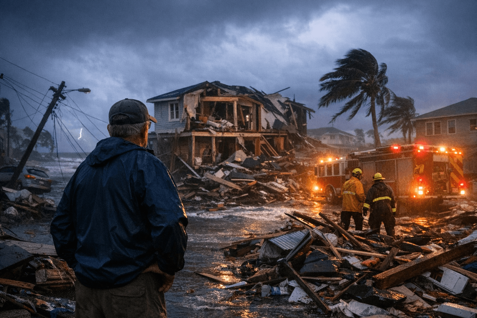
But the fundamental limitation of seasonal forecasting is track and timing. A seasonal outlook can project how many storms will spin up across the entire basin; it cannot place a single one on a map. "Even a below-average season can still be impactful," forecasters noted in the report, a reminder with a direct policy implication: emergency managers and households in hurricane-prone areas should not interpret a low seasonal number as permission to stand down.
History reinforces that point. Some of the most destructive Atlantic hurricane seasons on record produced relatively modest storm totals. What determines the human and economic toll in any given year is where a storm goes and how strong it is when it arrives, not how many form in the open ocean. Climate change adds another layer of complexity: even as overall counts fluctuate from season to season, research suggests warming atmospheric conditions can amplify rainfall rates and increase the likelihood of rapid intensification in individual storms.
Wednesday's projection is CSU's earliest read on the season. The university typically issues updated forecasts as June 1, the official start of the Atlantic hurricane season, approaches, incorporating the latest oceanic and atmospheric data. Each successive outlook narrows the uncertainty as real-time conditions become clearer.
For risk managers, insurers, utilities and municipal governments, even a below-average forecast is a planning signal, not a reprieve. A single landfalling hurricane carries the capacity to overwhelm local emergency resources, disrupt supply chains and expose insurance gaps that only become visible when damage is already done. Households in coastal and flood-prone areas have the same window before June that they have every year: review evacuation routes, replenish emergency kits and confirm insurance coverage is current. The seasonal number is irrelevant once a storm is in the Gulf.
This article was produced by Prism’s automated news system from verified source data, official records, and press releases, then run through automated quality and moderation checks before publishing. The system is built and supervised by the people who set the standards it runs under. Read our full AI policy.
Did this article answer your question?