Israel expands control map in southern Lebanon, talks continue with US
Israel’s new southern Lebanon map pushes its control line deeper near Nabatieh. Washington is still pressing talks that call for Israeli withdrawal and Lebanese sovereignty.
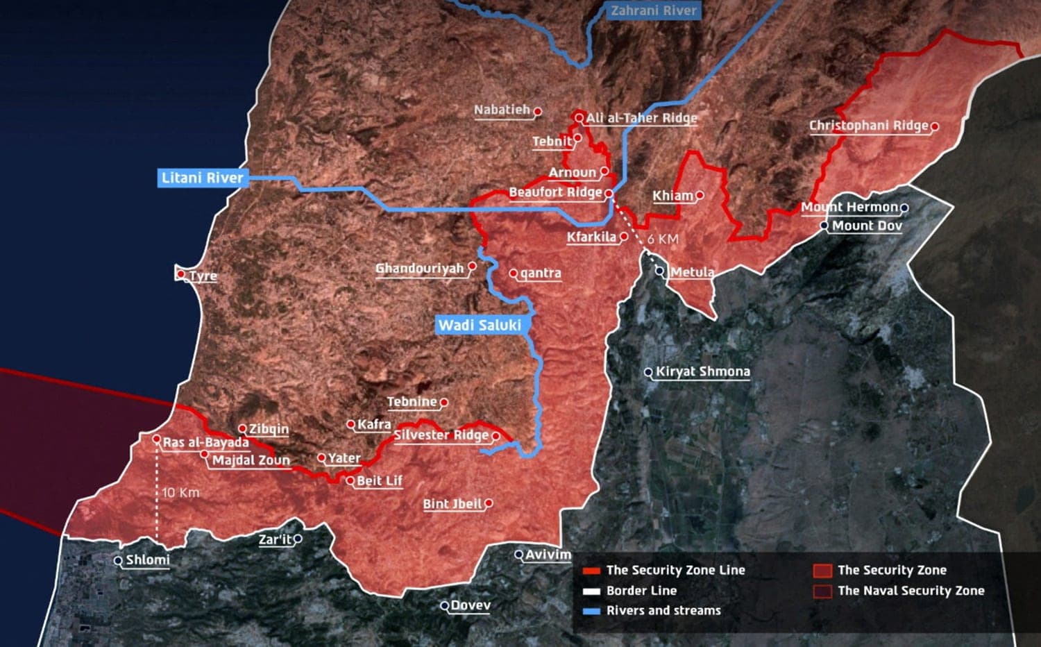
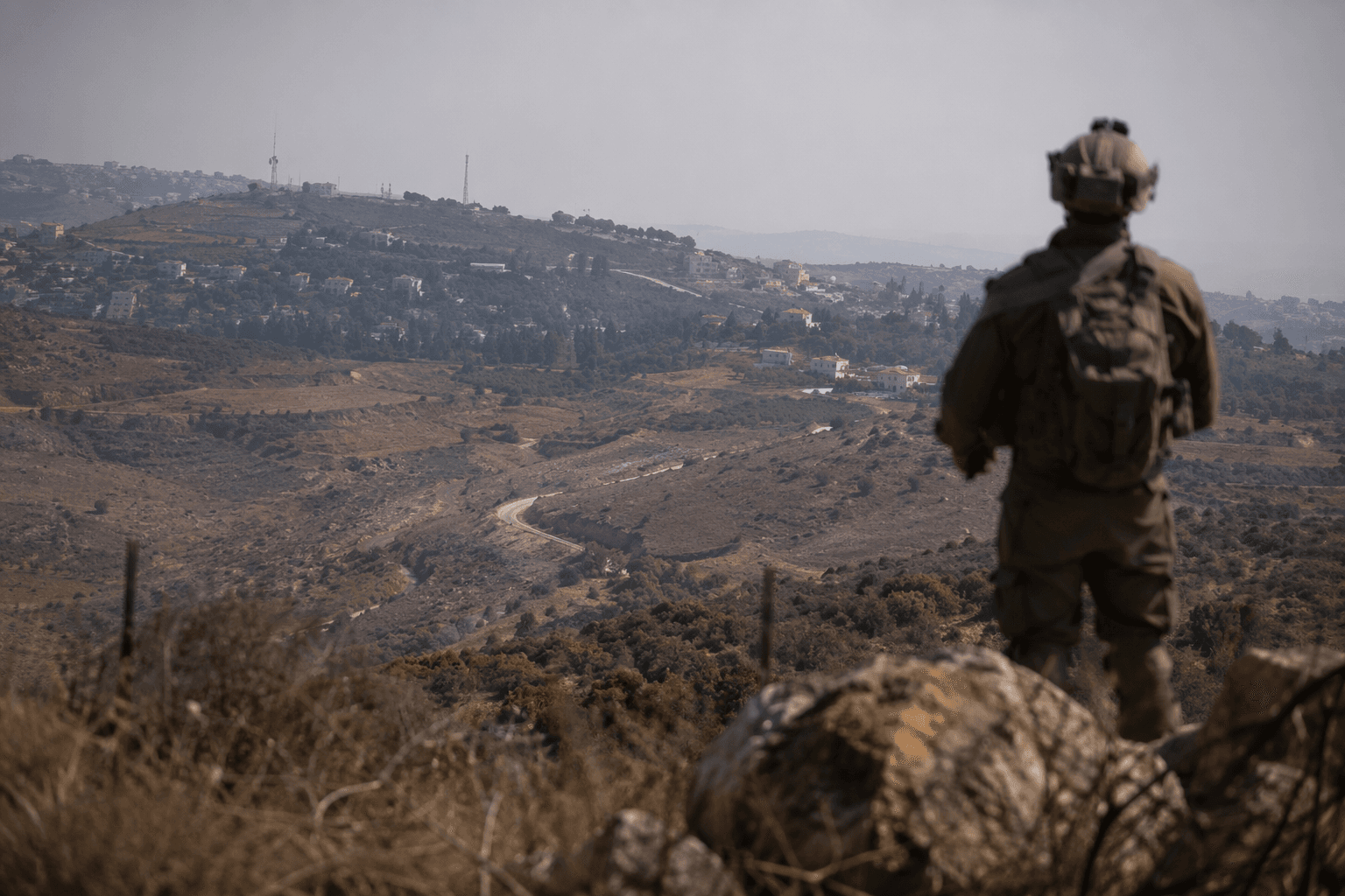
Israel’s military has drawn a larger line around its presence in southern Lebanon, publishing a new map on June 18 that shows troops operating several kilometres deeper into the country, including near Nabatieh north of the Litani River. The public map is more than a battlefield update. It is a political signal that Israel is trying to keep a buffer in place while talks continue with the United States over how long that deployment can last.
The map is the second such public depiction of the frontier since April, when Israel first released a buffer-zone map. This version marks a deeper footprint and labels the area a “security zone” where Israeli soldiers are operating. The move suggests an effort to normalize a temporary military posture before the broader diplomatic track can force a withdrawal, or at least define one on terms Israel can accept.
That timing collides with the ceasefire framework Washington has been trying to build. The U.S. State Department said the fourth trilateral meeting between Israeli and Lebanese representatives took place on June 2 and 3, and that the sides agreed to implement a ceasefire contingent on a complete cessation of Hizbollah fire and the evacuation of Hizbollah operatives from the South Litani Sector. The State Department also said the sides agreed to create “pilot zones” where the Lebanese Armed Forces would take exclusive control, with the goal of advancing a comprehensive peace and security agreement. It said the future relationship between Israel and Lebanon must be decided by the two sovereign governments.
The map cuts against that framework because it treats the military line on the ground as a bargaining position, not a temporary emergency measure. The State Department has already said the April 16 cessation of hostilities was intended to last 10 days and was later extended for 45 days to keep negotiations alive. By pushing its control line deeper now, Israel appears to be testing how far it can formalize a longer-term presence in southern Lebanon without breaking the wider agreement or provoking a broader war.
The pressure is coming from both sides of the border. Hezbollah leader Naim Qassem rejected the Washington-backed ceasefire plan, calling it a “roadmap” for destruction, while Israeli Defence Minister Israel Katz said Israel would continue operations for the time being. Hezbollah attacks on Israeli positions in the south have continued, and the fighting has driven major displacement in Lebanese border communities. For Lebanon, the unresolved questions are stark: sovereignty, the status of border villages and whether any Israeli withdrawal will happen on a timetable that actually holds.
If the deployment stays in place, the map may become a precedent. If it collapses, it could expose how fragile the entire regional pause remains.
This article was produced by Prism’s automated news system from verified source data, official records, and press releases, then run through automated quality and moderation checks before publishing. The system is built and supervised by the people who set the standards it runs under. Read our full AI policy.
Know something we missed? Have a correction or additional information?
Submit a Tip