Mexico City Is Sinking Fast, NASA Images Show Damage From Space
Mexico City’s sinking is now visible from space, with some areas dropping more than 2 centimeters a month as groundwater pumping and aging infrastructure collide.

From orbit, Mexico City’s sinking is no longer an abstraction. New NASA imagery built from NISAR data collected between Oct. 25, 2025, and Jan. 17, 2026, showed parts of the capital dropping by more than half an inch, or more than 2 centimeters, each month.
The scale is staggering. In some places, the city has sunk more than 39 feet over less than a century, turning a long-running engineering problem into a crisis that now threatens housing, streets, drainage lines, potable-water systems and one of the world’s busiest transit networks. NASA and the NASA Jet Propulsion Laboratory said the subsidence has been documented since at least 1925, and that some parts of the metropolitan area were sinking by around 14 inches a year in the 1990s and 2000s.

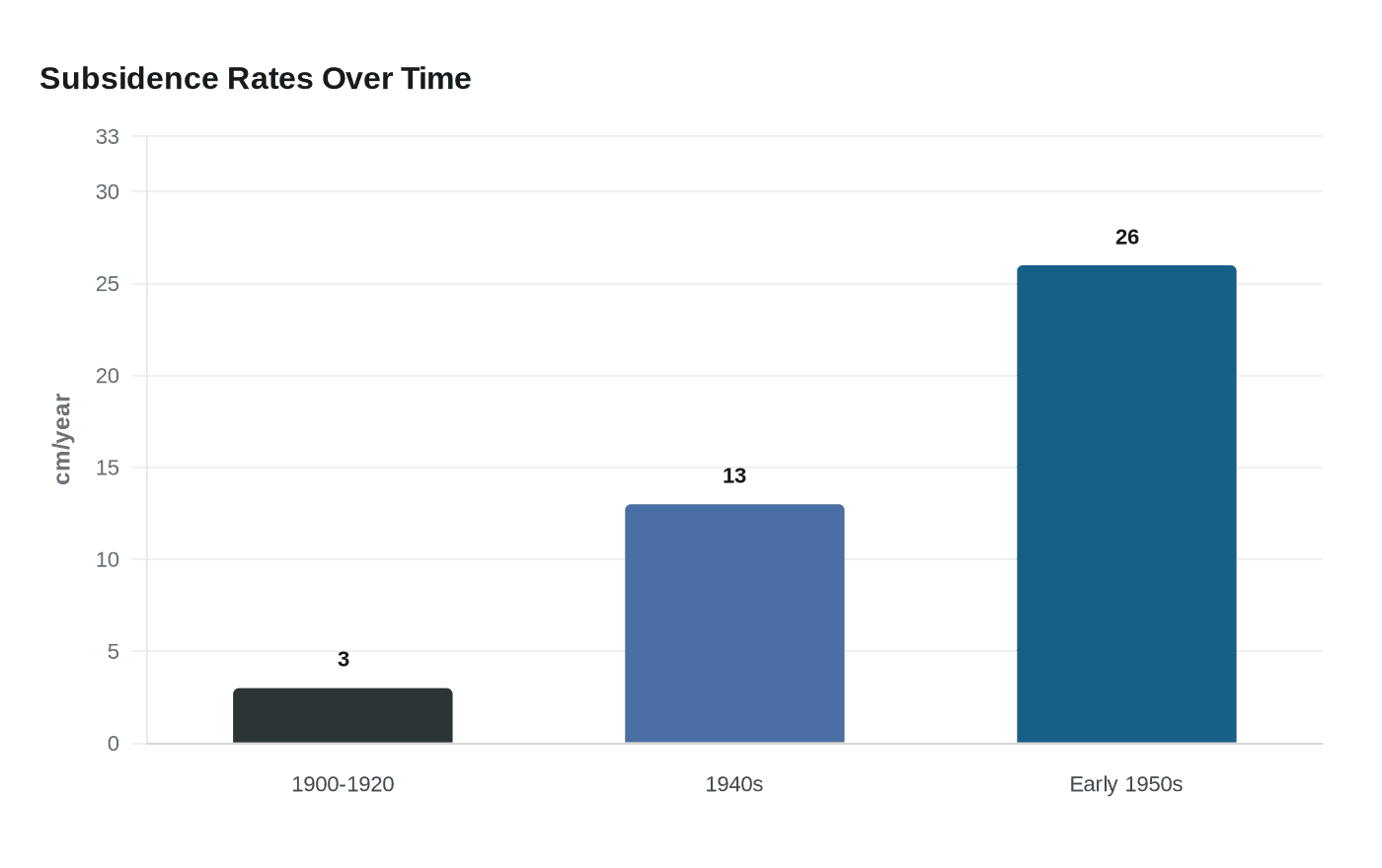
Mexico City’s vulnerability is rooted in geography and policy choices. The capital sits on an ancient lake bed in the Valley of Mexico, and decades of groundwater pumping have emptied and compacted the aquifer beneath it. A 2006 study reported subsidence rates in downtown Mexico City of 3 centimeters a year from 1900 to 1920, 13 centimeters by the 1940s and 26 centimeters in the early 1950s, showing how the problem accelerated as groundwater extraction intensified. A 2025 study added that new construction can also contribute to settlement, with about 32% of subsidence at one study site tied to a highway and a little more than 68% to groundwater pumping.
Enrique Cabral, a geophysics researcher at the National Autonomous University of Mexico, said the process damages "critical infrastructure" and called it "a very big problem." The damage is not limited to cracked facades. The U.S. Geological Survey has said colonial-era buildings and infrastructure have been harmed by land subsidence caused by depletion of the aquifer below the city, and in the historic center buildings are leaning as the ground continues to settle.
The transit system is exposed as well. A 2024 Nature article said the Mexico City Metro carries more than 4 million passengers a day, putting immense pressure on a network that must keep operating even as the ground beneath it moves. NASA said the sinking has fractured roads, buildings and water lines, and the risk spreads across daily life, from commuting to clean water access.
The monuments standing along Paseo de la Reforma show how visible the damage has become. NASA said the Angel of Independence, built in 1910, stands 114 feet tall and has had 14 steps added to its base as the land around it sank. The satellite map also pointed to Chalco Lake, a wetland south of the city that once provided habitat for the endangered axolotl, a reminder that today’s subsidence is tied to the region’s older water systems, many of them drained or altered over generations to reduce flooding.
Mexico City’s crisis is a warning for other megacities: when groundwater extraction, urban growth and weak water management outpace geology, the costs arrive slowly, then all at once, in housing, transit, heritage sites and public safety.
This article was produced by Prism’s automated news system from verified source data, official records, and press releases, then run through automated quality and moderation checks before publishing. The system is built and supervised by the people who set the standards it runs under. Read our full AI policy.
Did this article answer your question?