Pawnee National Grassland and North Sterling State Park: Trails, Wildlife, Recreation
Local outdoor sites at Pawnee National Grassland and North Sterling State Park offer trails, boating, and wildlife viewing, supporting health, local tourism, and outdoor access.
For Logan County residents, two nearby public landscapes provide distinct outdoor experiences: North Sterling State Park centers on water recreation and family services, while Pawnee National Grassland preserves broad shortgrass prairie, cultural sites, and off‑road opportunities. Both places matter for community health, local economies, and access to nature.
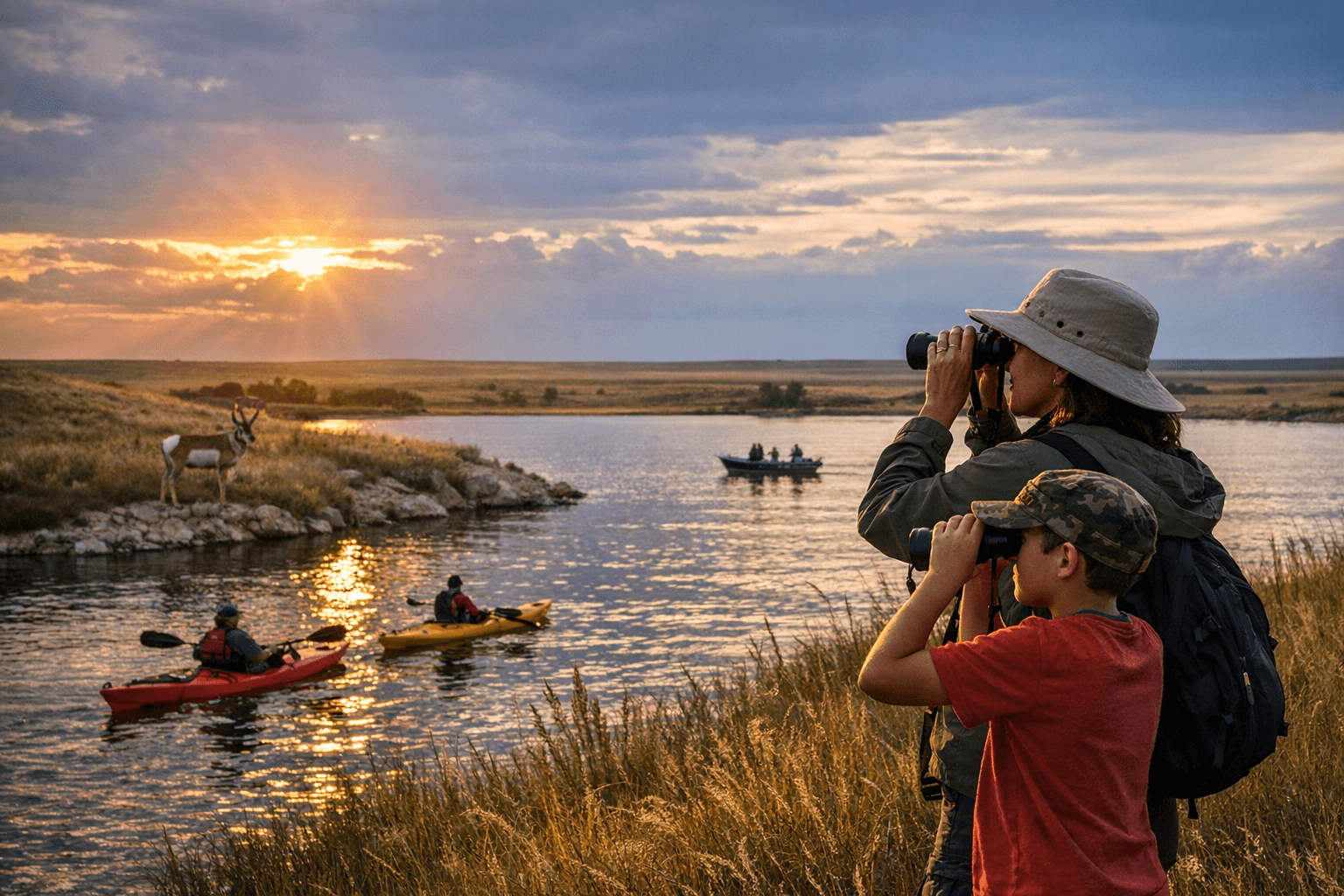
North Sterling State Park spans about 5,700 acres of grasslands and water around North Sterling Reservoir, which reaches nearly 3,000 surface acres when full. The park is located about 30 minutes north of town and offers boating, fishing, biking, birding, hiking, hunting, and horseback riding. Named facilities include Elks Campground, Chimney View Campground, Inlet Grove Campground, Elks Boat Ramp, South Boat Ramp, a marina, swim and ski beaches, an archery range, picnic areas, and a visitors center at the north end of the dam inside the Elks Entrance off County Road 33.
The Visitor Center sells annual and daily passes, camping permits, and boat and OHV registrations, and it accepts cash, checks and credit cards. Visitors are encouraged to borrow safety gear and interpretive materials: "Stop by to borrow free life jackets, binoculars, family activity backpacks and self-guided nature activities!" The marina concession reopened in 2015, and the park notes, "Since the marina concession reopened in 2015, we no longer stock or sell firewood, ice, bait, sodas or water. Supplies can be purchased at the Marina during the summer, Memorial Weekend through Labor Day." For direct questions or to check current hours and campground status contact the park at 24005 County Road 330, Sterling, CO 80751; (970) 522-3657; north.sterling.park@state.co.us.
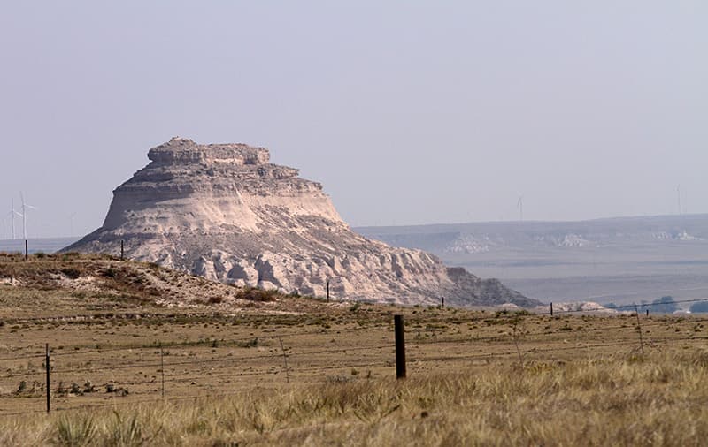
Pawnee National Grassland sits roughly 35 miles east of Fort Collins and 25 miles northeast of Greeley, covering 193,060 acres within a 30-by-60 mile landscape. The grassland is a mosaic of public, private, state and experimental-range parcels, so drivers should consult a Motor Vehicle Use Map before heading out. The grassland hosts a range of sites and experiences: Baker Draw Designated Shooting Area is open near Weld County Roads 96 and 63 with dirt berms providing 25-, 50- and 100-yard shooting opportunities; Main Draw OHV Area and the Lee and Dorothy Rhoads Farm Implement Museum are listed as open; Crow Valley Recreation Area and Picnic Site are listed as closed. As the managing agency says, "The area is rich in history and wildlife. A wide variety of plants and animals call the Pawnee National Grassland home." Visitors may encounter red-tailed hawks, prairie dog towns and scenic views near the Pawnee Buttes. Cultural sites include homesteads and Civilian Conservation Corps era cabins such as Stub Creek Cabin, which has been available as a rental in the past.
Public health and equity considerations thread through both sites. North Sterling’s free life jackets and family backpacks reduce barriers to safe water recreation, and the park’s volunteer program offers a practical access route: park volunteers earn a free annual pass with 48 hours of volunteer service. At Pawnee, the checkerboard ownership and closed two-tracks can create uneven access for residents without private vehicles or reliable GPS; obtaining a Motor Vehicle Use Map and confirming site status before travel helps prevent trespass and safety incidents. Wind and spring afternoon thunderstorms at North Sterling also heighten risk for boaters and day users.
For Logan County readers, these areas offer nearby options for exercise, learning and family outings, but plan ahead: check current marina and campground hours, confirm closures at Crow Valley and other sites, borrow life jackets at the Visitor Center, and obtain a Motor Vehicle Use Map for Pawnee trips. Thoughtful planning protects public health, preserves archaeological sites, and keeps access equitable for the community.
Sources:
Know something we missed? Have a correction or additional information?
Submit a Tip

