Severe storms pound Ohio, Pennsylvania, and Texas with flooding risks
Flooded streets, rescues and outages hit western Pennsylvania as Texas faced a life-threatening flash-flood watch with more than 8 inches possible.
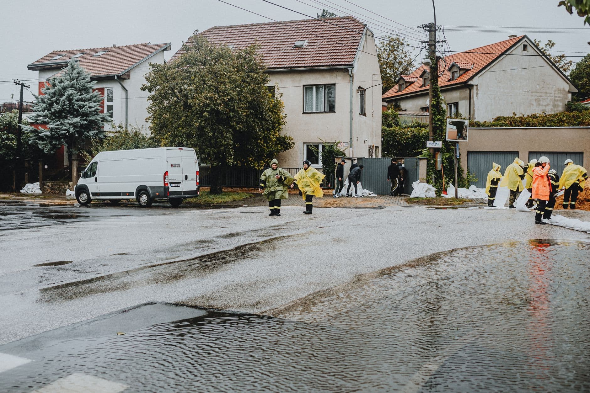
Torrential rain and gusty winds turned parts of western Pennsylvania into a flood and outage zone, with streets inundated, rescues underway and power lines knocked down as storms swept across Ohio and Pennsylvania. School days were disrupted by flooding and blackouts, while the National Weather Service warned that more strong to severe storms could still hit the Upper Ohio Valley and Lower Great Lakes.
The weather threat was not limited to one front. In western Pennsylvania, heavy rain inundated streets in at least one town, high winds scattered debris and downed trees, and crews dealt with scattered outages after power lines were taken out. The National Weather Service said scattered severe thunderstorms capable of damaging wind gusts were expected across the Upper Ohio River Valley and Lower Great Lakes, and that heavy thunderstorms could trigger areas of flash flooding.
The same broad system added pressure to communities already living with repeated severe-weather warnings. Flooding and outages forced school closures or delayed starts in parts of western Pennsylvania, a reminder that the most immediate costs of these storms are often measured in missed classes, blocked roads and damaged utility infrastructure rather than in rainfall totals alone. In a region where repeated storms have strained drainage systems and utility networks, each new round of heavy rain raises the risk of another round of disruptions.
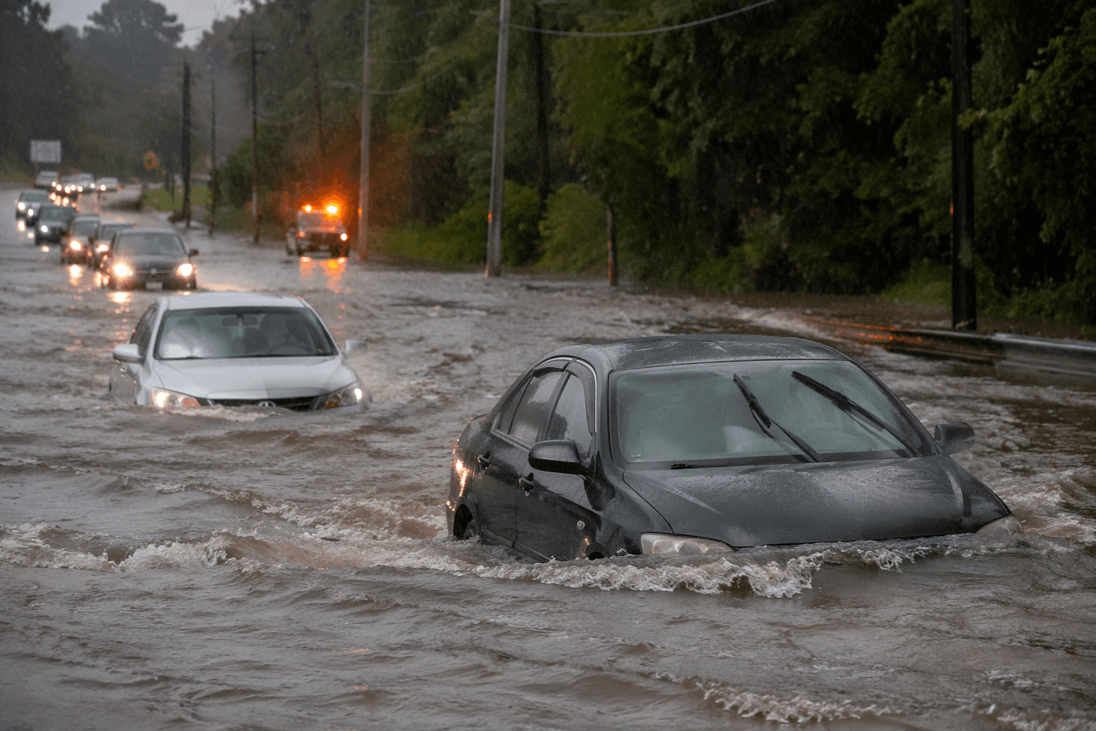
Farther south, central Texas faced a different but equally dangerous threat. The National Weather Service office in Austin and San Antonio said a Flood Watch remained in effect for South-Central Texas from the evening of June 14 through Tuesday evening, with pockets of heavy rainfall, high hourly rain rates and isolated totals of more than 8 inches possible. Forecasters said life-threatening flash flooding was possible in the watch area, and warned that heavy rain and lightning could arrive in bursts strong enough to overwhelm low-lying roads and creeks.
The Texas warning carried extra weight because of how fast floodwater can turn deadly in the Hill Country. A July 4 flood in the region sent a river up 26 feet in 45 minutes and killed more than 100 people, including summer campers. That history has made every new flood watch a signal for residents and emergency managers to watch roads, creeks and drainage channels closely, especially when the forecast includes high hourly rainfall rates and the possibility of more than 8 inches of rain.
This article was produced by Prism’s automated news system from verified source data, official records, and press releases, then run through automated quality and moderation checks before publishing. The system is built and supervised by the people who set the standards it runs under. Read our full AI policy.
Did this article answer your question?