Spring closures reshape Four Corners backcountry routes, check access before you go
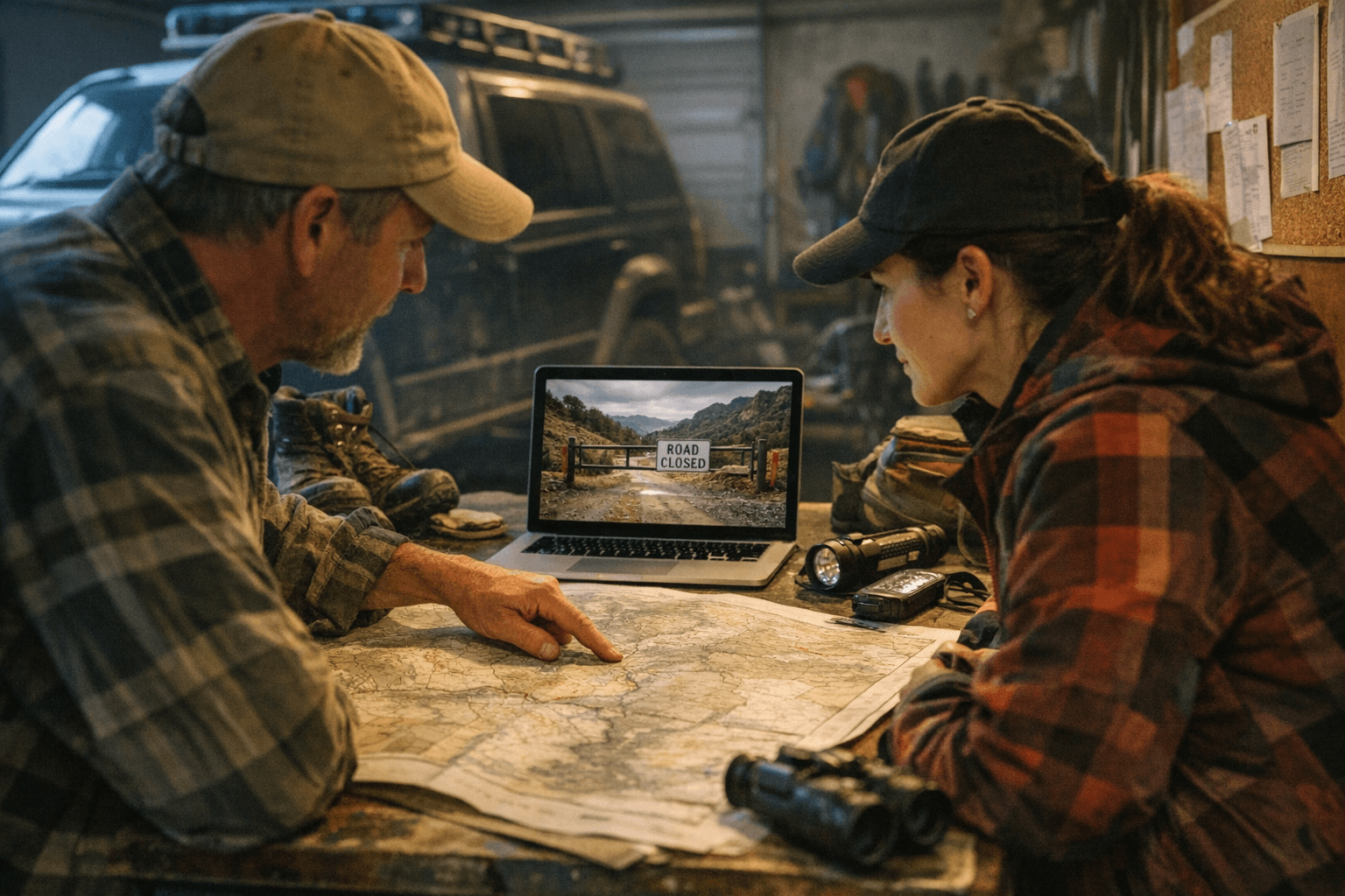
Spring closures can flip a Four Corners route from open to off-limits overnight. Check status first, or you risk a dead-end at a gate, mud, or a closed pass.
The closure most travelers miss
The biggest spring mistake in the Four Corners backcountry is assuming last year’s opening date still applies. In Colorado, roads and trails close during winter snowpack and spring runoff to prevent excess erosion, and the exact opening and closing dates change from year to year depending on conditions.
That matters because closures are not just about snow. Some routes shut for maintenance or special events, some upper-elevation roads stay closed for snow or mud, and a road that was open yesterday can be blocked by a downed tree or a fresh drift today. In shoulder season, the smartest move is not to trust memory, a stale post, or an old map.
Why spring closes so much country
Spring is rough on high-country travel because the ground is soft, the runoff is active, and a single tire track can do real damage. Stay The Trail says most Colorado roads and trails are closed during the snow-packed winter months and during spring runoff specifically to prevent excess erosion. The Bureau of Land Management adds another layer in Colorado, using seasonal closures to reduce disturbance to wintering wildlife, especially deer and elk, during the most stressful part of the year.
That is why a closure is not just bureaucratic tape. It is often the difference between a route that survives another season and one that gets rutted, widened, or shut down longer next year. For jeepers, mountain bikers, hikers, and drivers headed into high country or spring runoff zones, respecting the closure is part of keeping the route usable at all.
How to check status before you leave
The best habit is simple: check with the land manager a day or two before you go. If there is any uncertainty, call the relevant office directly. An online map, an old trail report, or a social post from last weekend can be out of date by the time your tires hit the road.
The United States Forest Service says status tables are updated as soon as ranger districts relay the information, which is helpful, but it also warns that road conditions can change fast. The San Juan National Forest specifically notes that upper-elevation roads remain closed for snow or mud and that roads are opened based on dates or sooner as conditions allow. In plain English, the route you want may not care what the calendar says.
A good spring check should include:
- The current road or trail status page for the district you are entering
- The Motor Vehicle Use Map for the exact forest route system
- A direct phone call if the route sits near snowline, runoff, or a known closure boundary
- A backup plan if the primary route is still shut
Why the Motor Vehicle Use Map still matters
The Forest Service says Motor Vehicle Use Maps, or MVUMs, show roads, trails, and the areas where your OHV is allowed, including the seasonal window of use. Those maps are required under the 2005 National Travel Management Rule, and the agency says they are available free online and at ranger district offices.
That makes the MVUM more than a paper map. It is the legal layer that tells you whether a route is open to your machine at all, and when. If you are running backcountry roads in the Four Corners, the MVUM should be paired with the latest conditions page, not used as a substitute for it.
What the San Juan Mountains are telling you right now
The San Juan Mountains are a perfect example of why you cannot generalize from one road to the next. San Miguel County’s road-conditions page lists Black Bear Pass, Ophir Pass, Imogene Pass, and Last Dollar Pass as closed, while Norwood/Dolores Road is open. That is the kind of split that catches people off guard, because it shows how sharply route status can differ even within the same region.
The Alpine Loop is another reminder to plan for the route you actually have, not the one you hoped for. The Bureau of Land Management describes the Alpine Loop Backcountry Byway as a rugged 4x4 road connecting Lake City, Silverton, and Ouray, with passes reaching up to 12,800 feet. It also warns that electronics and wireless devices do not work in most places along the route, which means dead zones are the norm, not the exception.
That combination changes everything. If you are banking on cell service to confirm a detour, download directions, or call for help, you are already behind. Offline maps and a real pre-trip check are not nice extras up there. They are the difference between a clean loop and a long turnaround.
Stay The Trail’s role in the spring check
Stay The Trail pulls together trail-access resources that compile Forest Service MVUMs and Bureau of Land Management motorized maps in one place, which makes it a practical starting point for sorting out seasonal access. It is especially useful when you are moving between Forest Service and BLM ground in the same trip, which happens all the time in the Four Corners backcountry.
The other important rule is easy to miss: some ATVs and side-by-sides are not street legal in Colorado even if they are licensed or plated elsewhere. That catches travelers who assume their machine’s paperwork in another state will carry them everywhere. It won’t, and that is exactly the kind of mistake that turns a fun spring run into a frustrating roadside conversation.
The route check that saves the day
The safest spring routine is boring, and that is exactly why it works. Pick the route, check the current status, confirm the MVUM, and call the office if anything is unclear. Then load offline navigation, because the Alpine Loop and other high-country routes can leave you with little or no wireless coverage when you need it most.
In the Four Corners, the best trips are the ones that stay flexible. A closed pass, a muddy section, or a wildlife closure does not have to kill the day if you know the alternatives and you checked them before the drive. Spring rewards people who treat access like part of the route, not an afterthought.
This article was produced by Prism’s automated news system from verified source data, official records, and press releases, then run through automated quality and moderation checks before publishing. The system is built and supervised by the people who set the standards it runs under. Read our full AI policy.
Did this article answer your question?

