Atchison County traces roots to Lewis and Clark, territorial days
Atchison County did not begin at a county line. Its story runs from Indigenous homelands and Lewis and Clark’s July 4, 1804 camp to the 1855 territorial map that still shapes life today.

Atchison County is easier to understand if you start at the Missouri border, not the courthouse map. The county sits in northeast Kansas in the Glacial Hills region, with the Missouri River carrying the eastern edge of its story and Atchison serving as the county seat beside the riverfront. On a 431.2-square-mile footprint, the county held 16,348 people in the 2020 census and is estimated at 16,172 on July 1, 2025, a reminder that this is a small county with a deep public memory.
Before the county line
The county’s formal birth date, August 25, 1855, can mislead readers into thinking the place began there. It did not. The Kansas Historical Society identifies Atchison County as one of the original 33 counties created by the Kansas Territorial Legislature, but the land had already been used, traveled, traded, and contested for generations before the line was drawn.
French explorers and trappers were the first Europeans to move through what is now Atchison County. Étienne de Bourgmont led a recorded expedition in the summer of 1724, and Perin du Luc reached the area in 1802-1803. Long before the county existed, Native nations shaped the region, and the history of the Delaware Indian reservation in 1831 and the Kickapoo Indian reservation in 1833 shows how territorial power began to settle over a much older landscape.
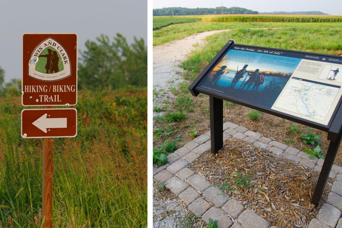
Lewis and Clark made that earlier world visible in a way still recognized today. On July 4, 1804, the Corps of Discovery camped in the area now part of Atchison County, observed an unoccupied Kansa village, and named a stream Independence Creek in honor of the holiday. William Clark’s description still carries weight because it captures the landscape before county roads, rail grades, and town plats: he wrote that it was “one of the most beautiful Plains, I ever Saw.”
Territorial conflict shaped the town that became the county seat
The county line and the town of Atchison came out of the same territorial struggle, but they were not the same thing. Atchison was founded in 1854, became a town in 1855, and incorporated as a city in 1858. The City of Atchison’s own history places the townsite in the proslavery side of Kansas Territory, which opened for settlement in 1854, and the early political divisions were visible in who stayed, who left, and who controlled the ground.
One of the clearest examples is J. W. B. Kelley, described in territorial history as one of the few freestaters in early Atchison. After making antislavery remarks, he was forced to leave. That episode shows how local civic life was shaped by border politics, not just by geography. A group of Latter-Day Saints also camped in the area in 1855 while heading west to Salt Lake Valley, adding another layer to a place already crossed by migration, conflict, and ambition.
Atchison County’s own dates matter here. It was established on August 25, 1855 and organized on September 17, 1855. That gap between establishment and organization is more than a clerical detail. It marks the difference between a county on paper and a county with offices, officers, and the machinery of local government.
River commerce, rail ambition, and the institutions that followed
The county’s next chapter turned on transportation. The first railroad in Atchison County was organized in 1857, followed by the Atchison, Topeka and Santa Fe Railroad, which became one of the defining forces in the city’s and county’s growth. Incorporation records for the railroad include entities dating from 1859, 1860, 1864, and 1895, a paper trail that reflects how quickly rail power became part of the region’s civic identity.
That rail future joined an existing river town and a religious presence that still stands out in Atchison today. Benedictines established St. Benedict’s Abbey in 1858 and Mount St. Scholastica in 1863. Those institutions are part of the city’s early built environment and remain among the most recognizable names tied to Atchison’s public face. They also help explain why the county seat became more than a stopping point on the river: it developed as a place where settlement, education, religion, and transportation intersected.
For visitors who want a visible connection to the earliest history, Riverfront Park offers one. The National Park Service identifies the Lewis and Clark Pavilion there as a memorial to the July 4, 1804 camp, linking the modern riverfront to the day Clark wrote his famous line about the plains. The park gives residents a tangible place where the county’s deep past meets the present shoreline.
Why the county still reads the way it does
Atchison County’s identity is not just a list of dates. It is the result of a long sequence of decisions and displacements that moved from Indigenous homelands to French exploration, from territorial reservation policy to proslavery settlement, and then from river commerce to rail expansion. Paschal Pensoneau, sometimes written Pensinau, was the first permanent settler in the county, settling along Stranger Creek in 1839 and opening a trading post and farm five years later. Even that detail shows how settlement followed waterways and trade routes before county borders hardened into law.
The county’s present scale makes those older forces easier to see, not harder. A place of 431.2 square miles and just over 16,000 residents has a civic life where landmarks, institutions, and remembered conflicts matter because they are still close at hand. The county line established in 1855 did not erase the Kansa village Lewis and Clark saw, the Delaware and Kickapoo reservation history, the territorial split over slavery, or the rail and religious institutions that later anchored Atchison. It simply fixed those layers onto a map residents still live with now.
This article was produced by Prism’s automated news system from verified source data, official records, and press releases, then run through automated quality and moderation checks before publishing. The system is built and supervised by the people who set the standards it runs under. Read our full AI policy.
Know something we missed? Have a correction or additional information?
Submit a Tip