Benedictine Bottoms offers wildlife habitat, wetlands and river views near Atchison
Benedictine Bottoms packs wetlands, river views and managed wildlife habitat into a close-to-Atchison outing for birders, hunters and families.
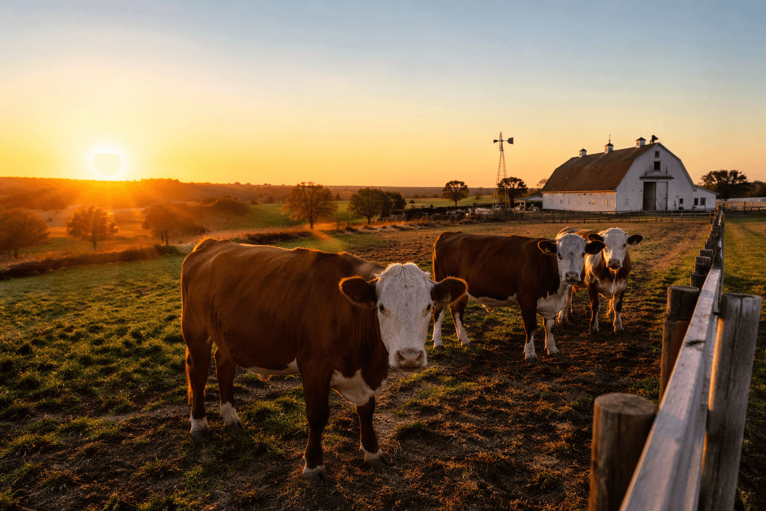
Benedictine Bottoms gives Atchison County a rare place where a restored floodplain, broad river views and tightly managed public access all meet just 2.5 miles northeast of Atchison on River Road. The 2,112-acre wildlife area sits in the Missouri River floodplain, with the river bordering its south and east sides, so it feels less like a neighborhood park and more like a working edge of the river itself. For a close-to-home outing, it offers a different kind of escape than downtown Atchison, one built around habitat, wildlife and changing water.
A floodplain rebuilt for timber, grass and water
Benedictine Bottoms was designed around three habitat types that existed before development: timber, native grass and wetlands. More than 175,000 trees were planted during construction, 550 acres of native grass were established and 450 acres of wetlands were developed, giving the site a layered landscape instead of one flat use. Low-profile earthen berms and the land’s natural contours help shape the wetlands, while three wells and distribution pipes provide water to about 45 acres.
That work matters because it explains why the area supports so many different kinds of wildlife in one place. The U.S. Army Corps of Engineers describes maturing riparian forests, native grasslands, emergent wetlands, food plots and scour holes there, along with water-control structures, a pump and a water-distribution system. Benedictine Bottoms is not simply open space along the river. It is a deliberately engineered habitat mosaic that keeps changing with the floodplain.
How to visit, and what the rules mean for a first trip
Kansas Department of Wildlife and Parks keeps the public side of Benedictine Bottoms straightforward, but not unrestricted. The area is open to the public from April 1 through September 30. From October 1 through March 31, an access and hunting permit is required, and those permits are issued by computer draw only, with applications accepted online in July.
The site also falls under KDWP’s Special Hunts program, which is limited-entry and application-only. Hunters who do draw access must check in and out with the GoOutdoorsKS app, use only non-toxic shot, and leave off-road vehicles, ATVs and horses out of the area. Alcohol and cereal malt beverages are not allowed, and dove hunting on the area closes September 30. That mix of access and restriction makes the Bottoms useful for people who want a quiet public outing, but it also rewards advance planning.
What each season brings to the Bottoms
Spring and summer are the easiest seasons for a first visit because the area is openly accessible, the wetlands are active and the habitat is in full growth. KDWP says many songbirds, shorebirds, wading birds and waterfowl use the wetlands throughout the year, so a warm-weather trip can still turn up a surprising amount of bird life. The open-access months also fit families and weekend explorers who want a close, low-key nature stop without dealing with the hunting permit system.
Fall shifts the tone. Dove hunting closes September 30, and the permit season starts October 1, which means the public-use landscape becomes a regulated access area as the weather cools. Winter and early spring are the most controlled months, but they are also when the broader floodplain character of the site is easiest to see, especially after high water. After prolonged spring and summer flooding in 2019, KDWP said Benedictine Bottoms rebounded with some of the best vegetation and habitat seen since the 2011 flood. That is part of the point of a Missouri River floodplain site: it does not stay fixed.
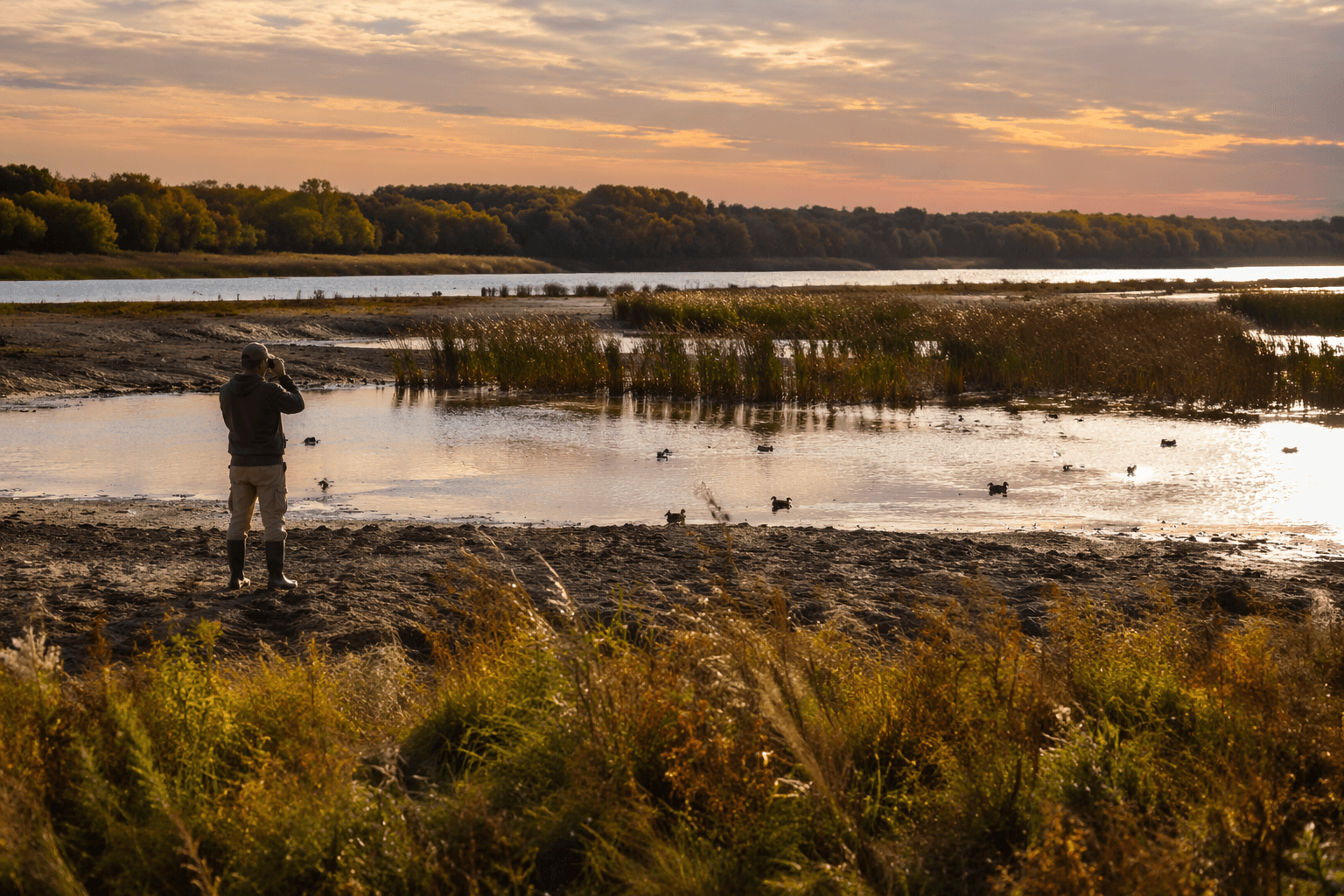
Why birders keep coming back
Birding is one of the clearest reasons Benedictine Bottoms stands out in Atchison County. eBird lists 159 species from the hotspot and 178 checklists, a strong sign that the area is being watched regularly by birders and producing consistent returns. Among the species highlighted there are ring-necked pheasant, white-throated sparrow, northern harrier, Harris’s sparrow, American tree sparrow and snow goose, which gives the site seasonal range rather than a single signature bird.
The habitat mix is what makes that possible. Wetlands, native grass and timber all sit close together, and the Missouri River edges the site on two sides, so the area attracts different species at different times of year. For local birders, that means the Bottoms is not just a one-season stop. It is one of the county’s most useful places for tracking migration, winter waterfowl and grassland species in the same landscape.
A field site for Benedictine College and local science
Benedictine Bottoms also functions as an outdoor classroom tied to Benedictine College. Faculty and students have used the area for biodiversity and demography research, including a 50-nest-box project for migratory birds, tree survivorship work and small-mammal studies. College researchers have also surveyed invertebrates, birds and plants there, and faculty profiles connected to the work include Virginia Huddleston, Daniel Bowen and Terry Malloy.
That makes the Bottoms more than a place to hike or hunt. It is a living site where local students can measure what a restored floodplain actually does over time. The research activity also reinforces the practical value of the habitat work, because the same wetlands and timber that draw wildlife are the features that make the area useful for long-term observation.
Why the site matters beyond county lines
The U.S. Army Corps of Engineers identifies Benedictine Bottoms as the first Missouri River Recovery Program site purchased by the Corps. The land was bought in 1993 and 1994 as a Missouri River Fish and Wildlife Mitigation Project under authority in the Water Resources Development Act of 1986, and it was primarily in agricultural row-crop production at the time. In 2006, the broader Missouri River Recovery Program was launched to address endangered-species obligations while preserving flood control, navigation, water supply, fish and wildlife preservation and recreation.
That history is why the current shape of the Bottoms matters. In 2024, the Corps outlined a plan to restore 65 acres of shallow-water habitat and the dynamic river processes that maintain it, in part for native fish and wildlife including the endangered pallid sturgeon. For Atchison County, the result is a public landscape that is close enough for an afternoon drive, specific enough to support birds and wildlife, and important enough to keep changing as the river changes.
This article was produced by Prism’s automated news system from verified source data, official records, and press releases, then run through automated quality and moderation checks before publishing. The system is built and supervised by the people who set the standards it runs under. Read our full AI policy.
Know something we missed? Have a correction or additional information?
Submit a Tip