Autauga Bluebird Trail brings citizen science to Highway 14 corridor
A volunteer-built bluebird corridor now runs along Highway 14, linking Autauga and Elmore counties with nesting boxes, monitoring and a low-cost conservation model.
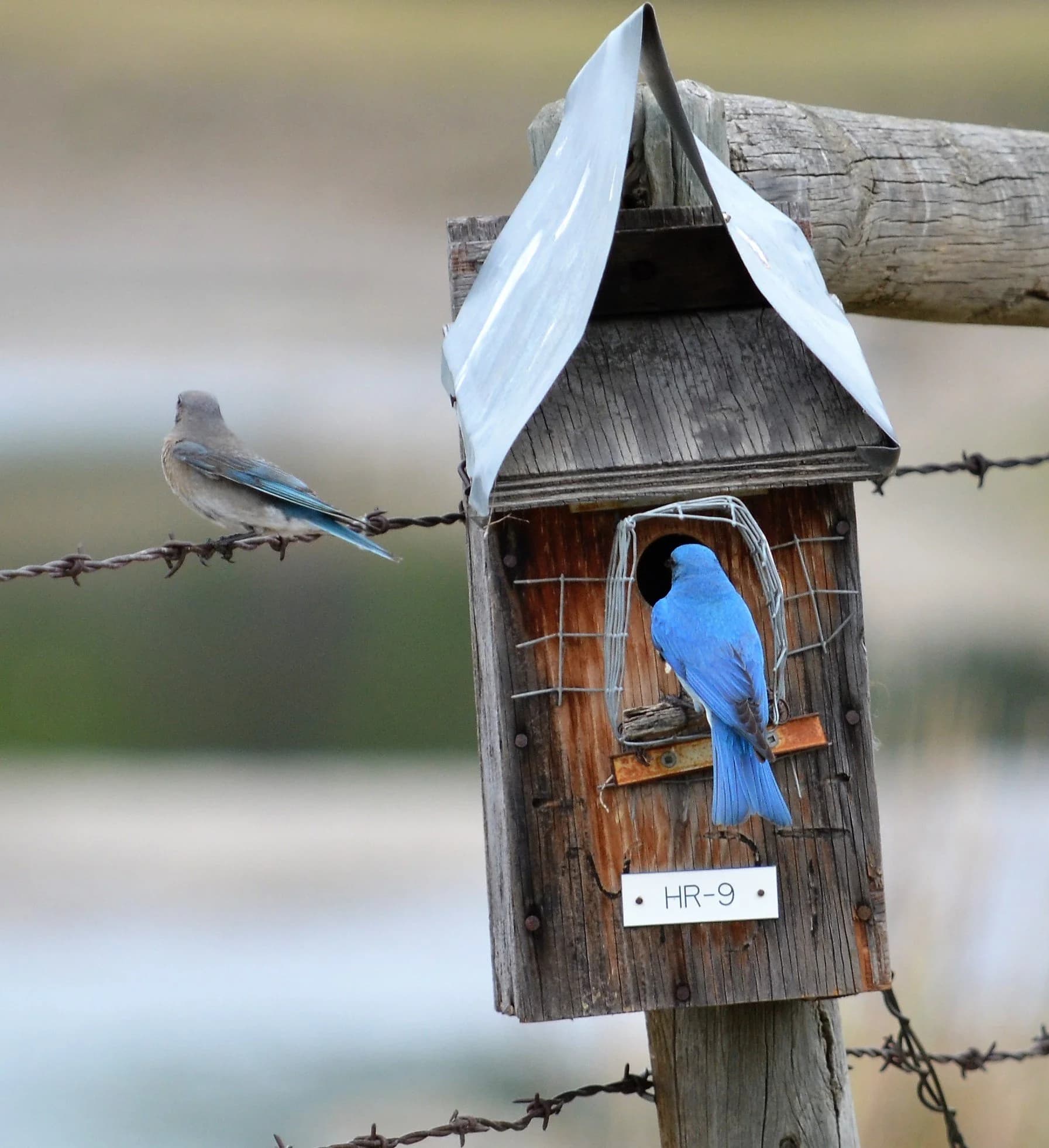
The Autauga Bluebird Trail is not a single park or overlook. It is a stitched-together roadside corridor along Highway 14, built around nesting boxes, volunteer monitoring and a route that now reaches into Elmore County as well as Autauga County. That makes it both a conservation project and a practical piece of local civic infrastructure, one that gives residents a place to watch Eastern bluebirds and supports a repeatable model of stewardship.
How the Highway 14 corridor works
The trail’s official site says it was founded by Tommy Pratt and identifies itself as the official site for the Alabama Bluebird Trail, or ABBT. Its history page says Pratt, Charles Kennedy and several members of the Alabama Wildbird Conservation Association had the idea of turning Alabama Highway 14 into a bluebird trail, which explains why the project feels tied to a road system rather than a single preserve. The map page says the trail has expanded into Elmore County, and that the route is updated as bluebird houses are added.
That structure matters because the trail is built for active management, not passive viewing. Volunteers build and maintain nesting boxes for cavity-nesting birds, and the site organizes the project with a management guide, maps, FAQs, photo galleries and species resources. The contact page says people can become a volunteer or monitor by contacting Anita at 561-314-5979, which gives the trail a clear on-ramp for residents who want to help keep the corridor functioning.
A volunteer network with measurable output
The trail’s own materials show results rather than just aspiration. Its photo gallery says “Bluebirds nesting,” with photos credited to Bill Houghton of Montgomery, Alabama, and a trail update titled “Autauga Bluebird Trail Flourishing” dated Nov. 4, 2008 said 2008 was a good year for Eastern Bluebirds living in Autauga County. Those details show a project that has been producing field observations for years, not just generating interest in birds in the abstract.
The corridor also fits the biology of the bird it serves. Outdoor Alabama describes the Eastern bluebird as a breeder, common in all seasons and regions, and lists it as having the lowest conservation concern. That status does not make the trail unnecessary; it makes the trail a smart, low-risk way to keep a familiar species visible in the landscape while supporting the broader habitat network that cavity-nesting birds depend on.
Why the geography matters on Highway 14
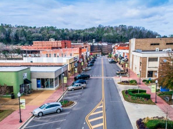
Highway 14 gives the trail a different value than a traditional nature site. Drivers can follow the route without a long hike, a special permit or a destination-style trip, which lowers the barrier for families, teachers and casual bird watchers who want to see how conservation looks in everyday county life. Because the trail spans Autauga and Elmore counties, it also shows how local environmental projects in central Alabama often cross county lines while still remaining rooted in one community.
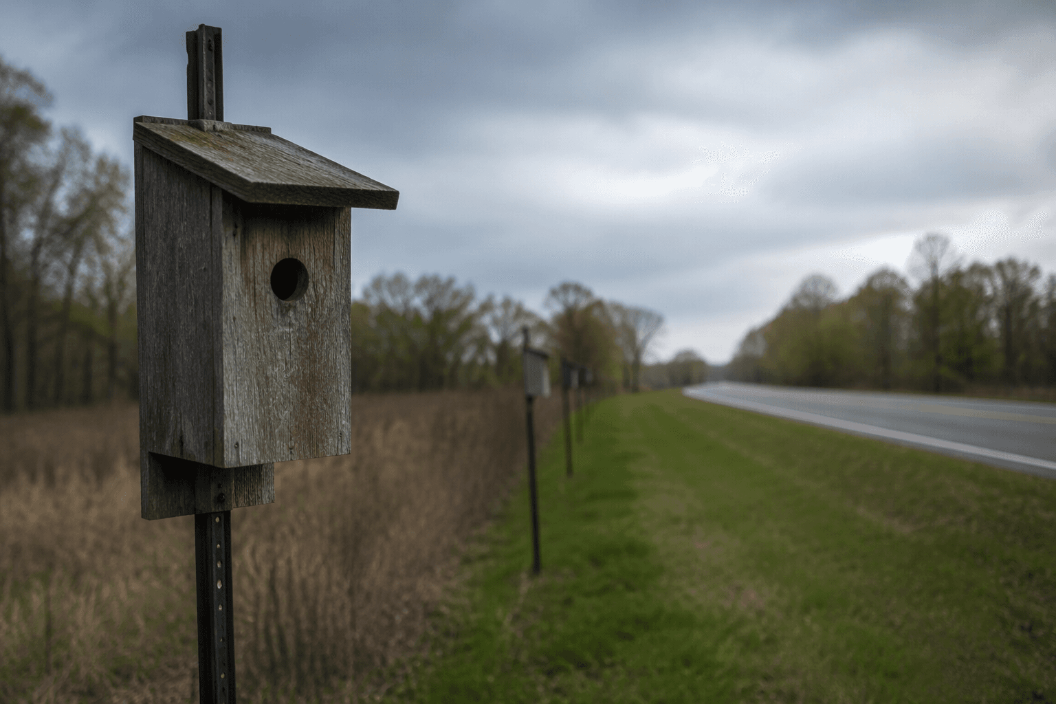
That road-based design has economic implications as well. A corridor people can revisit in spring, summer, fall or winter is more likely to produce small, repeated stops than a one-time outing, and those short trips can spill over into nearby gas stations, cafes and other Highway 14 businesses in the Prattville area. In a county where many visitor experiences depend on convenience as much as scenery, that matters: the trail turns ordinary driving time into an outdoor activity without requiring major public spending.
Part of a larger Alabama birding system
The Autauga Bluebird Trail is local, but it sits inside a much larger statewide birding network. Alabama Birding Trails says the state has 280 sites and more than 430 bird species have been spotted here, which places the Highway 14 corridor inside an established tourism and conservation framework rather than on the margins of it. Audubon’s “Birding in Alabama,” published April 28, 2016, underscores that birding is a recognized draw across the state, with refuges, parks and migration viewing opportunities that bring people to many regions of Alabama.
The trail’s value, then, is not that it competes with bigger birding destinations. It is that it translates that larger birding culture into something Autauga County can maintain at street level, with volunteer labor, simple infrastructure and a route that is easy to find. Bill Houghton’s gallery caption, the 2008 update and the current maps all point to the same thing: this is a working conservation corridor, not a one-season promotion.
What to look for along the route
The trail’s own materials suggest a few practical ways to read the corridor when you drive it. Bluebird houses are the core infrastructure, but the site also points readers to information on other species, which broadens the project beyond a single bird. The map page makes clear that the route changes as new houses are added, so the trail is best understood as a living network of monitored stops rather than a fixed scenic loop.
- Look for nesting boxes maintained by volunteers.
- Use the site’s maps to follow the Highway 14 route through Autauga and Elmore counties.
- Check the gallery for nesting activity and other visual markers of habitat use.
- Contact Anita at 561-314-5979 if you want to volunteer as a monitor.
That mix of stewardship, habitat and repeated observation is what gives the Autauga Bluebird Trail staying power. It is a countywide asset built by residents, carrying conservation work into plain view along one of the region’s most accessible roads.
This article was produced by Prism’s automated news system from verified source data, official records, and press releases, then run through automated quality and moderation checks before publishing. The system is built and supervised by the people who set the standards it runs under. Read our full AI policy.
Did this article answer your question?