Decatur County places index maps towns, communities, and local history
Decatur County’s place names are a working map, from Decaturville’s courthouse square to railroad-born Parsons and riverfront Perryville. The index turns local history into a guide for getting around now.

Decatur County’s map makes more sense once you stop reading it as one stretch of rural road and start reading the names locals actually use. Decaturville, Parsons, Scotts Hill, Perryville, Beacon, Bible Hill, Sugar Tree, Bath Springs, Tie Whop, Lick Skillet, and Cozette are not just labels on a page; they point to schools, river access, cemeteries, old post offices, community centers, and the landmarks people still use to explain where they live. The Decatur County Historical Society says the county has three incorporated towns and even more unincorporated communities, which is why the place-name index works as a practical guide rather than a list of trivia.
How the county got its shape
Decatur County itself was created in November 1845 from the part of Perry County west of the Tennessee River, and it carries the name of naval hero Stephen Decatur Jr. That origin matters because the river still shapes how the county reads on the ground: one community may sit near a landing, another at a road connector, and another around a church, school, or crossroads that never became a formal town. The county had 11,435 residents in the 2020 Census, and U.S. Census Bureau estimates put it at 11,800 on July 1, 2024 and 11,820 on July 1, 2025, a pattern of slow recent growth that keeps the county small enough for names to matter and large enough for those names to mean different things.
The Tennessee State Data Center says it publishes 2020 population totals for Tennessee’s 95 counties and 345 incorporated areas, and Decatur County fits squarely into that statewide map of small places with distinct identities. County government’s FAQ lists 2020 populations of 795 for Decaturville, 2,590 for Parsons, and 855 for Scotts Hill. Those numbers help explain why a county-wide place index is useful: the incorporated towns are compact, and the unincorporated communities fill in the rest of the county’s daily geography.
Decaturville is the courthouse town
Decaturville, established in 1847, is the county seat, and that alone makes it the first stop for anyone trying to orient themselves. The Decatur County Courthouse sits on Main Street, and the Court Square area serves as the backdrop for community events throughout the year. That courthouse-centered layout is more than a postcard scene; it is the anchor for records, civic life, and the way many residents still describe downtown by reference points rather than street numbers.
The town’s records history explains why that matters. The historical society says county offices were moved after a courthouse-records fire, then operated from the Eli Vise store on the southeast corner of Court Square, before court was later held in the Decaturville School building. The Eli Vise store itself was destroyed by fire in 1968. In a county where court records, town memory, and public gatherings have all shifted buildings, Decaturville’s name carries more than a location, it carries the habit of finding civic life by landmark.
Perryville and Parsons show how different the county can be
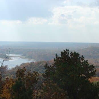
Perryville gives the county its oldest local town identity. The historical society describes Perryville as the oldest town in Decatur County, incorporated before the county was organized and selected as the county seat of Perry County in 1821. It sits on the Tennessee River, which helps explain why riverfront history remains a live part of the county’s geography and not just a line in a chronology. If you are tracing a family branch, planning a scenic drive, or looking for the place behind an old reference, Perryville is one of the names that tells you the county’s story began before its current borders did.
Parsons comes from a different era and a different logic. Around 1889, the Tennessee Midland Railroad Company helped create the town after Henry Myracle deeded 143 1/3 acres to start it on his land. That railroad origin sets Parsons apart from courthouse towns and river landings. It also helps explain why some Decatur County places grew from transport routes and land transactions rather than from an older seat of government or a river crossing.
Why the numbers help you read the map
The population figures give the towns real scale. Decaturville’s 795 residents, Parsons’ 2,590, and Scotts Hill’s 855 make clear that the county’s incorporated places are modest in size, even before you count the unincorporated communities that round out the index. Decaturville’s 2010 census population of 867 also shows that the town has not been growing in a straight line, which is another reason local names matter more than broad assumptions about the county as a whole.
The county’s own positioning language adds another layer. Decatur County describes itself as a Tennessee Three-Star Community and highlights recreation, hunting, and river access. That is not just branding. It tells boaters where the river matters, families where the weekend options are, and newcomers why the county’s communities are spread out the way they are. A place-name index becomes especially useful in a county where daily life can involve a courthouse visit in Decaturville, a river stop in Perryville, a school run in Parsons, and a drive through one of the smaller named communities in between.
How to use the index in everyday life
The easiest way to use the list is as a route map. A weekend visitor can string together Decaturville, Perryville, and Parsons to understand how the county’s civic center, river history, and railroad past fit together. A family researcher can use the names to place relatives in the right community before looking for church records, cemetery markers, or school references. A business owner can use the same names for wayfinding or heritage signage, because people often recognize a community name long before they can name a road.
The historical society’s invitation to share information, pictures, documents, and letters makes the index even more useful over time. That is how a county map becomes a living record rather than a fixed list. Each added photograph, obituary, deed, or school record sharpens the difference between one community and the next, whether the name is well known, like Perryville, or one of the smaller places that still shapes how Decatur County residents talk about where they are from.
In Decatur County, the place names are the map, and the map is still doing real work.
This article was produced by Prism’s automated news system from verified source data, official records, and press releases, then run through automated quality and moderation checks before publishing. The system is built and supervised by the people who set the standards it runs under. Read our full AI policy.
Did this article answer your question?