Lafayette County digital museum maps trace the county’s changing past
Historic maps in Lafayette County show how Oxford growth, old roads and vanished places still shape property lines and neighborhoods today.
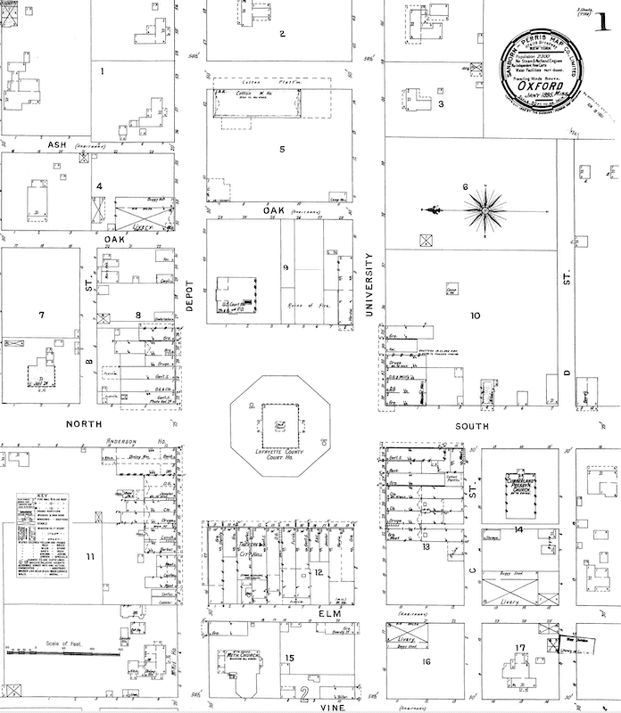
The Lafayette County Digital Museum’s maps page lets readers compare roads, settlements, institutions and land use across time in Lafayette County. The archive turns old paper maps into a working guide to how the county came together and why it looks the way it does now.
What the maps reveal
A good historic map can show where older roads once funneled traffic, where schools and churches anchored rural communities, and how once-prominent places slipped out of daily use. In Lafayette County, that matters because Oxford is the obvious hub, but Taylor, Abbeville and Harmontown remain part of a larger county story that stretches beyond the square.
Those place layers also reflect the county’s early history. Lafayette County was founded in 1836, after treaties forced most of the native Chickasaw population from the area, and Oxford was incorporated in 1837. Lafayette County is the site of the University of Mississippi and the home of William Faulkner. The Mississippi Encyclopedia describes Lafayette County as the educational and literary center of northern Mississippi since the antebellum period.
Why this matters for today’s county
A map can explain why a road curves the way it does, why a property boundary looks odd, or why a place name still survives even though the original settlement is gone. That can help buyers who want to understand the land they are considering, families tracing a home site through generations, and planners tracking how Oxford and the surrounding county continue to change.
USAFacts estimates Lafayette County’s population at about 59,600 in 2025, so a single archive serves a county that includes a university town, rural communities and shifting land use patterns all at once.
The museum’s broader history network
The maps program is part of the Lafayette County Digital Museum’s larger mission of preserving, restoring and displaying local history. The museum’s site also points readers to the Lafayette County Historical and Genealogical Society, a volunteer, non-profit organization whose purpose is “to seek, collect, preserve, and disseminate facts” about Lafayette County, Mississippi.
Map reading gets stronger when it is paired with local records. The county’s own history work draws on chancery court records, the Lafayette County Heritage Book, Skipwith Shares, 20 years of The Lafayette County Heritage News, the Oxford Falcon and Eagle newspapers, and Mississippi Extant and Extinct Towns.
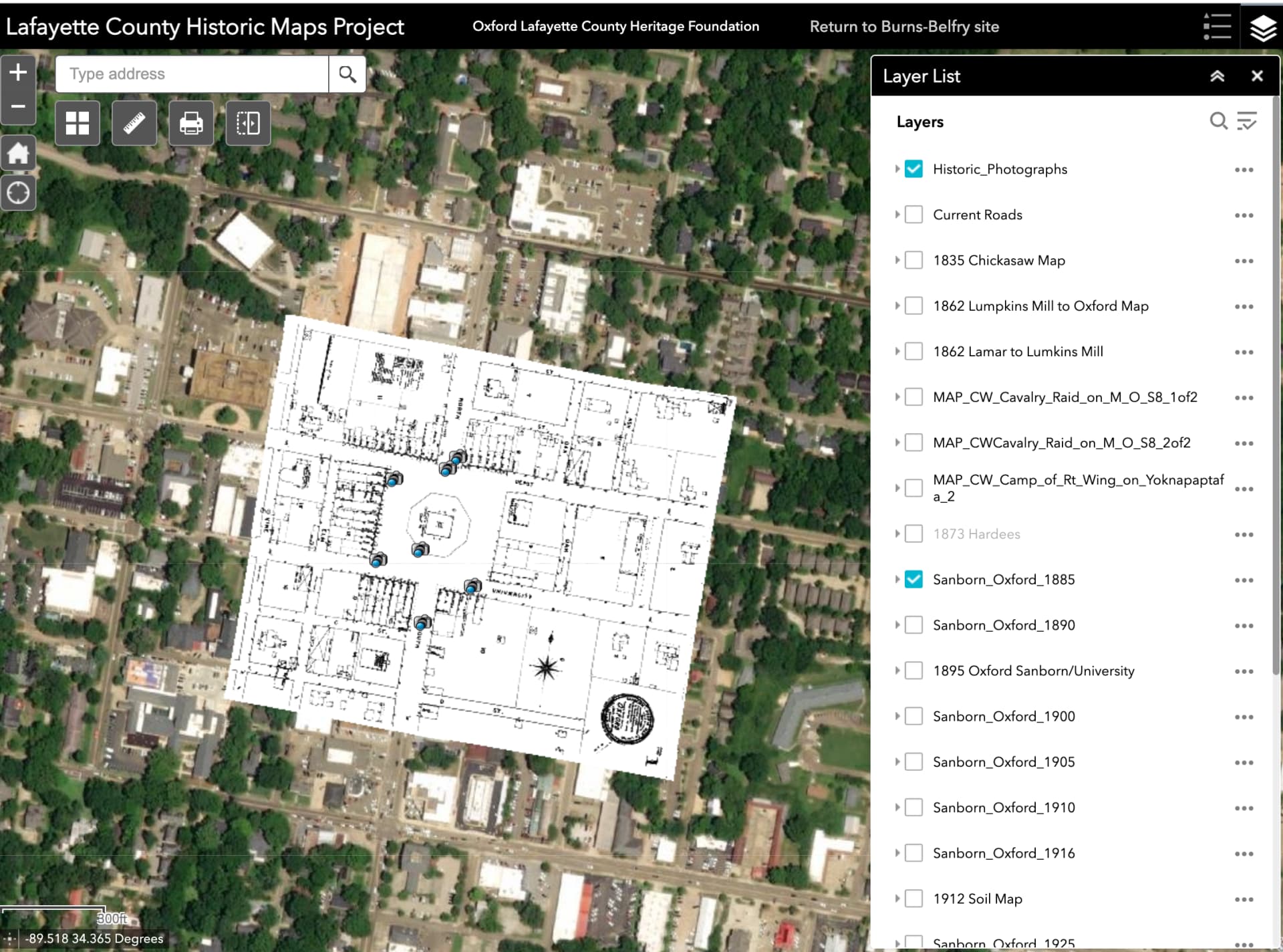
Exhibits can be submitted, which keeps the project open to community additions rather than frozen as a finished collection. Its news section shows that the digital museum is meant to keep growing, not just store images. For local families, that means a new scan, a newly identified place name or a better description of an old route can still become part of the public record.
How to use the maps alongside other collections
Lafayette County’s map history is not confined to one website. Other repositories, including OldMapsOnline and Pastmaps, also surface county material, and Pastmaps lists 147 old maps for Lafayette County spanning 1940 to today. That wider map trail can be useful when one collection answers a road question and another provides a different date or scale.
A practical way to approach the material is to compare layers, not just look at individual images. Start with a place you know, such as Oxford, then move outward to the county roads, rural crossroads and former town sites. The most revealing changes are often the least dramatic ones: a route that straightens, a church district that shifts, a settlement name that drops off later maps, or a school site that once marked the center of a community.
This article was produced by Prism’s automated news system from verified source data, official records, and press releases, then run through automated quality and moderation checks before publishing. The system is built and supervised by the people who set the standards it runs under. Read our full AI policy.
Did this article answer your question?