Lake County GIS helps residents find parcels, roads and boundaries
Lake County’s GIS maps let you check parcel lines, road access, shoreland constraints, public land and survey corners before you buy, hunt, build or travel.
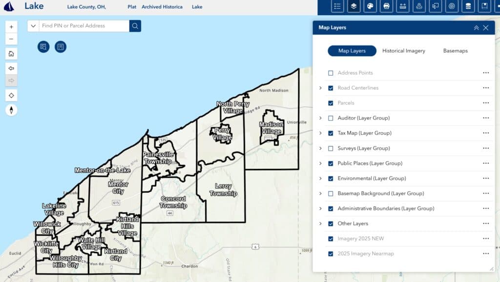
Lake County Geographic Information Systems, built inside the county’s Information Technology department, offers public-facing online maps for residents and visitors across the North Shore and provides analysis, data and maps for county employees. The system turns land records, roads and survey points into something you can actually use before you make a decision.
Why the county’s maps matter
In a county that stretches from Two Harbors to Finland and includes places like Silver Bay, Beaver Bay and the Lake Superior shoreline, the most useful question is often the simplest one: where exactly am I, and what surrounds me? GIS helps answer that by tying together parcels, roads, public lands, boundaries and recorded land information in one place. For property owners, hunters, hikers and homebuyers, that can mean less guesswork and fewer surprises when a driveway, trailhead, shoreline lot or township line does not sit where a paper map suggested.
The county’s GIS system also connects to the Recorder’s Office, which keeps original recorded subdivision plats, registered land surveys for Torrens properties, some government surveys, some recorded plats without an official name, Minnesota Department of Transportation right-of-way plats and certificates of location of government corners. Lake County’s vaults hold official copies of all real estate documents recorded since the county was organized in 1856, and the county still maintains a blind Tract Index as the basis of its recording system.
The five most useful things you can do with Lake County GIS today
1. Check parcel lines before you buy, build or fence
Parcel boundaries are the first reason most people open a county map. A Lake County parcel viewer can help you see where one property ends and the next begins, which matters when you are planning a garage, a dock approach, a shed or even a fence line in a rural township. That is especially important in Lake County, where lots can sit near shoreline, wooded tracts and long, irregular road corridors.
The county’s presence in the Minnesota Geospatial Commons includes a dataset that represents the approximate real property areas in Lake County.
2. See what road actually serves a property
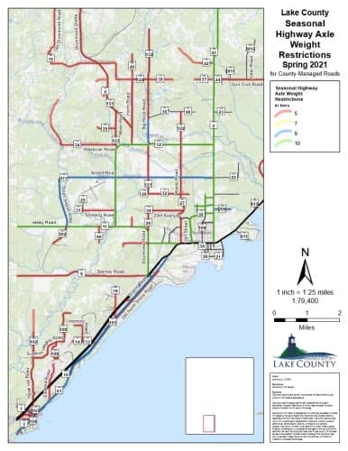
A parcel on a map is one thing; legal access is another. Lake County GIS helps you compare parcels with nearby roads so you can see whether a property fronts a county road, a township road, a private drive or another access point. That can matter for delivery, emergency response, utility planning and homebuying.
The Lake County Recorder’s Office also keeps Minnesota Department of Transportation right-of-way plats and government corner certificates, which are often part of figuring out where road edges, rights-of-way and survey points sit in relation to private property. In a county with dispersed rural development, that road relationship can change how a property is used and what can be built on it.
3. Sort out public land, private land and boundary questions
One of the most valuable uses of the county maps is figuring out who controls the ground under your feet. That includes distinguishing county land, state land, private property and other public assets, which matters for hunting access, hiking routes, timber questions and shoreline use. If you are heading toward a trailhead, a forested township or a lake access point, the map can show whether you are approaching public land or crossing onto private land.
This is where Lake County’s survey and recorder records reinforce each other. The county’s maps sit on top of the documents that track subdivision plats, land surveys and recorded corners.
4. Use Survey Explorer to find corners and boundary points
Lake County’s Survey Explorer inside the Lake County Atlas Parcel Viewer gives users access to the county’s corner monument locations and corner certificates if certified. Those corner monuments mark the corners of sixteenths, sections, townships and other important points in Lake County’s Public Land Survey System.
The Public Land Survey System is the foundation of property boundary descriptions in Minnesota, and the Survey Explorer page lists more than 312,000 PLSS corners statewide. When a parcel line seems unclear or a legal description needs context, corner monuments are the markers that connect the map to the ground.
5. Look at the bigger infrastructure picture around a parcel
A GIS map is not just for landowners. It can also help you understand nearby infrastructure, from roads and survey corners to public boundaries and land records that shape development, emergency planning and recreation. In a county with Lake Superior frontage, shoreline communities and large forested areas, that context matters when you are checking a future home site, planning a hunt or trying to reach a trail system.
Lake County’s public mapping tools give that kind of spatial context without requiring a trip to multiple offices. They make it easier to see how a parcel fits into the county’s road network, recorded plats, corner system and public land pattern.
What the county’s records add behind the maps
The Recorder’s Office keeps the original plats, land surveys and corner certificates that give the maps their legal and historical foundation, while the blind Tract Index remains the county’s recording system.
How to use the maps well
A quick map check can save time, but the strongest use comes from pairing tools together. Start with the parcel viewer to locate the property, use the road layer to see access, then open Survey Explorer if a boundary or corner point needs more precision. If the issue involves a recorded plat, right-of-way or government corner, the Recorder’s Office records provide the official paper trail behind the digital layer.
This article was produced by Prism’s automated news system from verified source data, official records, and press releases, then run through automated quality and moderation checks before publishing. The system is built and supervised by the people who set the standards it runs under. Read our full AI policy.
Did this article answer your question?