Menominee County is Wisconsin’s Menominee Indian Reservation, 234,000 acres
Menominee County is Wisconsin’s Menominee Indian Reservation, 234,000 acres of forests, wetlands and shoreline. That land base and its stewardship define the county.
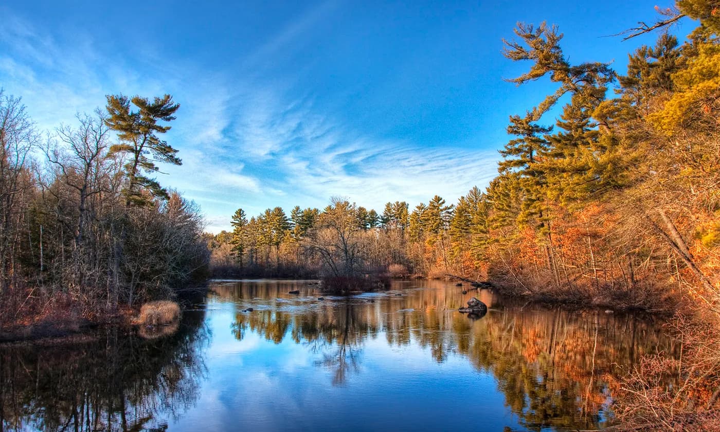
Menominee County is easy to misunderstand if it is treated like just another county on a birding map. Wisconsin’s Menominee County is actually the Menominee Indian Reservation, a 234,000-acre homeland shared by about 4,000 tribal members. That scale changes the way the place reads on the ground: this is not a compact town-centered county, but a broad tribal landscape where forests, wetlands, rivers, lakes and shoreline shape daily life as much as they shape bird habitat.
A county that is also a homeland
The Great Wisconsin Birding & Nature Trail page for Menominee County opens with the county’s central fact: the reservation is the county. That matters because it explains why the landscape feels different from neighboring counties in northeastern Wisconsin and nearby parts of Michigan. Instead of a patchwork defined mainly by municipal edges, Menominee County is organized around a reservation-scale land base that still functions as a homeland, not just a recreation zone.
The numbers tell the story with unusual clarity. A place that covers 234,000 acres and is home to about 4,000 tribal members is large enough to sustain multiple habitat types and the institutions needed to care for them. For a visitor, that means the county is best understood through its land and water systems: the Menominee River, inland lakes, wetlands, forests and the Lake Michigan shoreline all sit inside the same living geography.
Why the habitat mix matters
Menominee County’s natural assets include the Lake Michigan shoreline, the Menominee River, forests, inland lakes and wetlands. Those features make the county attractive in every season, but they do more than draw birders. They also support quiet water access, scenic drives and the kind of habitat transitions that reveal how a reservation landscape works over time.
The birding value changes with the calendar. Spring and fall migration make the county especially compelling because water, edge habitat and forest cover concentrate bird movement. Summer brings the deeper green of the forests and the draw of the county’s waters, while winter makes the same geography feel stripped down and honest, a reminder that the land endures through each season rather than being reset for tourist use.
That is one reason the county’s appeal is broader than a single trailhead or park. The land is expansive enough that the experience is cumulative: shoreline, river, wetland and forest are not separate attractions so much as connected parts of a reservation landscape that keeps supporting wildlife and community life at the same time.
History written into the land
The Menominee Indian Tribe of Wisconsin traces its origin to the mouth of the Menominee River, about 60 miles east of the present reservation. The tribe says five clans were created there: Bear, Eagle, Wolf, Moose and Crane. That origin story ties the county’s present identity directly to the river system that still defines the region.
The historical scale is even larger. The Menominee once occupied more than 10 million acres across what is now Wisconsin and Upper Michigan, including most of central Wisconsin. Seen against that backdrop, the present reservation is both a continuation and a remnant of a much larger homeland, which gives the county’s current land use and habitat stewardship added weight.
The tribal timeline also marks 1928 as the year tribal members could elect an advisory board, a reminder that formal governance evolved long before the modern era of federal recognition and restoration. The Menominee History framework in the tribe’s strategic planning materials organizes that long arc into treaty era, pre-termination, termination, restoration and later governance, showing how land, law and leadership have remained intertwined.
Termination, restoration and sovereignty
The most consequential turning point came on Dec. 22, 1973, when President Richard Nixon signed the Menominee Restoration Act. That law restored federally recognized sovereignty to the Menominee Indian Tribe of Wisconsin after termination, a legal break that remains central to understanding why the county’s landscape cannot be separated from politics and governance.
This is not just a ceremonial history note. Restoration changed the framework under which the tribe could govern land, manage resources and sustain institutions on the reservation. It also explains why the county’s identity is inseparable from sovereignty: the same land that supports bird habitat and scenic travel routes is also the territory of a federally recognized tribal government that has had to defend and restore its authority.
The county’s land and water resource management plan, covering 2018 to 2027, shows that stewardship is still active work. Prepared with county and tribal conservation officials involved, it reflects a local reality that is easy to miss from outside the county line: habitat management, water resources and land planning are not abstract environmental ideas here, but shared responsibilities rooted in place.
A living landscape, not a static brochure
PBS Wisconsin’s Tribal Histories feature Menominee elder and preservationist David Grignon telling oral history along the Wolf River, and that image fits the county better than any generic tourism label. The point is not only that the county has beautiful water and forest country. It is that the landscape carries memory, and that memory is maintained through tribal knowledge, public history and ongoing stewardship.
That is why Menominee County stands apart from a simple state trail listing. It is a reservation county with 234,000 acres, about 4,000 tribal members, a river-born origin story, a record of termination and restoration, and a land base still shaped by county and tribal planning. The birding appeal is real, but the deeper story is the reservation-scale landscape behind it, where ecology, sovereignty and identity remain bound to the same ground.
This article was produced by Prism’s automated news system from verified source data, official records, and press releases, then run through automated quality and moderation checks before publishing. The system is built and supervised by the people who set the standards it runs under. Read our full AI policy.
Did this article answer your question?