Florida Keys sanctuary protects reefs, seagrass and marine life
The Florida Keys sanctuary starts at the shoreline and covers 4,539 square miles, where one wrong move can flatten coral, damage seagrass or trigger enforcement.

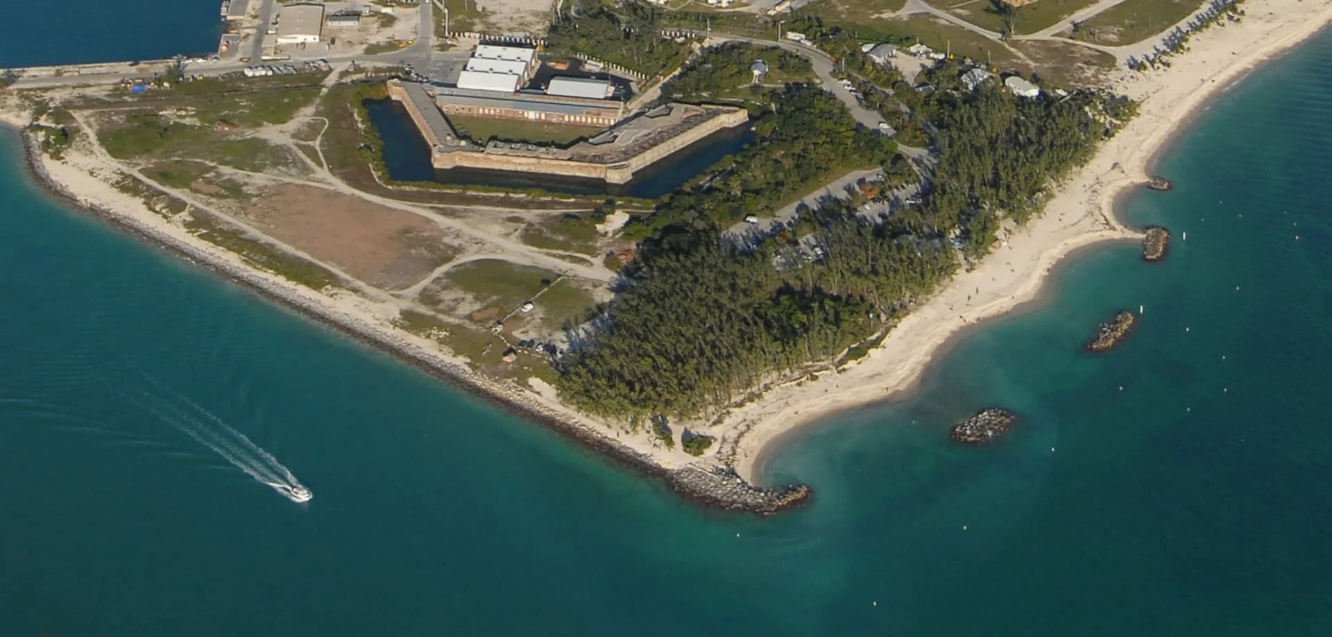
Run a boat too close to a reef line in the Florida Keys, and the damage starts before anyone notices. In Monroe County, the water itself is protected, from the mean high-water mark on land out through 4,539 square miles of sanctuary waters, so the rules matter the moment a skiff leaves the dock, a snorkeler steps off a sandbar or an angler heads for the drop-off.
A protected waterway that begins at the shore
Florida Keys National Marine Sanctuary was designated on Nov. 16, 1990, after a string of boat groundings and growing concern about reef decline. The sanctuary spans the islands from south of Miami westward to Dry Tortugas National Park, and its boundary starts at the mean high-water line, which means the protected zone is not some far-off offshore patch. It is the daily operating environment for Keys residents, charter captains, dive boats, anglers and weekend visitors.
The sanctuary sits at the center of one of the richest marine landscapes in North America. It is home to the only coral barrier reef in the continental United States, the largest documented contiguous seagrass community in the Northern Hemisphere and more than 6,000 animal species. It also contains submerged historical and cultural resources, so the same waters that hold coral, seagrass and mangroves also hold shipwrecks, navigation aids and other pieces of maritime history.
The management story here predates the 1990 designation. NOAA has managed segments of the Florida Reef Tract since 1975, when Key Largo National Marine Sanctuary was created to protect 103 square nautical miles of coral reef habitat. Looe Key National Marine Sanctuary followed in 1981, covering 5.3 square nautical miles, and those earlier designations laid the groundwork for the larger sanctuary Monroe County knows now.
How the map translates into a day on the water
The sanctuary’s zoning is not just bureaucratic cartography. The Restoration Blueprint adds 37 marine zones, including 20 wildlife management areas and 15 zones aimed at supporting coral reef restoration, along with a 20% boundary expansion aligned with the existing Area to Be Avoided. In practice, that means the map is built to separate heavy use from the most sensitive habitat, especially where seagrass beds, nesting birds, sea turtles and coral restoration sites need breathing room.
For visitors, the easiest way to avoid trouble is to check the sanctuary’s Marine Sanctuary Explorer app before heading out. It lets users bookmark an itinerary, receive GPS-based prompts and read stories about marine life, habitats and safe boating, while also identifying Blue Star-certified scuba, snorkel and fishing operators.

Blue Star is a voluntary stewardship program created by the sanctuary with local dive-shop input and the REEF Environmental Education Foundation. It steers people toward operators that teach responsible diving, snorkeling and fishing etiquette, and Blue Star businesses actively educate customers about reef protection. On the enforcement side, Florida Fish and Wildlife Conservation Commission officers work with NOAA to enforce sanctuary rules, so the line between a careless day on the water and an official violation is not abstract.
Why the rules exist in the first place
The sanctuary was built around damage that was already visible. Vessel groundings were a major driver of protection, and groundings can happen because of poor navigation, engine failure, bad weather, rough seas or simple unfamiliarity with local waters. Even a small recreational boat can dislodge and break coral colonies, which is why a shortcut across shallow water can leave scars that last far longer than one tide cycle.
That is also why reef restoration sits alongside prevention. Restoration after Hurricane Irma in 2017 became the first sanctuary-led effort to help reef recovery after a natural disaster, and NOAA says the same techniques have been used to address hundreds of groundings by small commercial and recreational vessels each year.
The sanctuary’s rules and tools are meant to reduce the kinds of mistakes that create both ecological and economic costs. Tear up seagrass in a shallow flat, strike coral on a reef edge or ignore a protected zone, and the damage is not limited to the site you touched. It affects the fish, birds, sea turtles and the operators whose livelihoods depend on healthy water.
Rebuilding coral, not just defending what is left
The sanctuary is now as much a restoration laboratory as a protected seascape. Coral restoration has grown from a few hundred corals outplanted each year to hundreds of thousands.

Mission: Iconic Reefs is the best-known piece of that effort. The program aims to restore seven ecologically and culturally important reefs to self-sustaining levels by 2040, and later set a goal of raising coral cover from 2% to 25% across those seven sites. In 2020, the first large-scale Mission: Iconic Reefs project was a three-year effort to outplant more than 60,000 nursery-raised coral fragments at Eastern Dry Rocks.
The long-range target is bigger still. The project was five years into a 20-year plan to outplant five million corals on seven reefs.
A seafloor full of history
The sanctuary is not only a living reef system. Many hundreds of shipwrecks lie scattered along the reefs, and the Shipwreck Trail highlights nine historic wreck sites chosen for their historical, biological, archaeological and aesthetic value. The sanctuary also protects submerged cultural resources through permits and regulations, so even old iron and timber on the bottom can be part of the management picture.
One of the more vivid examples is the suspected pirate slave ship Guerrero, wrecked at the northern end of Key Largo in 1827.
What visitors should keep in mind
Monroe County’s waters are a place to fish, snorkel and dive, but they are not open water in the casual sense many visitors expect. The current zoning, wildlife management areas and restoration zones are designed to keep people moving through the water without crushing the habitat beneath them.

- Use the Marine Sanctuary Explorer app before launching.
- Choose Blue Star-certified operators when booking dives, snorkels or fishing trips.
- Treat shallow seagrass flats and reef edges as fragile ground, because they are.
- Stay alert for protected marine zones, especially in areas set aside for wildlife or coral restoration.
- Assume that a bad turn, a grounding or careless anchoring can do real damage long before anyone sees it.
Edward “Eddie” J. Kertis, Jr. was named superintendent on June 9, 2026, placing day-to-day oversight of the system under a new chief as restoration, zoning and visitor pressure continue to shape Monroe County’s waters.
This article was produced by Prism’s automated news system from verified source data, official records, and press releases, then run through automated quality and moderation checks before publishing. The system is built and supervised by the people who set the standards it runs under. Read our full AI policy.
Did this article answer your question?