Leffingwell camp site marks early Arctic exploration on Flaxman Island
Flaxman Island’s Leffingwell camp is a fragile record of early Arctic science, and its preservation now depends on keeping a remote North Slope landmark from being lost.
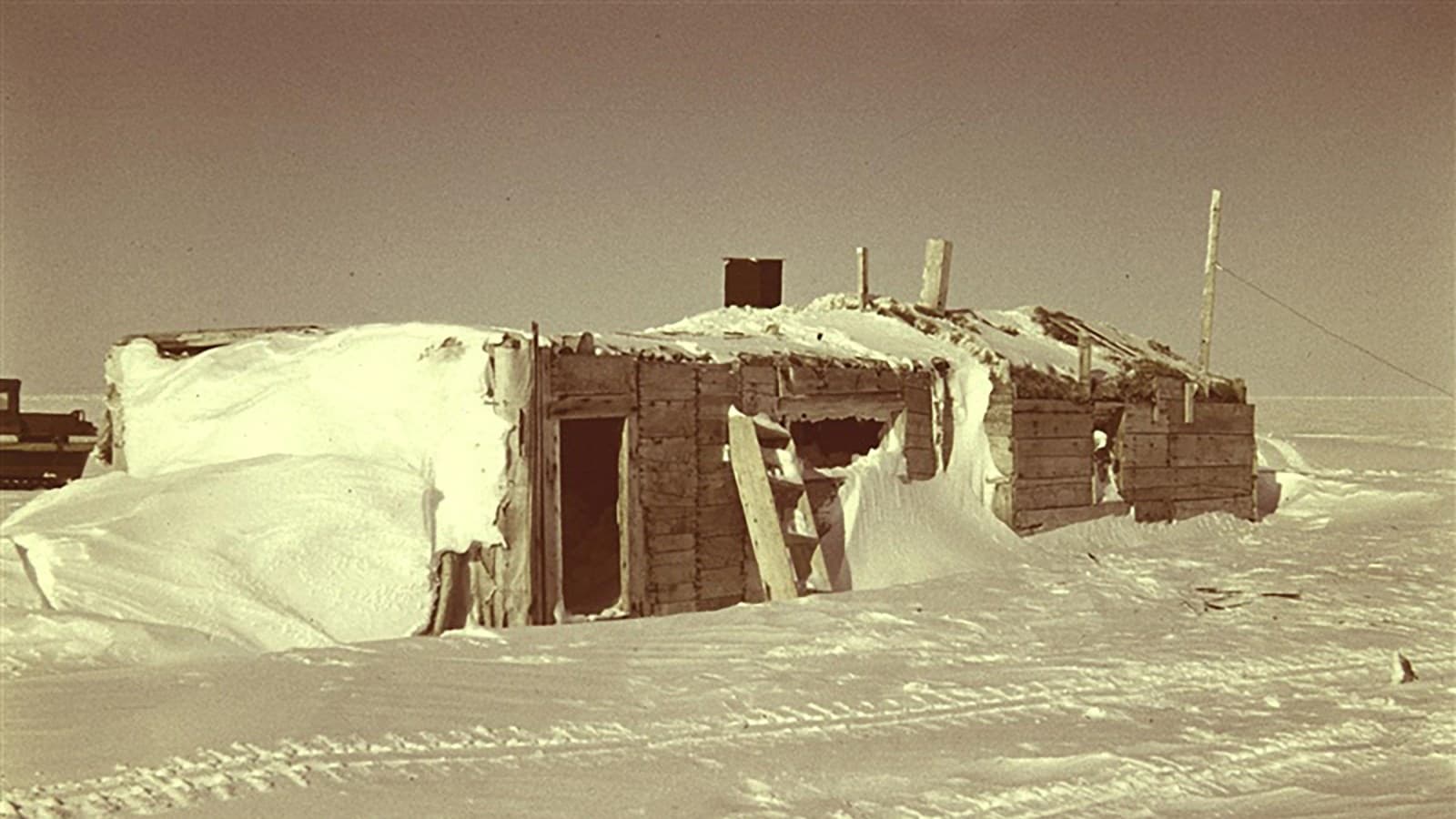
Wind, salt, ice, and erosion all work on Flaxman Island, where Leffingwell Camp Site survives as a thin but powerful trace of the first generation of Arctic field science. The National Park Service lists it as managed by the North Slope Borough and not open to the public, which makes its documentation as important as the ground it occupies.
A remote landmark on Flaxman Island
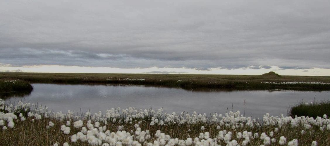
Leffingwell Camp Site sits on Flaxman Island in the Beaufort Sea, about 58 miles west of Barter Island. CoastView describes Flaxman as a barrier island between the Beaufort Sea and Lion Bay, which helps explain why a camp built there faced constant exposure to weather, shifting shorelines, and sea ice. A topo-map listing places the site at approximately 70.185°N, 146.0038889°W, in the Flaxman Island A-4 USGS map area.
That geography matters because the site is not a museum stop with a parking lot and signs. It is a protected historic place in one of the North Slope’s most isolated coastal settings, where the landscape can change faster than paper records or visitors can keep up. For residents who know how hard it is to maintain buildings, fuel caches, and airstrips in exposed places, the camp’s survival is its own reminder that preservation in the Arctic is never passive.
The explorer behind the camp
The site is tied to Ernest de Koven Leffingwell, a University of Chicago-trained geologist who sailed to Alaska in 1906 and based his Arctic work on Flaxman Island from 1907 to 1914. He spent nine summers and six winters along the Arctic coast, relying on small boats and dog teams to carry out fieldwork in an era before aircraft, satellites, or modern weather forecasting.
The camp itself grew out of that kind of improvised Arctic logistics. Remnants from Leffingwell’s ice-crushed wooden ship were salvaged to build structures on Flaxman Island, turning wreckage into a base of operations that lasted through 1914. He later returned to the Alaska North Slope in 1909 to 1912 and again in 1913 to 1914, working with one assistant to map 250 kilometers of the Arctic coast.
That is the practical story behind the site: this was not a ceremonial outpost, but a working camp used for repeated field seasons. The UAF Geophysical Institute describes Leffingwell as a scientist and explorer who spent nine winters in Flaxman Island, and University of Alaska Fairbanks material places his Arctic work in the wider context of early 20th century exploration, when travel and science depended on endurance as much as equipment.
What Leffingwell’s work changed
Leffingwell’s camp matters because of the science that came from it. During the 1906 to 1908 Anglo-American Polar Expedition, he helped determine the edge of the continental shelf, adding evidence that helped rule out the idea of a land bridge north of Alaska. His work also helped shape early understanding of permafrost and contributed to the naming of many northern Alaska rock formations.
That makes the site more than an isolated camp ruin. It is tied to the development of Arctic geology itself, including the language used to describe the ground, the shelf, and the coast that North Slope residents still live with today. Barbara DeFelice’s 1999 bibliographic entry in the Alaska Division of Geological and Geophysical Surveys is one of the records that captures how Leffingwell’s research style influenced later Arctic geological work.
The site also fits into a longer history of Arctic travel. A University of Alaska Fairbanks story from 2023 used the 1923 MacMillan expedition to show how different travel was a century ago, when men still sailed into the far north under conditions that now seem almost unimaginable. Leffingwell’s camp belongs to that same era of field science, when a base on Flaxman Island could anchor years of observation about geology, geography, and sea ice.
Why the site still matters now
Leffingwell Camp Site was designated a National Historic Landmark on June 2, 1978, and it carries National Register property ID 71001093. Those designations matter because they recognize the site as a cultural resource, not just a place name on an old map. The National Park Service record also makes clear that the site is not open to the public, which means its value lies in stewardship, documentation, and the information still held in the landscape.
For North Slope residents, that distinction is practical. The borough’s historic places are not only about memory or tourism, but about what can still be learned from them before weather, shoreline change, or simple neglect erases the evidence. On a barrier island in the Beaufort Sea, where the coast is exposed and access is limited, documentation is part of preservation.
The site also broadens how the North Slope is understood. The borough’s history is often told through villages, oil infrastructure, and municipal government, but Flaxman Island adds another layer: the age of field science, when individual explorers and local expertise shaped what outside institutions knew about the Arctic. Leffingwell Camp Site stands as a compact record of that transition, and its continued protection keeps an early chapter of North Slope history from slipping into the sea.
This article was produced by Prism’s automated news system from verified source data, official records, and press releases, then run through automated quality and moderation checks before publishing. The system is built and supervised by the people who set the standards it runs under. Read our full AI policy.
Did this article answer your question?