North Slope Borough winter trail links villages for seasonal supplies
When the CWAT firms up, North Slope villages gain a temporary freight corridor that can move fuel, equipment, and emergency supplies between communities and the Dalton Highway.
The North Route mapping layer, updated Oct. 1, 2024, shows roughly 500-plus miles of hard-packed snow roads across the North Slope. The Community Winter Access Trail can move fuel, freight, and other goods between villages and the Dalton Highway, turning a stretch of winter weather into a practical lifeline for travel, resupply, and emergency response.
How the winter trail works
The North Slope Borough built the CWAT as a five-year pilot project that began in 2018 to develop snow roads between North Slope communities and the Dalton Highway. A 2019 Alaska Department of Transportation and Public Facilities memo described the goal as improving winter trail conditions and connecting major communities. The route is a seasonal land link for villages that depend on winter overland access.
The borough manages the trail for authorized users under a federal right-of-way. It is not a casual shortcut across the tundra. It is a managed corridor with markers, maintenance, and rules that determine who can use it and when the route is safe enough to open for travel.
Residents who use the trail watch the same signs every winter: freeze-up, snow depth, thawing conditions, and river crossings. BLM monitors those conditions with satellite-linked temperature cables, snow-depth sensors, and stream-gauging stations, because a trail that looks firm in one stretch can turn unstable fast in another.
Where it runs and who it serves
From 2P east of the Colville River, the system extends westward to Utqiagvik, Atqasuk, Wainwright, and Point Lay. The system also reaches Nuiqsut across the central North Slope.
Public access is limited across the planning area and the Dalton Highway is the only permanent road connection to the rest of the Alaska Highway System. When it is open, the trail gives communities a seasonal route for goods, services, and people that would otherwise depend on air or barge service alone.
Not every village sits on the same route. The borough created its alternative shipping program for Point Hope, Point Lay, and Kaktovik, which do not have access to the CWAT trail.
What moves over the trail
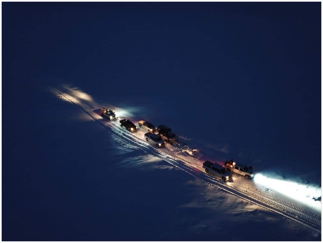
The CWAT is designed for more than pickup trucks and snow machines. The borough, the state, private industry, and BLM worked together on the pilot program, with contractors prepacking and maintaining the snow surface, posting markers, and using professional pilot vehicles and escort vehicles to move caravans when conditions allow.
That operating model is built around low-ground-pressure equipment such as Steigers or Rolligons, which can travel over snow and tundra without the same impact as standard highway vehicles. BLM says caravans can include up to 15 vehicles.
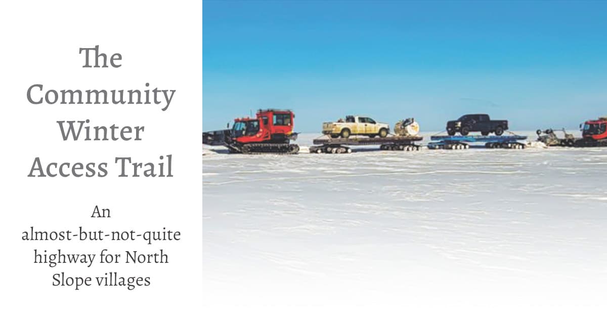
Eligible shipments can include vehicles, fuel tanks, sewer tanks, and household goods.
Why the trail matters in a shortage
In January 2026, the borough said Anaktuvuk Pass was facing a fuel shortage after temperatures dropped below -40°F and aircraft mechanical issues disrupted scheduled deliveries. The borough was in daily contact with Everts Air Cargo, which had one aircraft dedicated to fuel delivery, while also exploring an emergency fuel haul over the CWAT as a short-term response.
The borough said Anaktuvuk Pass relies on a 150,000-gallon ULSD tank that is no longer enough for annual needs, and that a new 250,000-gallon tank is in design for 2026-2027. On Jan. 9, 2026, Mayor Josiah Aullaqsruaq Patkotak signed an emergency declaration authorizing overland fuel delivery without waiting for routine state and federal approvals, and the borough said Everts Air delivered about 4,500 gallons of ULSD by air that day while the community stayed in conservation mode.
The money and planning behind it
State capital records show a FY2020 request of $1,672,077. State capital records show the project was awarded a total of $4,000,000 and tied to a Traveler Safety and Inspection Program within NPR-A villages.

The trail was planned as a safety and inspection system as well as a transportation corridor, with public money supporting labor, contractual services, equipment, materials, freight, and travel for trail maintenance.
The CWAT reduces commodity shipping costs to Alaska Native villages by providing seasonal access for authorized vehicles and goods. Industry uses the trail to transport equipment and connect winter infrastructure for permitted oil and gas activities.
What residents should watch each winter
The route depends on a narrow weather window, and the same factors that make it possible can shut it down quickly.
- Freeze-up has to be strong enough to support traffic.
- Snow depth has to be sufficient for packing and maintenance.
- River crossings need ongoing monitoring for breakup and thaw.
- Marker visibility matters for caravans and escort vehicles.
- Fuel, freight, and emergency loads must be timed to the trail window.
This article was produced by Prism’s automated news system from verified source data, official records, and press releases, then run through automated quality and moderation checks before publishing. The system is built and supervised by the people who set the standards it runs under. Read our full AI policy.
Did this article answer your question?