Tennis ball-sized hail pounds Rockwall County as storms trigger warnings
Tennis ball-sized hail hit Rockwall County as storms rolled through Rockwall, Heath and Royse City, with Royse City seeing the largest hail at 2 inches.
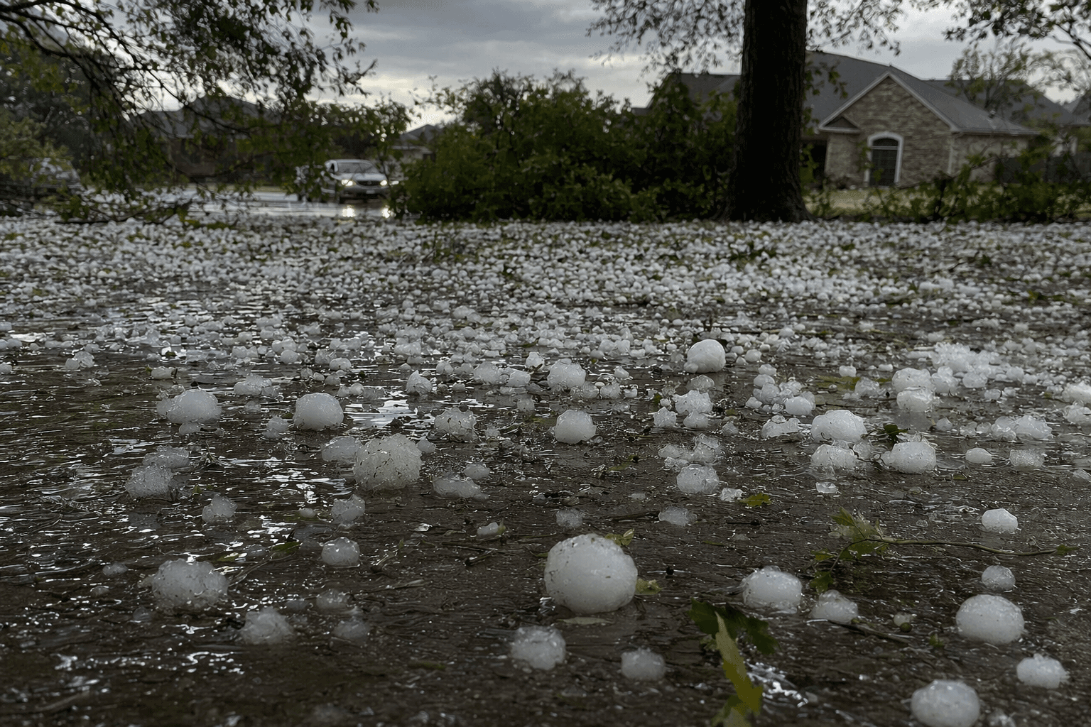
Tennis ball-sized hail swept across Rockwall County on Monday evening, with the strongest storm threat lining up near Rockwall and Heath around 7:40 p.m. CDT and reaching Royse City around 8 p.m. CDT. The National Weather Service warned of hail up to tennis ball size and wind gusts up to 60 mph as the line moved through parts of North Texas.
The warning covered Rockwall County along with southern Hunt County, northeastern Kaufman County, northwestern Van Zandt County, northwestern Rains County and southeastern Collin County. NWS guidance also pointed to McLendon-Chisholm, Lake Ray Hubbard, White Rock Lake, Nevada, Josephine and Lavon as locations in the storm path. A Severe Thunderstorm Watch for Rockwall County began at 6:55 p.m. CDT and was set to expire at 2 a.m. Tuesday, while a Tornado Watch was also active in parts of the broader outbreak.
Royse City took a direct hit from the hail core. Stormersite reported the largest hail near the city at 2.00 inches, or hen egg-sized, and said five hail reports came in within 10 miles of Royse City. Interactive Hail Maps logged 12 reports of on-the-ground hail by trained spotters in Royse City and 32 severe-weather warnings there in the previous 12 months, underscoring how often the city sits in the path of damaging storms.
Rockwall also saw repeated hail reports. Interactive Hail Maps recorded 24 reports of hail on the ground in Rockwall and said the city had been under severe-weather warnings 26 times in the prior 12 months. For residents, the immediate check should start with roofs, gutters, window screens, vehicle windshields, siding, fence panels and AC units, especially in neighborhoods and corridors where hail fell hardest around Rockwall, Heath and Royse City.

Homeowners should photograph damage before making repairs, keep damaged materials if possible and save receipts for tarps, auto glass work and emergency cleanup. The combination of hail, wind and tornado watches made this an outbreak with real property risk, not just a lightning show.
HailTrace estimated the April 27 storm system touched 15 states, 2,082 cities and as many as 774,802 properties, showing how far the damage footprint stretched beyond Rockwall County. For local families already dealing with roof leaks, broken glass and dented cars, the storm’s impact will be measured in repairs still visible long after the warnings expire.
This article was produced by Prism’s automated news system from verified source data, official records, and press releases, then run through automated quality and moderation checks before publishing. The system is built and supervised by the people who set the standards it runs under. Read our full AI policy.
Did this article answer your question?