Bisti/De-Na-Zin Wilderness draws visitors to San Juan County badlands
Bisti/De-Na-Zin is a 45,000-acre remote badlands where the west entrance has basics and the east side has none. Bring water, a map and a compass.
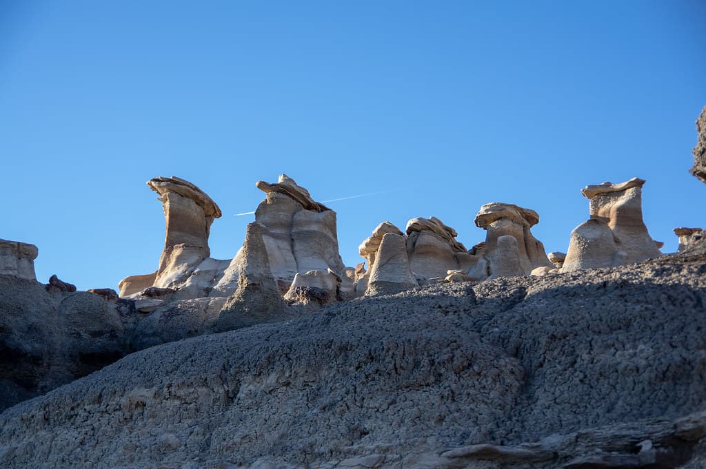
Bisti/De-Na-Zin Wilderness is one of San Juan County’s most striking public lands, but it is not a place to approach casually. The Bureau of Land Management manages and protects the 45,000-acre wilderness, and the City of Aztec’s visitor brochure captures its appeal in plain terms: an otherworldly landscape about 30 miles south of Farmington that stays open year-round and rewards preparation as much as curiosity.
What makes Bisti/De-Na-Zin different
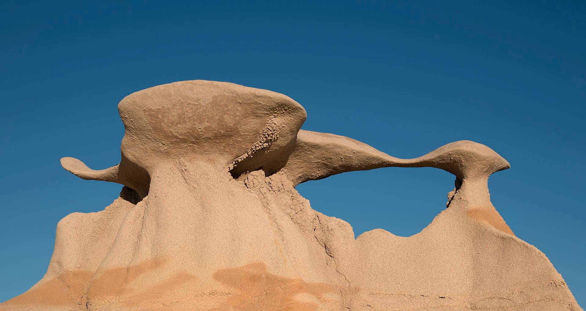
The scale alone sets it apart. Visit Farmington describes the broader Bisti Badlands area as roughly 60 square miles of remote badlands, a sweep of eroded terrain where hoodoos, rock fins, petrified wood and fossils mark the work of wind and water over millions of years. It is part of the county’s outdoor identity because it does not behave like a conventional park. There are no manicured overlooks or easy loops built around amenities; the draw is the landscape itself, and reaching it means entering one of northwest New Mexico’s most unusual geologic settings.
The area’s name also carries meaning that matters locally. The Aztec brochure says Bisti is a Navajo word meaning “amongst sandstone,” while a Bureau of Land Management brochure hosted by the National Park Service says Bisti means “a large area of shale hills.” Both versions point to the same place: a landform shaped by layered sediment, erosion and time. De-Na-Zin is tied to cranes, and the BLM brochure notes that petroglyphs of cranes have been found in the area, linking the wilderness name to Indigenous imagery that is literally carved into the region’s story.
Culture is part of the landscape
The wilderness is not just a scenic stop for photographers and hikers. In a New Mexico Magazine piece published Aug. 7, 2024, a Diné guide said, “This land is traditionally held for ceremonial purposes.” That perspective gives visitors an important frame of reference before they step onto the badlands: this is public land, but it is also a place with cultural meaning that predates tourism by generations.
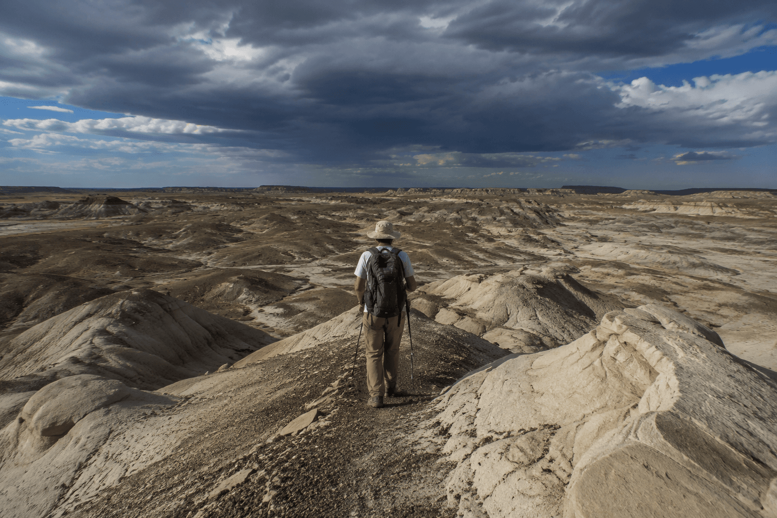
That is why the most responsible way to read Bisti/De-Na-Zin is as both landscape and living place. The hoodoos and fossil fragments may be what brings many people in, but the surrounding land carries stories tied to Navajo language, petroglyphs and ceremonial use. Respecting that history is as much a part of visiting as bringing enough water for the hike.
Know the entrances before you drive out
The two access points are not the same, and that difference matters the moment you arrive. The western Bisti entrance has vault restrooms, a group picnic shelter and ADA parking. The eastern De-Na-Zin entrance has no facilities at all. That means the western side is the better choice if you want basic support services, while the eastern side demands more self-sufficiency from the start.
This is not a landscape where you can count on infrastructure once you leave the pavement. BLM visitor guidance says hiking is required to see the formations, and there are no marked trails. Visitors are told to bring water, a map and a compass, which is the clearest sign that orientation here depends on personal preparation rather than signage or built routes. In practical terms, that means a short visit can still become a serious outing if you drift off your line of travel.
The remote setting also shapes how you should think about safety. The badlands are open year-round, but “open” does not mean easy. The lack of marked trails, the distance from services and the split between one developed entrance and one primitive entrance all raise the stakes for navigation and pacing. Once you are inside the wilderness, you need to be able to manage your own route and your own return.
A landscape shaped by policy as well as erosion
Bisti/De-Na-Zin’s protection has its own history. Congress approved linking the former Bisti and De-Na-Zin Wilderness Areas in late 1996, and one source places the wilderness’s original establishment in 1984 before that later merger. Today it sits within BLM National Conservation Lands, a system authorized in 2000 under then-Secretary of the Interior Bruce Babbitt. That federal framework is what helps keep the badlands from being overbuilt or overmanaged.
For San Juan County, that matters because Bisti/De-Na-Zin remains a rare kind of public land: scenic enough to draw visitors from across the Four Corners, but protected in a way that preserves its rough edges. The wilderness character depends on limited development, minimal facilities and the expectation that people who go there will come prepared. In a county filled with destinations, this one stands out because it still asks visitors to meet the land on its own terms.
The result is a place that delivers exactly what its name suggests: shale hills, cranes, fossils and open space shaped by deep time. For anyone heading south from Farmington or out from Aztec, the most important thing to know is simple: the badlands are accessible, but they are not accommodating.
This article was produced by Prism’s automated news system from verified source data, official records, and press releases, then run through automated quality and moderation checks before publishing. The system is built and supervised by the people who set the standards it runs under. Read our full AI policy.
Did this article answer your question?