Northern Minnesota wildfires spread, evacuations continue in St. Louis County
Evacuations were still active in St. Louis and Lake counties as 17 wildfires burned in Northeast Minnesota, and smoke alerts spread across much of the state.
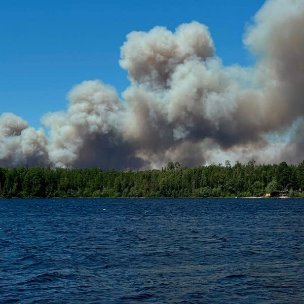
Evacuations continued in St. Louis and Lake counties on July 14 as 17 wildfires burned across Northeast Minnesota, including three inside the Boundary Waters Canoe Area Wilderness and one new fire outside the wilderness. The largest fires affected access near Ely, Winton and Lac La Croix, where crews were handling suppression, structure protection and evacuation support.
The Bear Trap Fire had grown to about 12,896 acres near Lac La Croix, roughly 20 miles north of Ely, and the Thumb Fire had crossed into Canada. Other major fires included the Sioux Fire, estimated at about 3,516 acres north of the Echo Trail and east of Jeanette Campground, and the Camp Fire near Winton, which had reached about 2,200 acres.

The Camp Fire was first reported July 7, started as a 1.6-acre blaze about 8 miles north-northeast of the Cloquet Line outside the BWCAW, and was caused by lightning. The fire later reignited and prompted Ready, Set, Go evacuation zones, including door-to-door notices in the Go area. In St. Louis County, the sheriff’s office had activated the same evacuation process as hot, dry and windy weather kept fire danger high.
The U.S. Forest Service closed the Boundary Waters Canoe Area Wilderness at 12:01 a.m. July 14 after the forest had already been under a fire ban since July 11. The closure followed a surge in fire activity across the Superior National Forest, which had recorded 19 wildfires since July 7. Local access points, trails and recreation sites around the Boundary Waters were also being shut down.
A July 6 storm with thunder, lightning and little precipitation moved through the area before multiple fires were detected. Gov. Tim Walz had already declared a peacetime emergency on May 17 to unlock additional state help, after fires ignited across Lake, Crow Wing and St. Louis counties. The Minnesota Department of Public Safety’s Homeland Security and Emergency Management division was coordinating with the DNR, MnDOT, the Minnesota Interagency Fire Center and local responders.
Smoke was spreading too. The Minnesota Pollution Control Agency issued an air quality alert for northeast Minnesota beginning July 14 and extending through July 16, and the alert broadened across much of Minnesota as smoke drifted south. The National Weather Service had already placed Cook, Itasca, Koochiching, Lake and St. Louis counties under a red-flag warning on July 12, with temperatures near 100 degrees and little rain in the forecast.
This article was produced by Prism’s automated news system from verified source data, official records, and press releases, then run through automated quality and moderation checks before publishing. The system is built and supervised by the people who set the standards it runs under. Read our full AI policy.
Did this article answer your question?