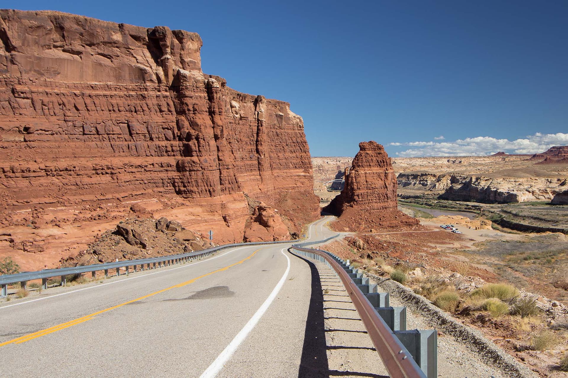
Utah’s Bicentennial Highway 95 leads through remote canyon country
Highway 95 is Utah’s smart red-rock bypass: quieter than the marquee park roads, rich in history, and unforgiving if you don’t fuel up first.
If you want southern Utah without the crush, Highway 95 is the road to know, but only if you treat it like a remote backcountry route, not a casual detour. Gas up in Hanksville and commit to the drive with water on board, because this is the kind of corridor where the scenery is excellent and the margin for error is thin.
The quiet red-rock bypass
Utah State Route 95 runs from SR-24 near Hanksville to US-191 south of Blanding, a stretch commonly described as about 121 miles, with road-trip coverage often stretching that to roughly 126 to 133 miles once you account for the full drive and the places worth stopping. It is part of the Trail of the Ancients National Scenic Byway, and it earns that designation the hard way, by crossing some of the most isolated country in the state.
The practical appeal is simple: traffic is generally light, the pavement is excellent, and the road gives you big canyon-country views without the constant pressure that comes with Utah’s more famous park loops. If you want a route that feels like a real expedition but still works as a manageable day drive, this is one of the best bets in the Southwest.
A highway with a bicentennial backstory
Highway 95 is not just a scenic cut-through. It began as part of Utah’s state highway system in 1935, first as a route to connect Blanding with Natural Bridges, then was extended to Hanksville in 1949. For more than 25 years after that, it remained unpaved.
That changed in 1976, when paving and improvements were completed in time for the U.S. Bicentennial celebration. That is where the “Bicentennial Highway” name comes from, and it matters because the road was built to do more than serve travelers. It became a transportation corridor that tied together communities, settlements, and access points across a rugged part of the Colorado Plateau.
That history gives the drive a useful sense of purpose. You are not just chasing overlooks. You are following a road that shaped access in one of the least forgiving sections of southeastern Utah.
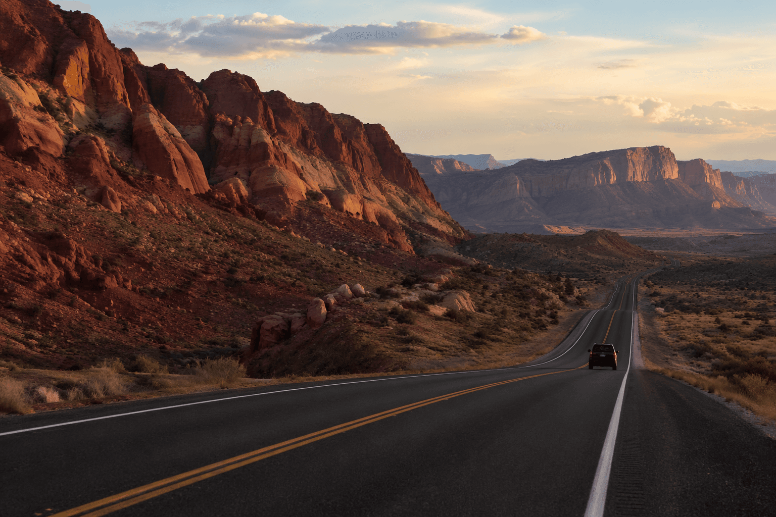
What the drive actually delivers
The best thing about Highway 95 is how quickly it moves from open desert into canyon country that feels engineered by geology for the long haul. It threads past remote rock formations, deep cuts, and stretches of solitude that make even short pullouts feel like destinations. This is where the road’s value really shows: it gives you access to a cluster of public lands that would take much longer to stitch together any other way.
Natural Bridges National Monument is the anchor stop. The monument was established in 1908, making it the oldest national monument in Utah, and it preserves three of the largest known natural bridges in the world. Those bridges are Sipapu, Kachina, and Owachomo, and the names honor Indigenous heritage, which gives the site a cultural weight that goes well beyond the postcard view.
From the scenic drive at Natural Bridges, you can also see the Bears Ears buttes, one of the cleanest viewpoints in the Four Corners region. Bears Ears National Monument is separate from Natural Bridges and is managed by the Bureau of Land Management and the U.S. Forest Service, which is a good reminder that this highway is really a gateway into a larger landscape of federal lands, not a stand-alone scenic strip.
Stops worth building into the day
If you treat Highway 95 as a straight shot, you miss the point. The road works best when you build in pauses for hiking, ruins, and the odd roadside stop that breaks up the long miles. Visit Utah notes that you can make the drive in about half a day if you stay moving, but a full day starts to make sense the moment you stop for a hike in Natural Bridges or poke around Ancestral Puebloan ruins between there and Blanding.
A few places deserve a place on the itinerary:
- Natural Bridges National Monument, for the bridges, the scenic drive, and the connection to Bears Ears views
- Glen Canyon National Recreation Area access points, which widen the route’s reach into the larger canyon landscape
- Hog Springs Recreation Area, a useful side stop when you want a breather from the pavement
- Bluff-area food and fuel planning, including Stan’s Burger Shak, which gives the day a real-world rhythm instead of a sterile point-to-point sprint
Bluff is especially handy if you are building the route into a larger loop through Cedar Mesa and White Canyon. That’s where the road starts to feel less like transportation and more like a trip architecture tool, the thing that lets you connect scenery, meals, and overnight planning without doubling back.
How to plan it without getting stranded
This is the section that matters most if you actually travel this road. A local visitor resource advises travelers to plan ahead, gas up, take water, and expect limited cell service, and that advice is not there for decoration. One report on the Hite area says the nearest towns with available fuel and water are Hanksville, 51 miles west, and Blanding, 79 miles east.
That means the route rewards preparation in a very specific way:
- Leave Hanksville full of fuel, not half-full
- Carry more water than you think you need
- Do not count on a quick cell signal rescue
- Build your timing around stops, not around making up time later
- If you want Natural Bridges and a side hike, give the day a full-day window instead of trying to squeeze it into a transit run
That is why Highway 95 is such a strong alternative route right now. It gives you iconic red-rock scenery, a real historical spine, and access to some of the most important public lands in southeastern Utah, while staying quieter than the better-known corridors that often monopolize the conversation. The tradeoff is that you have to think like a traveler in remote canyon country: fill the tank, respect the distances, and let the road set the pace instead of trying to outdrive it.
This article was produced by Prism’s automated news system from verified source data, official records, and press releases, then run through automated quality and moderation checks before publishing. The system is built and supervised by the people who set the standards it runs under. Read our full AI policy.
Know something we missed? Have a correction or additional information?
Submit a Tip